Hike at a Glance
Max elevation: 342m
Min elevation: 5m
Total Ascent: 2666m
Hike overview
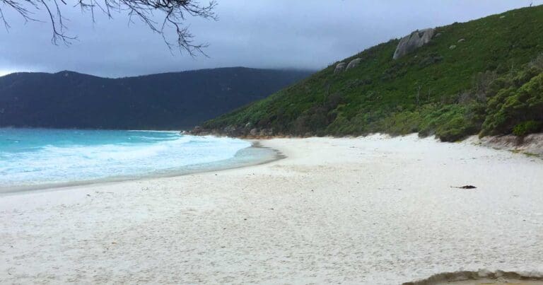
Victoria's most popular multiday hike, the Wilsons Promontory South East Circuit, weaves its way from the slopes of Mount Oberon down to the eastern shore of Wilsons Promontory National Park, where it traverses south above the dramatic waters of Bass Strait to the southernmost lighthouse on mainland Australia. From the dramatically-positioned lighthouse, the trail takes you north through the heart of the park, before returning to Tidal River via spectacular Oberon Bay. Along the way, the trail takes bushwalkers through verdant rainforest, across stunning beaches, wide heathlands and stands of thick coastal tea-tree, while secluded campsites offer beautiful views and bays with cerulean waters to swim in.
The trailhead at Telegraph Saddle car park is just over three hours from Melbourne by car (there is no public transport). The walk can be done in either direction, from Telegraph Saddle or from Tidal River. During the summer holidays a shuttle bus service runs between Tidal River and Telegraph Saddle car park, but at other times of the year you have to walk from Tidal River up the road to the Telegraph Saddle to collect your car.
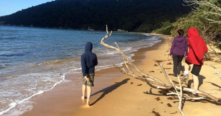
From the car park the trail meanders through thick forest down to the beautiful bay of Sealers Cove, before you ford Blackfish Creek and climb over the next headland. The trail then descends to the cerulean waters of Refuge Cove. Heading further south again, you traverse thickly-forested hillsides before exiting on to the long beach of Little Waterloo Bay.
At the end of the beach, the trail steadily climbs again, eventually traversing the edges of high cliffs that afford the walker breathtaking views across the crashing seas below. You then take a long forested section before reaching the junction with the Lighthouse Track. From here, you are just a short, well-advised side trip out to the lighthouse. Completed in 1859 from granite quarried nearby, the lighthouse stands 19m tall and offers overnight accommodation for hikers after a truly unique experience.
Back at the junction, the trail climbs to the inland campsite of Roaring Meg, which is located by a beautiful fern-lined creek. Heading north further inland, you cross wide heathlands under the watchful eye of crimson rosellas and superb fairywrens, before being deposited on the Telegraph Track. This is followed past Halfway Hut to Telegraph Track junction, where the trail leads west along a sandy four-wheel drive track to the stunning Oberon Bay, from whose campsite is a great place to go swimming after a long day on the trail.
The trail traverses north across the beach at Oberon Bay, skirting mountainsides as it passes gorgeous Little Oberon Bay and Norman Bay, which provides stunning views back towards Mount Oberon, before depositing you back at the creature comforts of Tidal River elated at covering some of the best terrain the State has to offer.
Wilsons Promontory Lightstation
Situated on a small peninsula extending into the turbulent Bass Strait, the Wilsons Promontory Lightstation and its historic residences represent the southernmost settlement on the Australian mainland. The lightstation is accessible solely by foot via the Southern Prom Circuit Hikes.
Built in 1859 from local granite, the lightstation offers a unique opportunity to experience the park's rugged coastal environment while staying in historic cottages adjacent to the lighthouse. In the 1800s, lighthouse keepers, often with families, managed the light with supplies arriving only every six months and no external communication. Today, visitors can experience a glimpse of this isolated lifestyle by staying in the cottages, available for both individual and group bookings for one or two nights.
The three bookable cottages are fully equipped for a comfortable stay, featuring a shared kitchen with an oven, hotplates, microwave, fridge, cooking utensils, crockery, and cutlery.
Tips
- Visitors booked in on any of the overnight hikes at Wilsons Promontory National Park must sign-in at the Tidal River Visitor Centre before setting out.
Content use
Please don’t copy GPX files or content from this site to AllTrails or other platforms. Each trail has been personally mapped, documented, and refined to support Australia’s bushwalking and hiking community. While some details come from land managers, every listing reflects significant personal effort. This is a free, community-driven initiative—your respect helps keep it that way.
Walk map and GPX file
Max elevation: 342 m
Min elevation: 5 m
Total climbing: 2666 m
Total descent: -2867 m
Getting there
Getting to the trailhead: Wilsons Promontory National Park.
Wilsons Promontory National Park is about a three-hour drive from Melbourne. To reach the park, take the Monash Freeway (M1), then continue on the South Gippsland Freeway (M420/A440) to Meeniyan. From there, follow the Meeniyan-Promontory Road (C444) to the park entrance. Once inside the park, it’s a 30-minute drive to Tidal River. Be mindful of wildlife while driving, especially between dusk and dawn. The nearest fuel and electric vehicle charging station is located at Yanakie.
Closest towns to this walk: Fish Creek, Foster, Inverloch, Meeniyan, Port Albert, Port Welshpool, Sandy Point, Tarra Valley, Tarwin Lower, Tidal River, Yanakie
Access conditions
- 2WD Access
- Public Transport
- Bitumen Road
- Gravel Road
- Speed Bumps
- Accessible Toilet
- Public Toilets
- Untreated Water
- Picnic Shelter
About the region
Discover the walking trails of Wilsons Promontory National Park. Wilsons Promontory National Park, located at the southernmost tip of mainland Australia, offers a variety of walks, bushwalks, and hikes that showcase the area's stunning landscapes. Situated near the town of Foster in Victoria, Wilsons Prom is approximately three hours' drive from Melbourne, the state's capital city.
Visitors can explore remote coastal bushland trails and relax on pristine beaches, all while being surrounded by the park's signature granite tors. Whether you choose to camp at the family-friendly Tidal River or hike to a more secluded campsite, encounters with the local wildlife, including wombats, kangaroos, and emus, are common.
Norman Beach, just a short walk from the Tidal River Campground, is perfect for swimming or snorkelling, offering a unique view of Victoria's largest marine national park. Families can enjoy a comfortable stay at Tidal River, with options ranging from powered or unpowered campsites to roofed accommodation.
For those seeking more challenging hikes, the granite peaks of Mount Oberon provide breathtaking panoramic views over the sea, especially at sunset. Mount Bishop offers an excellent alternative, with a summit accessible from the Lilly Pilly car park or via the Lilly Pilly Circuit walk. The summit rewards hikers with views of the Prom's western coastline and offshore islands. For a broader perspective of the National Park, consider the lesser-known Vereker Outlook.
Adventure seekers can take on an overnight hike through The Prom, exploring the remote and rugged northern regions or heading south to visit the historic Wilsons Promontory Lightstation and Sealers Cove. For a more tranquil experience, enjoy the secluded beaches of Wilsons Prom, such as Cotters Beach, Whisky Bay, and Fairy Cove. Accessible options, including all-terrain wheelchairs, TrailRiders, and beach wheelchairs, are available to ensure everyone can enjoy the park's natural beauty.
When visiting the beaches and coastal areas, it's important to be aware of natural hazards. To ensure a safe and enjoyable day at Wilsons Promontory National Park, please follow the recommended water safety guidelines.
Want to find the best trails in Wilsons Promontory National Park for an adventurous hike, casual walk, or a family trip? Trail Hiking Australia has the best trails for walking, hiking, running, and more.
Similar walks nearby
Looking for more walks in or near Wilsons Promontory National Park? Try these trails with a similar difficulty grade.
Track grade
Grade 4 (Hard) - Challenging Walks for Experienced Walkers: Grade 4 on the AWTGS signifies challenging walking tracks. Bushwalking experience is recommended for these tracks, which may be long, rough, and very steep. Directional signage may be limited, requiring a good sense of navigation. These walks are suited for experienced walkers who are comfortable with steeper inclines, rougher terrain, and potentially longer distances.
Explore safe
Plan ahead and hike safely! Carry enough water, pack layers for changing conditions, and bring safety gear like a torch, PLB, and reliable communication device. Check official sources for trail updates, closures, and access requirements, and review local weather and bushfire advice. Most importantly, share your plans with someone before you go. Being prepared makes for a safer and more enjoyable hike! Stay Safe, Explore More, and Always #ExploreSafe.
Packing checklists
What you carry in your pack depends on factors like weather, terrain, and your adventure type. Not sure what to bring? My free planning, food, and packing checklists are a great starting point, covering day hikes, overnight trips, and multi-day adventures. Use them to customise your kit and always prioritise safety.
Let someone know
Before heading out, take a moment to fill out your trip intentions form. It’s a quick way to share your hike details with family or friends. If something goes wrong, they can notify emergency services, ensuring a faster response and peace of mind. Stay safe and enjoy your adventure
Suggest an edit
Spotted a change on this trail? Maybe there are new features, the route has shifted, or the trail is permanently closed. Whatever the update, I’d love your input. Your feedback helps fellow hikers stay informed and ensures that our trail info stays fresh and reliable.
Acknowledgement of Country
Trail Hiking Australia acknowledges the Traditional Owners of the lands on which we hike and pay respects to their Elders, past and present, and we acknowledge the First Nations people of other communities who may be here today.
/Wilsons-Prom-South-East-Circuit-Hike%20(32).jpg)
/Wilsons-Prom-South-East-Circuit-Hike%20(37).jpg)
/Wilsons-Prom-South-East-Circuit-Hike%20(38).jpg)
/Wilsons-Prom-South-East-Circuit-Hike%20(42).jpg)
/Wilsons-Prom-South-East-Circuit-Hike%20(2).jpg)
/Wilsons-Prom-South-East-Circuit-Hike%20(30).jpg)
/Wilsons-Prom-South-East-Circuit-Hike%20(44).jpg)
/Wilsons-Prom-South-East-Circuit-Hike%20(41).jpg)
/Wilsons-Prom-South-East-Circuit-Hike%20(6).jpg)
/Wilsons-Prom-South-East-Circuit-Hike%20(13).jpg)
/Wilsons-Prom-South-East-Circuit-Hike%20(33).jpg)
/Wilsons-Prom-South-East-Circuit-Hike%20(12).jpg)
/Wilsons-Prom-South-East-Circuit-Hike%20(27).jpg)
/Wilsons-Prom-South-East-Circuit-Hike%20(10).jpg)
/Wilsons-Prom-South-East-Circuit-Hike%20(18).jpg)


6 Reviews on “Wilsons Prom: South East Circuit Hike (55km)”
It feels like the sealers cove stretch has been down forever. I love that boardwalk. Last time I looked into they still hadn’t started to rebuild it.
Gavan Mitchell I hear it might not be reopened until 2025.
Sadly the track from Telegraph Saddle to Sealers Cove was badly damaged in storms and is still closed. It is only possible to reach sealers cove currently by hiking via LW and refuge bays which makes it a much longer hike. Always check the Parks Vic site for track closures before booking and local fire reports before starting.
The Hiking Physio.au yes. Hopefully it’ll be open again this year or maybe early next. Thanks for reminding people to always check conditions first. One to add to the list for the future.