Hike at a Glance
Max elevation: 737m
Min elevation: 612m
Total Ascent: 428m
3,332 views
Hike overview
Enjoy a scenic adventure along the West Ridge and Ballantina Walking Tracks, a moderately challenging loop trail that circles Mount Alexander in Mount Alexander Regional Park. This hike offers a diverse landscape, taking you through beautiful native grasslands, towering Manna woodland, and past iconic granite lookouts with breathtaking views.
Starting at Old Koala Park, the trail winds its way along a mix of surfaces – paved roads, formed gravel paths, and unformed tracks. Keep your eyes peeled for the Ballantinia antipoda, a tiny threatened herb native to the area.
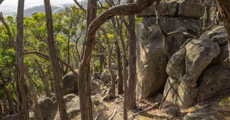
The jewel in the crown is Lang's Lookout. Situated on the eastern slopes, this spectacular platform offers unparalleled views across the sprawling fields of Sutton Grange. Imagine yourself surrounded by massive granite boulders stacked majestically on the mountainside.
Descend from Lang's Lookout and continue your journey towards Shepherd's Flat Lookout. Here, you'll be treated to panoramic views of Harcourt and the surrounding countryside from high within the park. Soak in the beauty of the sprawling landscapes.
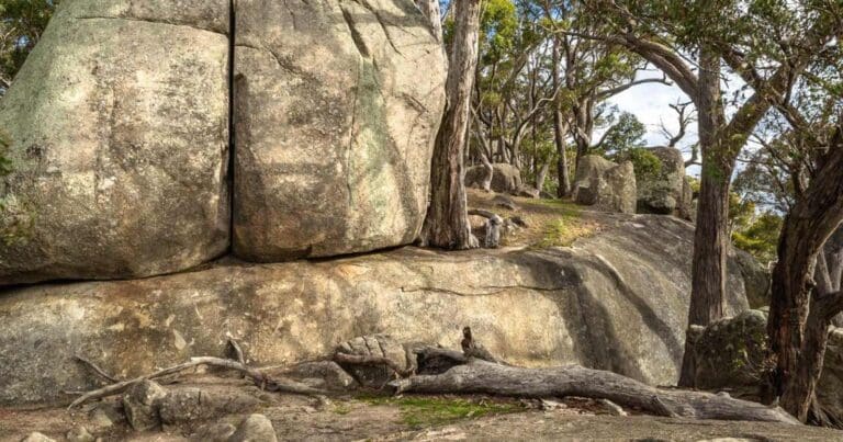
No West Ridge hike is complete without a visit to Dog Rocks. This awe-inspiring granite outcrop boasts countless enormous boulders that jut out dramatically from the western slopes of Mount Alexander. Take some time to explore the unique rock formations and marvel at the breathtaking views. The name "Dog Rocks" comes from 1846, when a station manager spotted many dingoes frequenting the area.
The West Ridge Walking Track offers a moderate challenge with a combination of well-maintained paths and more rugged sections. Allow approximately 2 hours to complete the 6km loop, and come prepared for diverse terrain and potential changes in weather. This hike is a fantastic way to experience the best of Mount Alexander Regional Park – stunning scenery, diverse flora, and a rich historical connection.
Map and GPX file
Max elevation: 737 m
Min elevation: 612 m
Total climbing: 428 m
Total descent: -429 m
Photo gallery
Image: Goldfields Guide
Got some great shots from this hike? Upload your photos here to inspire others and show off the beauty of the trail!
Uploading your photos doesn’t mean you lose ownership. You can be credited for your contributions, and you can request removal at any time.
Getting there
Closest towns to this walk: Campbells Creek, Castlemaine, Harcourt, Maldon, Newstead
Getting to the trailhead in Mount Alexander Regional Park.About the region
Explore Mount Alexander Regional Park. Striking granite outcrops and forested slopes give way to scenic lookouts and walking tracks, making this a popular destination for free camping, bushwalking, and cycling.
Rising 350 metres above the surrounding area, Mount Alexander Regional Park is a prominent landmark offering magnificent views and a natural forest setting for picnics and bushwalking. It also provides important habitat for several rare or threatened species.
Spanning 14,000 hectares, Mount Alexander rises as the highest point in the Bendigo region, known for occasional winter snow. The well-equipped Leanganook Campground offers a base for exploring, with multiple campsites nestled around a central picnic area.
This land holds deep significance. Originally called "Lanjanuc" by the Ja Ja Ja people, the mountain served as a sacred ceremonial ground. In 1851, the discovery of gold nearby ignited a global gold rush, forever changing the area's history.
Today, the park offers a glimpse into both natural beauty and historical intrigue. Hike to stunning lookouts, camp under the stars, or simply enjoy a picnic surrounded by nature's grandeur. So pack your bags and explore the wonders of Mount Alexander Regional Park.
Similar trails nearby
Looking for hikes and trails in Mount Alexander Regional Park or nearby? Try these walks with a similar grade.
Track grade
Grade 3 (Moderate) - Walks for Most Fitness Levels: Grade 3 on the AWTGS represents moderate walking tracks. These are ideal for walkers with some fitness who are comfortable with some hills and uneven terrain. While suitable for most ages, some bushwalking experience is recommended to ensure a safe and enjoyable experience. Tracks may have short, steep hill sections, a rough surface, and many steps. The total distance of a Grade 3 walk can be up to 20 kilometers.
Explore safe
Plan ahead and hike safely! Carry enough water, pack layers for changing conditions, and bring safety gear like a torch, PLB, and reliable communication device. Check official sources for trail updates, closures, and access requirements, and review local weather and bushfire advice. Most importantly, share your plans with someone before you go. Being prepared makes for a safer and more enjoyable hike! Stay Safe, Explore More, and Always #ExploreSafe.
Packing checklists
What you carry in your pack depends on factors like weather, terrain, and your adventure type. Not sure what to bring? My free planning, food, and packing checklists are a great starting point, covering day hikes, overnight trips, and multi-day adventures. Use them to customise your kit and always prioritise safety.
Let someone know
Before heading out, take a moment to fill out your trip intentions form. It’s a quick way to share your hike details with family or friends. If something goes wrong, they can notify emergency services, ensuring a faster response and peace of mind. Stay safe and enjoy your adventure
Suggest an edit
Spotted a change on this trail? Maybe there are new features, the route has shifted, or the trail is permanently closed. Whatever the update, I’d love your input. Your feedback helps fellow hikers stay informed and ensures that our trail info stays fresh and reliable.
Acknowledgement of Country
Trail Hiking Australia acknowledges the Traditional Owners of the lands on which we hike and pay respects to their Elders, past and present, and we acknowledge the First Nations people of other communities who may be here today.


