Hike at a Glance
Max elevation: 123m
Min elevation: 12m
Total Ascent: 165m
Hike overview
Tomaree Head Summit walk offers a short but challenging hike and picturesque ocean views across Port Stephens and beyond. It's a must-see destination if you're in the area.
Take the invigorating short walk to the summit of Tomaree Head, 161m above the Port Stephens entrance. As you hike the track, you'll enjoy unparalleled views of idyllic Port Stephens and its coastline. From the top, you can even see as far as Cabbage Tree and Boondelbah islands these nature reserves are the world's only nesting sites for the endangered Gould's petrel.
When you reach the summit, enjoy panoramic views of Yacaaba Head, Cabbage Tree, Boondelbah and Broughton Islands from the north platform.
From the south platform, views of Zenith, Wreck and Box Beaches, Fingal Island and Point Stephens Lighthouse will be sure to impress. If you're hiking Tomaree Coastal Walk or Shoal Bay to Fingal Bay walking track the views to the south will be of interest so you can map out the landscape ahead to your destination.
There's a picnic table at the lookout, so if you have time, take a picnic lunch or some morning tea to enjoy as you take in the view. On the way back down, don't forget to try Fort Tomaree walk and check out the historic World War II gun emplacements.
Tips
- Take care along the steep sections on this walk as well as paved areas that can become slippery when wet.
- Remember to take your binoculars if you want to whale watch - the best time of year is between May and October.
- Zenith Beach is a sanctuary zone, meaning no collecting or fishing is permitted.
- A toilet is available at the boat ramp, a 4 minute walk from the track entry back towards Shoal Bay.
Visit NSW National Parks and Wildlife Service for more information on this trail.
Content use
Please don’t copy GPX files or content from this site to AllTrails or other platforms. Each trail has been personally mapped, documented, and refined to support Australia’s bushwalking and hiking community. While some details come from land managers, every listing reflects significant personal effort. This is a free, community-driven initiative—your respect helps keep it that way.
Walk map and GPX file
Max elevation: 123 m
Min elevation: 12 m
Total climbing: 165 m
Total descent: -165 m
Getting there
Getting to the trailhead: Tomaree National Park.
Tomaree Head Summit walk commences at Tomaree Head. From Nelson Bay, follow Shoal Bay Road to the lower Zenith Beach carpark. Parking is available at the lower Zenith Beach carpark or upper Zenith beach carpark. On busy days you may need to find a parking spot on Shoal Bay Road.
Closest towns to this walk: Anna Bay, Corlette, Fingal Bay, Medowie, Nelson Bay, Port Stephens, Salamander Bay, Shoal Bay
About the region
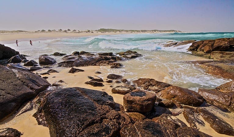
Tomaree National Park near Port Stephens is a great weekend getaway. With so many coastal lookouts it's easy to go whale watching, hike the tracks, or explore the historical significance of Fort Tomaree.
Tomaree National Park provides a magnificent backdrop to the coastal villages of Nelson Bay, Shoal Bay, Fingal Bay, One Mile, Boat Harbour and Anna Bay. With 27km of connected hiking Tomaree Coastal Walk offers you a taste of everything in this surprisingly diverse park.
It's the only place in NSW where you can see outcrops of the acid volcanic rock rhyodacite. The national park also borders the largest marine park in the state as well as the largest moving coastal sand dune in the southern hemisphere at nearby Worimi Conservation Lands. The Worimi connection to Country is strong and you can learn more about this at Birubi Point Aboriginal Place.
It's an excellent spot for whale watching and offers a range of scenic walks, including the short Wreck Beach walk through coastal angophora forest and the longer Morna Point walk that comes alive with spring wildflowers. Keep your eyes out for sea eagles in the sky, koalas dozing high in the trees, and echidnas on the ground.
The park's beaches are pretty places for a family barbecue and there are picnic facilities around Anna Bay, Fingal Bay, and Fishermans Bay. Enjoy a swim or snorkel at the beaches patrolled by lifeguards including One Mile Beach, Fingal Bay Beach, or Birubi Beach. Although there are some good places for fishing you'll need to check the marine park zoning before setting out.
However you choose to spend your time in Tomaree National Park, make sure you hike Tomaree Head Summit. It's steep but short and you'll be rewarded with panoramic ocean views over Port Stephens, and Broughton, Cabbage Tree and Boondelbah Islands nature reserves. While you're there, check out the historic gun emplacements, part of Fort Tomaree and built in 1941 as part of Australia's World War II east coast defence system.
Similar walks nearby
Looking for more walks in or near Tomaree National Park? Try these trails with a similar difficulty grade.
Track grade
Grade 5 (Difficult) - Walks for the Most Experienced: Grade 5 represents the most challenging walking tracks on the AWTGS. These are only recommended for very experienced and fit walkers with specialised skills, including navigation and emergency first aid. Tracks are likely to be very rough, very steep, and unmarked. Walks may be more than 20 kilometers. These challenging walks demand a high level of fitness and experience to navigate difficult terrain, significant elevation changes, and potentially unformed paths.
Explore safe
Plan ahead and hike safely! Carry enough water, pack layers for changing conditions, and bring safety gear like a torch, PLB, and reliable communication device. Check official sources for trail updates, closures, and access requirements, and review local weather and bushfire advice. Most importantly, share your plans with someone before you go. Being prepared makes for a safer and more enjoyable hike! Stay Safe, Explore More, and Always #ExploreSafe.
Packing checklists
What you carry in your pack depends on factors like weather, terrain, and your adventure type. Not sure what to bring? My free planning, food, and packing checklists are a great starting point, covering day hikes, overnight trips, and multi-day adventures. Use them to customise your kit and always prioritise safety.
Let someone know
Before heading out, take a moment to fill out your trip intentions form. It’s a quick way to share your hike details with family or friends. If something goes wrong, they can notify emergency services, ensuring a faster response and peace of mind. Stay safe and enjoy your adventure
Suggest an edit
Spotted a change on this trail? Maybe there are new features, the route has shifted, or the trail is permanently closed. Whatever the update, I’d love your input. Your feedback helps fellow hikers stay informed and ensures that our trail info stays fresh and reliable.
Acknowledgement of Country
Trail Hiking Australia acknowledges the Traditional Owners of the lands on which we hike and pay respects to their Elders, past and present, and we acknowledge the First Nations people of other communities who may be here today.
/Tomaree%20Head%20Summit%20Walk%20(3).jpg)
/Tomaree%20Head%20Summit%20Walk%20(2).jpg)
/Tomaree%20Head%20Summit%20Walk%20(4).jpg)
/Tomaree%20Head%20Summit%20Walk%20(1)_1.jpg)
/Tomaree%20Head%20Summit%20Walk%20(5).jpg)
/Tomaree%20Head%20Summit%20Walk%20(1).jpg)


