Hike at a Glance
Max elevation: 102m
Min elevation: 48m
Total Ascent: 173m
Hike overview
The Mount Tibrogargan Circuit is a fantastic hiking option located within Glass House Mountains National Park, Queensland. This moderately graded trail stretches for roughly 4.5 kilometers and should take around 2 hours to complete at a leisurely pace.
The circuit offers a scenic journey around the base of Mount Tibrogargan. The adventure begins with a short 10-minute climb to the Mountain View lookout. Here, you'll be rewarded with breathtaking panoramas of Mount Beerwah, Mount Coonowrin, Mount Tibberoowuccum, and Mount Tunbubudla.
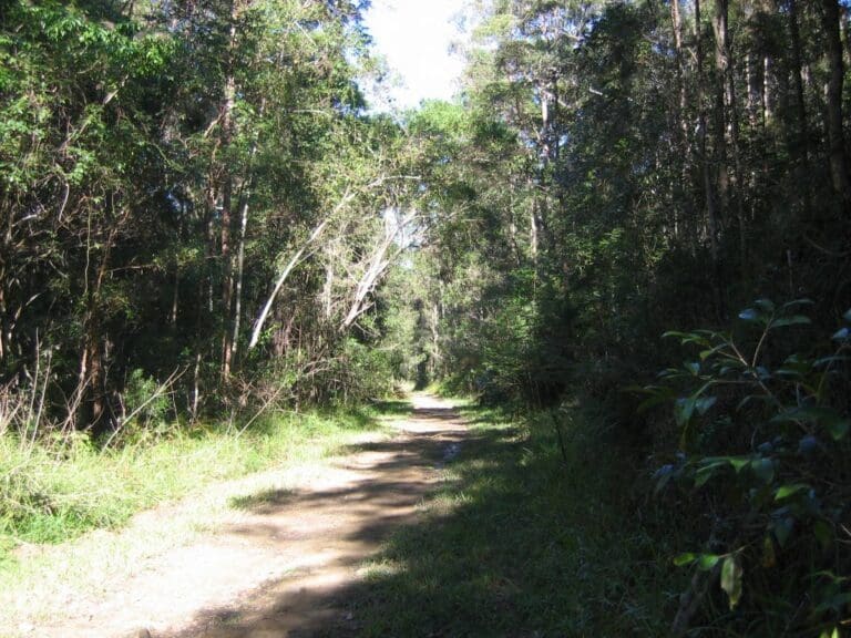
As you continue along the well-maintained track, you'll be immersed in the beauty of the native Australian landscape. The trail winds through casuarina groves, open eucalypt forests, and melaleuca woodlands, offering glimpses of Mount Tibrogargan from various angles. Keep your eyes peeled for majestic peregrine falcons soaring overhead!
The lighting can dramatically impact the character of the mountains. Early mornings or evenings are prime times to witness the sheer rock cliffs bathed in a warm glow. Take a moment to rest at a designated stop and truly appreciate the imposing presence of Mount Tibrogargan.
While the circuit itself focuses on the base of Mount Tibrogargan, you'll also catch glimpses of surrounding peaks like Mount Cooee and Mount Tibberoowuccum throughout the hike. The meticulously crafted rock arch bridges along the trail are a testament to the care put into constructing this exceptional path.
If you're seeking a scenic and enjoyable hike in the Glass House Mountains, the Mount Tibrogargan Circuit is undeniably a top contender.
Gallery
Got some great shots from this hike? Upload your photos here to inspire others and show off the beauty of the trail!
Click to view form >>
Submitting your photos doesn’t mean you lose ownership. You can be credited for your contributions, and you can request removal at any time.
Content use
Please don’t copy GPX files or content from this site to AllTrails or other platforms. Each trail has been personally mapped, documented, and refined to support Australia’s bushwalking and hiking community. While some details come from land managers, every listing reflects significant personal effort. This is a free, community-driven initiative—your respect helps keep it that way.
Walk map and GPX file
Max elevation: 102 m
Min elevation: 48 m
Total climbing: 173 m
Total descent: -173 m
Getting there
Getting to the trailhead: Glass House Mountains National Park.
To get to Mount Tibrogargan carpark from Glass House Mountains township by car:
It’s a short drive, only 5.1 kilometers, and it should take approximately 6 minutes to get there. The route is straightforward; you’ll be following Steve Irwin Way and Barrs Road.
From Brisbane, follow the Bruce Highway north, take the Glass House Mountains tourist drive turn-off and follow the signs to the Glass House Mountains.
The Glass House Mountains Visitor and Interpretive Centre is a great place to visit first for an orientation to the area. It is located at Settler’s Rotary Park on Bruce Parade, corner of Reed Street, Glass House Mountains.
Within the national park, there are separate entrance points to each of the recreation nodes around the mountain peaks—Beerburrum, Beerwah, Ngungun and Tibrogargan entrances.
Closest towns to this walk: Beerwah, Elimbah, Glass House Mountains, Landsborough, Maleny, Moodlu, Mooloolah Valley, Woodford
Access conditions
- 2WD Access
- 4WD Access
- Bitumen Road
- Winding Road
- Speed Bumps
- Large Car Park
- Accessible Parking
- Public Toilets
- Picnic Table
About the region
Explore the Glass House Mountains National Park: A Land of Dramatic Beauty and Rich History.
The Glass House Mountains National Park is a captivating landscape dominated by the craggy peaks that rise majestically from the surrounding plains. These volcanic plugs, formed millions of years ago, hold a significant place in Australian heritage and are listed on the Queensland and National Heritage Register.
Walking trails weave through open forests, leading you to lookouts boasting panoramic views of the mountains. Explore the base of Mount Tibrogargan for ever-changing perspectives, or conquer the summit of Mount Ngungun for breathtaking views of the surrounding peaks and landscapes.
For the adventurous, the Yul-yan-man track offers a challenging Grade 5 hike, perfect for experienced rock scramblers. Skilled climbers and abseilers will find other challenging routes and dedicated climbing areas to test their abilities.
Beyond the dramatic peaks, the park encompasses a scenic tapestry of pine plantations, bushland, and cultivated fields. Remnants of open eucalypt woodland and heath vegetation provide a habitat for diverse flora and fauna, including 20 plant species of high conservation value.
Lieutenant James Cook named these distinctive mountains during his voyage along Australia's east coast. Geologically, they are intrusive plugs formed by volcanic activity 26 to 27 million years ago.
The park holds deep cultural significance for the Aboriginal Traditional Owners. The Glass House Mountains served as a meeting place for ceremonies and trade, and many sacred sites are still protected within the park's boundaries.
Similar walks nearby
Looking for more walks in or near Glass House Mountains National Park? Try these trails with a similar difficulty grade.
Track grade
Grade 3 (Moderate) - Walks for Most Fitness Levels: Grade 3 on the AWTGS represents moderate walking tracks. These are ideal for walkers with some fitness who are comfortable with some hills and uneven terrain. While suitable for most ages, some bushwalking experience is recommended to ensure a safe and enjoyable experience. Tracks may have short, steep hill sections, a rough surface, and many steps. The total distance of a Grade 3 walk can be up to 20 kilometers.
Explore safe
Plan ahead and hike safely! Carry enough water, pack layers for changing conditions, and bring safety gear like a torch, PLB, and reliable communication device. Check official sources for trail updates, closures, and access requirements, and review local weather and bushfire advice. Most importantly, share your plans with someone before you go. Being prepared makes for a safer and more enjoyable hike! Stay Safe, Explore More, and Always #ExploreSafe.
Packing checklists
What you carry in your pack depends on factors like weather, terrain, and your adventure type. Not sure what to bring? My free planning, food, and packing checklists are a great starting point, covering day hikes, overnight trips, and multi-day adventures. Use them to customise your kit and always prioritise safety.
Let someone know
Before heading out, take a moment to fill out your trip intentions form. It’s a quick way to share your hike details with family or friends. If something goes wrong, they can notify emergency services, ensuring a faster response and peace of mind. Stay safe and enjoy your adventure
Suggest an edit
Spotted a change on this trail? Maybe there are new features, the route has shifted, or the trail is permanently closed. Whatever the update, I’d love your input. Your feedback helps fellow hikers stay informed and ensures that our trail info stays fresh and reliable.
Acknowledgement of Country
Trail Hiking Australia acknowledges the Traditional Owners of the lands on which we hike and pay respects to their Elders, past and present, and we acknowledge the First Nations people of other communities who may be here today.


4 Reviews on “Mount Tibrogargan Circuit Walk (4.5km)”
This is a delightful circuit trail that perfectly complements a visit to Tibberwoocum. The path is easy to follow with clear signage guiding you along the way. One of the highlights is the unique perspective of Tibrogargan from the base. You might even spot tiny figures rappelling down its sheer cliffs! Informative signs at designated lookouts help identify the surrounding mountain ranges, adding another layer of interest to the walk.
Natalie ?