Hike at a Glance
Max elevation: 166m
Min elevation: 159m
Total Ascent: 8m
Important info
Walking track conditions may change due to storms, bushfires or other environmental events. Always check current conditions when you register your walk. Walking tracks may involve uneven, sandy and slippery track surfaces and water crossings.
Hike overview
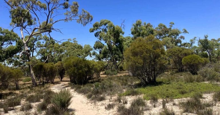
The Stringybark Nature Walk is a leisurely 1-kilometer loop trail located within Little Desert National Park, Victoria. This easy (grade 3) walk is perfect for those seeking a short and scenic introduction to the park's diverse plant life. The entire loop can be completed in about 30 minutes.
Conveniently situated on the Harrow-Nhill Road, the Stringybark Walk offers a glimpse into the heart of the Little Desert. As you embark on this peaceful loop, be sure to take note of the surrounding vegetation. Spring is an especially vibrant time to visit, with wildflowers like Mallee Honey-myrtle and a variety of native orchids adorning the landscape. Keep your eyes peeled for wildflowers not just at eye-level, but also consider looking underfoot to discover hidden gems.
The loop also provides ample opportunities for birdwatching, particularly after a refreshing rain shower. A helpful factsheet located at the trailhead provides valuable information to guide you along the walk.
Gallery
Got some great shots from this hike? Upload your photos here to inspire others and show off the beauty of the trail!
Click to view form >>
Submitting your photos doesn’t mean you lose ownership. You can be credited for your contributions, and you can request removal at any time.
Content use
Please don’t copy GPX files or content from this site to AllTrails or other platforms. Each trail has been personally mapped, documented, and refined to support Australia’s bushwalking and hiking community. While some details come from land managers, every listing reflects significant personal effort. This is a free, community-driven initiative—your respect helps keep it that way.
Walk map and GPX file
Max elevation: 166 m
Min elevation: 159 m
Total climbing: 8 m
Total descent: -8 m
Getting there
Getting to the trailhead: Little Desert National Park.
Little Desert National Park is roughly 375 kilometers west of Melbourne. Nestled between the Wimmera River and the South Australian border, the park offers a variety of access points.
For those arriving by car, sealed roads connect the park to the Western Highway. Additionally, a gravel road leads from Dimboola to the park’s eastern section. However, venturing beyond paved surfaces requires caution. Most off-road tracks are sandy and suitable only for experienced drivers in four-wheel drive vehicles (not all-wheel drive).
Public transportation is currently unavailable to reach the park. For those planning the Little Desert Discovery Walk, the distance remains the same – a four-hour drive from both Melbourne and Adelaide. While a car is currently the most convenient option, future developments in public transportation options may become available. Be sure to check park websites for the latest updates before your visit.
Closest towns to this walk: Dimboola, Harrow, Horsham, Jeparit, Kaniva, Nhill, Rainbow
About the region
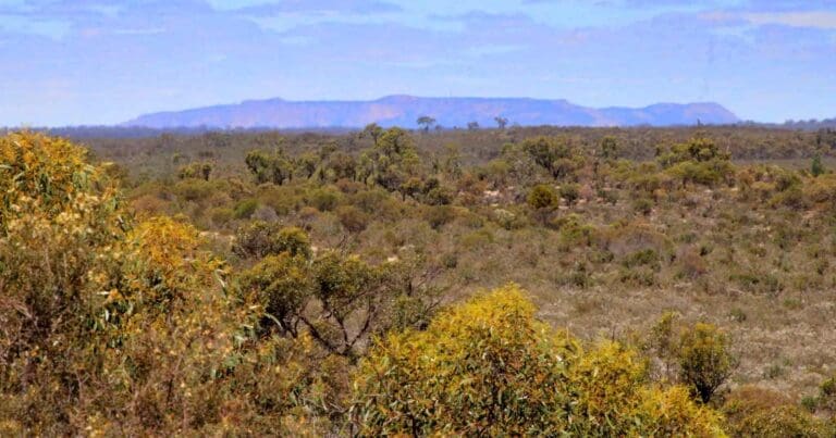
Little Desert National Park, located on the western border of Victoria, offers a captivating journey through a variety of landscapes. Explore vast stretches of pure mallee heathland, rolling sand dunes, and lush cypress pine and casuarina woodlands in the west. The park is rich in both cultural and natural significance.
The Wotjobaluk people are the traditional owners of this land, inhabiting it for thousands of years. Their connection to the area is evident in scarred trees, shell middens, stone tools, and oven mounds. As visitors, it's important to respect these Indigenous sites, which are part of Australia's heritage.
The park's diverse landscapes are shaped by the range of soil types. Despite the arid conditions, a surprising variety of plants and animals thrive here. This delicate balance between flora and fauna creates a unique ecosystem.
For the most enjoyable visit, plan your trip between late winter and early summer. During this time, the weather is comfortable, and the park comes alive with vibrant wildflowers. Camp alongside the Barringgi Gadyin (Wimmera River) and enjoy activities like bushwalking, birdwatching, or exploring the park by four-wheel drive. Remember, always follow water safety guidelines when exploring natural environments like rivers and lakes.
Similar walks nearby
Looking for more walks in or near Little Desert National Park? Try these trails with a similar difficulty grade.
Track grade
Grade 2 (Easy) - A Gentle Introduction to Inclines: Grade 2 on the AWTGS represents easy walking tracks that offer a slightly more challenging experience compared to Grade 1. Similar to Grade 1, no prior bushwalking experience is required. The track surface is typically hardened or compacted and may have gentle hill sections or occasional steps. The total distance of a Grade 2 walk is typically no greater than 10 kilometers. These walks are still suitable for families with a bit more experience or those seeking a gentle introduction to some inclines.
Explore safe
Plan ahead and hike safely! Carry enough water, pack layers for changing conditions, and bring safety gear like a torch, PLB, and reliable communication device. Check official sources for trail updates, closures, and access requirements, and review local weather and bushfire advice. Most importantly, share your plans with someone before you go. Being prepared makes for a safer and more enjoyable hike! Stay Safe, Explore More, and Always #ExploreSafe.
Packing checklists
What you carry in your pack depends on factors like weather, terrain, and your adventure type. Not sure what to bring? My free planning, food, and packing checklists are a great starting point, covering day hikes, overnight trips, and multi-day adventures. Use them to customise your kit and always prioritise safety.
Let someone know
Before heading out, take a moment to fill out your trip intentions form. It’s a quick way to share your hike details with family or friends. If something goes wrong, they can notify emergency services, ensuring a faster response and peace of mind. Stay safe and enjoy your adventure
Suggest an edit
Spotted a change on this trail? Maybe there are new features, the route has shifted, or the trail is permanently closed. Whatever the update, I’d love your input. Your feedback helps fellow hikers stay informed and ensures that our trail info stays fresh and reliable.
Acknowledgement of Country
Trail Hiking Australia acknowledges the Traditional Owners of the lands on which we hike and pay respects to their Elders, past and present, and we acknowledge the First Nations people of other communities who may be here today.


5 Reviews on “Stringybark Walk (1km)”
Did the Stringybark Nature Walk in Little Desert NP – perfect little 1km loop. Easy stroll through pretty bushland. Especially loved all the wildflowers blooming.