Hike at a Glance
Max elevation: 1054m
Min elevation: 262m
Total Ascent: 1774m
Important info
The Stirling Ridge Walk is a highly challenging and dangerous hike, suited only for experienced hikers with strong navigation skills. The ill-defined trail, steep rock scrambles, sharp elevation changes, and unpredictable weather make this trek extremely demanding. Sudden storms, high winds, and temperature drops can occur, and rescue is difficult in this remote area. Hikers must be fully prepared with the necessary gear, water, and emergency supplies. If you lack alpine experience or are unsure of your abilities, do not attempt this hike. Safety is paramount.
Hike overview
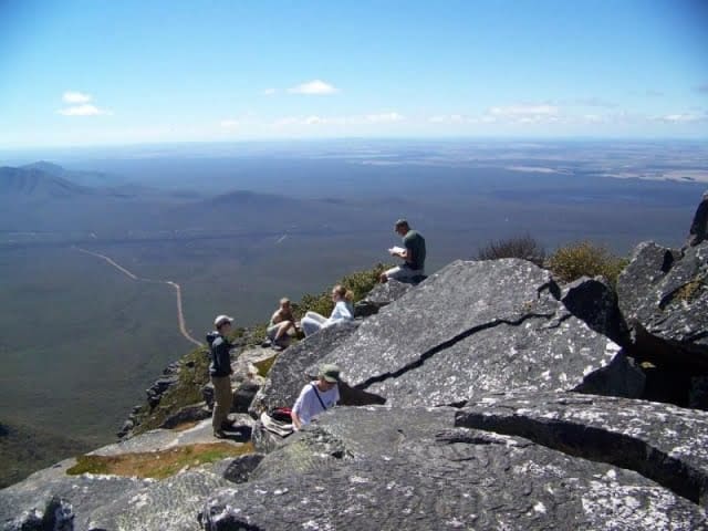
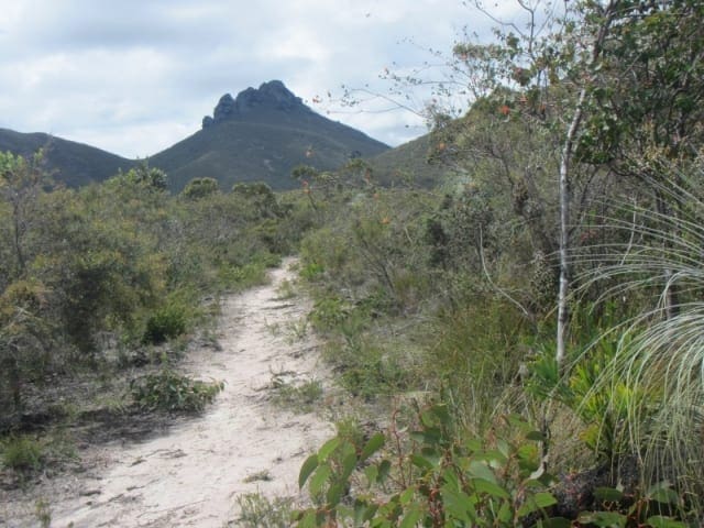
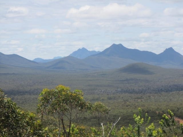
The Stirling Ridge Walk is a challenging and spectacular trek over the rugged mountain peaks between Bluff Knoll and Ellen Peak in Western Australia's Stirling Range National Park. The 19.5 km route, classified as a Grade 5 hike, typically takes about three days to complete, giving hikers ample time to appreciate the stunning natural beauty of this unique environment. However, it's not for the faint-hearted—good navigation skills are essential, and hikers should be prepared for steep rock scrambles and potentially severe weather conditions.
Known as the only sub-alpine hike in Western Australia, the Stirling Ridge Walk (SRRW) is more of a climb than a walk. It is regarded as the hardest hike in the state and one of the top six most difficult hikes in Australia. The ridge traverse is both breathtaking and dangerous, offering incredible rewards for those up to the challenge.
The route crosses over Ellen Peak (1,012 meters) and passes under the southern cliff of Pyungoorup Peak, before climbing over several distinct landmarks: Baker's Knob, the First, Second, and Third Arrows, Isongerup, Moongoongoonderup, and St James Peak. It finishes (or starts, depending on direction) with the ascent of Bluff Knoll, the highest peak at 1,073 meters.
The hike is a test of endurance and navigation, as the trail often dips steeply into passes between peaks, some as low as 600 to 800 meters. The path is far from straightforward, with constant changes in direction and elevation. It can feel disorienting at times as you scramble up steep inclines, only to be met with sharp turns and sudden descents, making this an exhilarating but demanding adventure.
When to Hike: The ideal time to hike the Stirling Ridge Walk is in late spring or early autumn. Spring is especially recommended, as it offers the added bonus of seeing the region's stunning wildflowers in bloom.
Direction: The hike can begin from either Ellen Peak or Bluff Knoll, but starting at Bluff Knoll is generally easier. The steep climb onto the ridge is more manageable at this end, where a well-defined trail leads up.
Exit Points: In addition to the main starting points at Bluff Knoll and Ellen Peak, there are only two other potential exit routes: one from First Arrow down to the North Mirlpunda Track, and another from Moongoongoonderup Ridge to the North Isongerup Track. These are difficult and should only be used in emergencies.
Tips
- The trail is unmarked, with no managed campsites or facilities. Be fully self-reliant and respect the environment by leaving no trace.
- Proficiency in navigation and the use of navigation equipment is crucial. Basic first aid knowledge is highly recommended.
- Minimise your impact on the landscape and take all waste with you, including food scraps.
- There are no reliable water sources on the ridge, so carry enough water for the entire hike—around 3 to 4 liters per person per day, or more in hot weather.
- Campsites are limited, and the weather can change rapidly.
- The trail can be difficult to follow, and emergency exits are hard to find.
- Carry a Personal Locator Beacon (PLB) for emergencies.
- Wear appropriate sun protection, sturdy boots, and weatherproof clothing.
- Be cautious of rough, uneven terrain and take extra care near rock ledges.
Gallery
Got some great shots from this hike? Upload your photos here to inspire others and show off the beauty of the trail!
Click to view form >>
Submitting your photos doesn’t mean you lose ownership. You can be credited for your contributions, and you can request removal at any time.
Content use
Please don’t copy GPX files or content from this site to AllTrails or other platforms. Each trail has been personally mapped, documented, and refined to support Australia’s bushwalking and hiking community. While some details come from land managers, every listing reflects significant personal effort. This is a free, community-driven initiative—your respect helps keep it that way.
Walk map and GPX file
Max elevation: 1054 m
Min elevation: 262 m
Total climbing: 1774 m
Total descent: -1963 m
Getting there
Getting to the trailhead: Stirling Range National Park.
To reach the trailhead for the Stirling Ridge Walk, you can start from either Bluff Knoll or Ellen Peak, both located within Stirling Range National Park, Western Australia. The most popular starting point is Bluff Knoll, accessible via Bluff Knoll Road, which branches off Chester Pass Road. The Bluff Knoll car park serves as a convenient trailhead, sitting at an elevation of 550 meters. From Albany, it’s about an hour’s drive north, while Perth is approximately a five-hour drive southeast. The Ellen Peak trailhead, on the northern side of the park, is more remote and less frequently used but can be accessed via rougher tracks that require careful navigation. Ensure you have a detailed map and check weather conditions before setting out.
Closest towns to this walk: Albany, Bluff Knoll, Borden, Forest Hill, Frankland, Frankland River, Gnowangerup, Katanning, Kendenup, Kojonup, Mount Barker, Mt Barker, Narrikup, Ongerup, Porongurup, Ravensthorpe
About the region
Stirling Range National Park is home to the only significant mountain range in the southern region of Western Australia, with peaks exceeding 1,000 metres above sea level. This unique landscape provides a challenging and spectacular hiking experience. The Aboriginal name for the range, Koi Kyenunu-ruff, translates to ‘mist rolling around the mountains,’ a phenomenon that frequently occurs in the area.
During spring and early summer, the ranges come alive with an abundance of wildflowers and birdlife, which can be observed from various hiking trails, lookouts, and picnic areas throughout the park. For those who prefer not to hike, a 42-kilometre scenic drive on mostly unsealed, graded roads winds through the heart of the park, offering numerous stops along the way.
Accommodation options include the Stirling Range Retreat and the Mount Trio Bush Camping and Caravan Park, both situated on the northern boundary of the park. Bluff Knoll, known as Bular Mial, holds cultural significance for the Minang and Goreng people, and informative signage at the Eastern Lookout shares valuable insights and stories about the area.
The peaks of the Stirling Range are prone to rapid and unpredictable weather changes, so hikers must be prepared for sudden cool changes that can bring temperature drops, rain, or hail. All visitors are strongly advised to avoid entering the bush or using footpaths during days of extreme fire danger. Those planning to hike off marked trails, as well as those intending to abseil or rock climb, should register their details at the shelter located in the picnic area across from the Bluff Knoll Road entry station. Registration is not required for those hiking established trails.
Recognition and acknowledgement are given to the Goreng and Menang people as the Traditional Owners of Stirling Range National Park.
Similar walks nearby
Looking for more walks in or near Stirling Range National Park? Try these trails with a similar difficulty grade.
Track grade
Grade 5 (Difficult) - Walks for the Most Experienced: Grade 5 represents the most challenging walking tracks on the AWTGS. These are only recommended for very experienced and fit walkers with specialised skills, including navigation and emergency first aid. Tracks are likely to be very rough, very steep, and unmarked. Walks may be more than 20 kilometers. These challenging walks demand a high level of fitness and experience to navigate difficult terrain, significant elevation changes, and potentially unformed paths.
Explore safe
Plan ahead and hike safely! Carry enough water, pack layers for changing conditions, and bring safety gear like a torch, PLB, and reliable communication device. Check official sources for trail updates, closures, and access requirements, and review local weather and bushfire advice. Most importantly, share your plans with someone before you go. Being prepared makes for a safer and more enjoyable hike! Stay Safe, Explore More, and Always #ExploreSafe.
Packing checklists
What you carry in your pack depends on factors like weather, terrain, and your adventure type. Not sure what to bring? My free planning, food, and packing checklists are a great starting point, covering day hikes, overnight trips, and multi-day adventures. Use them to customise your kit and always prioritise safety.
Let someone know
Before heading out, take a moment to fill out your trip intentions form. It’s a quick way to share your hike details with family or friends. If something goes wrong, they can notify emergency services, ensuring a faster response and peace of mind. Stay safe and enjoy your adventure
Suggest an edit
Spotted a change on this trail? Maybe there are new features, the route has shifted, or the trail is permanently closed. Whatever the update, I’d love your input. Your feedback helps fellow hikers stay informed and ensures that our trail info stays fresh and reliable.
Acknowledgement of Country
Trail Hiking Australia acknowledges the Traditional Owners of the lands on which we hike and pay respects to their Elders, past and present, and we acknowledge the First Nations people of other communities who may be here today.


10 Reviews on “Stirling Range Ridge Traverse Hike (19.5km)”
Absolutely stunning hike. Challenging but highly recommended.
Angad Singh