Hike at a Glance
Max elevation: 131m
Min elevation: 13m
Total Ascent: 208m
Hike overview
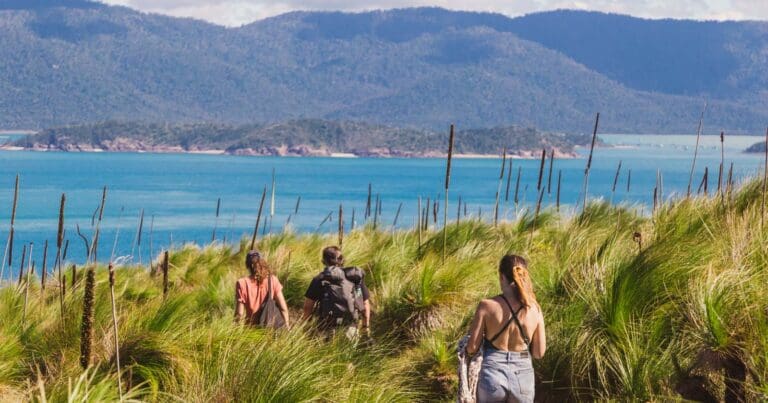
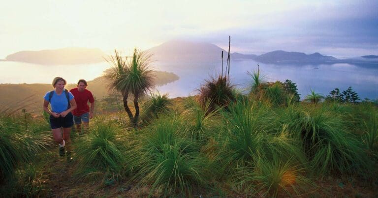
If you visit South Molle Island you should make time to walk some or all of the Spion Kop Track. This is one of the most scenic Whitsunday trails and you'll be rewarded with stunning views, from the saddle of the mountain to when you reach the lookout. Enjoy the magic 360-degree view.
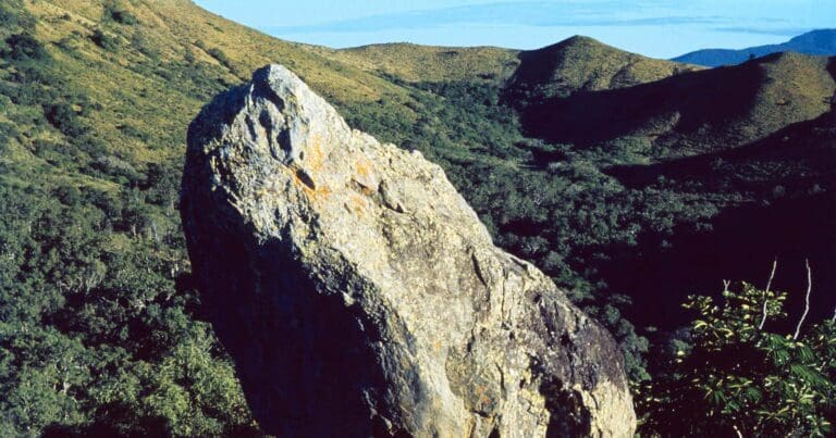
Offering spectacular views, this track traverses rainforest, grassland and open eucalypt fores to lookouts over the resort and Whitsunday Passage. This track also passes an ancient Ngaro stone quarry, an area of shattered rock high on the hillside and spilling toward the sea. The track is relatively flat and easy, and generally smooth.
Along the way you will take in the natural habitat of the island including grasslands, rain and eucalypt forests, white sandy beaches, rocky outcrops and a variety of vegetation and wildlife. The track passes the remnants of an ancient Ngaro stone quarry where you will see shattered rock high on the hillside and spilling down toward the sea. The trail is of moderate grade and suitable for either walking or mountain bike riding.
Tips
While you are on the islands, remove soil, weeds, seeds and pests from your boat, gear and clothes before moving to a new site. Wrap seeds and plant material, and place them in your rubbish.
Gallery
Got some great shots from this hike? Upload your photos here to inspire others and show off the beauty of the trail!
Click to view form >>
Submitting your photos doesn’t mean you lose ownership. You can be credited for your contributions, and you can request removal at any time.
Content use
Please don’t copy GPX files or content from this site to AllTrails or other platforms. Each trail has been personally mapped, documented, and refined to support Australia’s bushwalking and hiking community. While some details come from land managers, every listing reflects significant personal effort. This is a free, community-driven initiative—your respect helps keep it that way.
Walk map and GPX file
Max elevation: 131 m
Min elevation: 13 m
Total climbing: 208 m
Total descent: -207 m
Getting there
Getting to the trailhead: Molle Islands National Park.
Molle Islands National Park is just east of Shute Harbour. Access is by private or commercial boat from Airlie Beach or Shute Harbour. Some commercial transfer companies drop off and collect campers, bushwalkers and mountain bike riders. Arrange your passage before booking your camp site.
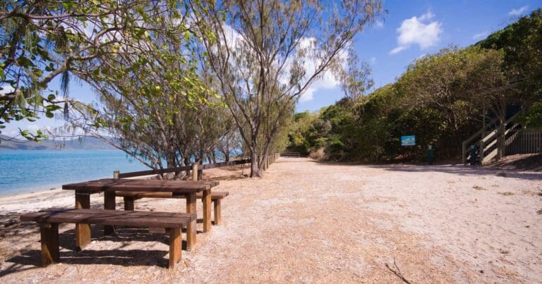
The tracks can be accessed from Bauer Bay (follow the track from the Bauer Bay jetty to the back of the golf course) or from Sandy Bay camping area. Access from Paddle Bay is walking only.
Closest towns to this walk: Airlie Beach, Cannonvale, Hamilton Island, Jubilee Pocket, Long Island, Proserpine, Shute Harbour
About the region
Molle Islands National Park is in North Queensland, Australia, 913 km northwest of Brisbane. The park covers several continental islands a short distance offshore including Long Island, Shite Island, Tancred Island, Repair Island, Planton Island, Goat Island, Denman Island and the majority of North Molle Island, Mid Molle Island and South Molle Island. The park features white sandy beaches, open eucalypt forests, rainforest-clad gullies and grasslands. The traditional owners of the islands were the Ngaro people.
White sandy beaches, pockets of rainforest and pale blue waters make these picturesque inshore islands a wildlife refuge and a scenic retreat for nature lovers. Molle Islands National Park is a group of continental islands lying off the Queensland coast 10km east of Airlie Beach.
Open eucalypt forests clothe the hillsides, rainforest grows in sheltered gullies and grasslands cover the more exposed slopes. The Ngaro Aboriginal people lived on and visited these islands for thousands of years. They used fire to flush out game and maintain the natural grasslands. A stone quarry for making tools and weapons remains on South Molle Island.
Once used for grazing, South Molle Island later became a national park and a resort was established in 1937. The islands and surrounding waters are protected in the Great Barrier Reef World Heritage Area.
Enjoy stunning views along South Molle's shared tracks (walking and mountain bike riding) with a variety of vegetation, wildlife and spectacular destinations on offer.
Similar walks nearby
Looking for more walks in or near Molle Islands National Park? Try these trails with a similar difficulty grade.
Track grade
Grade 3 (Moderate) - Walks for Most Fitness Levels: Grade 3 on the AWTGS represents moderate walking tracks. These are ideal for walkers with some fitness who are comfortable with some hills and uneven terrain. While suitable for most ages, some bushwalking experience is recommended to ensure a safe and enjoyable experience. Tracks may have short, steep hill sections, a rough surface, and many steps. The total distance of a Grade 3 walk can be up to 20 kilometers.
Explore safe
Plan ahead and hike safely! Carry enough water, pack layers for changing conditions, and bring safety gear like a torch, PLB, and reliable communication device. Check official sources for trail updates, closures, and access requirements, and review local weather and bushfire advice. Most importantly, share your plans with someone before you go. Being prepared makes for a safer and more enjoyable hike! Stay Safe, Explore More, and Always #ExploreSafe.
Packing checklists
What you carry in your pack depends on factors like weather, terrain, and your adventure type. Not sure what to bring? My free planning, food, and packing checklists are a great starting point, covering day hikes, overnight trips, and multi-day adventures. Use them to customise your kit and always prioritise safety.
Let someone know
Before heading out, take a moment to fill out your trip intentions form. It’s a quick way to share your hike details with family or friends. If something goes wrong, they can notify emergency services, ensuring a faster response and peace of mind. Stay safe and enjoy your adventure
Suggest an edit
Spotted a change on this trail? Maybe there are new features, the route has shifted, or the trail is permanently closed. Whatever the update, I’d love your input. Your feedback helps fellow hikers stay informed and ensures that our trail info stays fresh and reliable.
Acknowledgement of Country
Trail Hiking Australia acknowledges the Traditional Owners of the lands on which we hike and pay respects to their Elders, past and present, and we acknowledge the First Nations people of other communities who may be here today.


