Hike at a Glance
Max elevation: 93m
Min elevation: 71m
Total Ascent: 50m
Hike overview
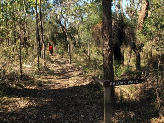
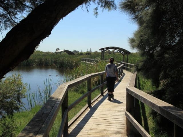
The Rotary South Bank River Trail offers a gentle 2.5-kilometre circuit along both shores of the Margaret River, providing a peaceful walk through the shaded forests of Wooditjup National Park. Located in Rotary Park at the northern edge of town, this trail is just a short stroll from Margaret River’s centre and is an ideal way to stretch your legs, whether you're passing through or staying in the region.
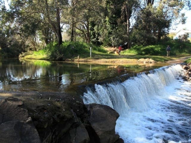
The walk begins in Rotary Park, following the northern bank of the river towards the Barret Street Weir. After crossing the weir, the trail loops back along the southern shore, leading walkers past towering native trees before crossing a charming footbridge near the old settlement and returning to the park. The well-formed path makes this an easy, accessible walk, perfect for families, casual walkers, and those looking to soak up the tranquillity of the river.
Rotary Park itself is a great place to pause and unwind. Nestled among tall marri and jarrah trees, it provides a cool retreat even on warm days. There are picnic areas, a wishing well, and access to the Margaret River Heritage Area, where you can explore historic buildings such as the Old Milking Shed, Dairy, and Group House. For those looking to extend their walk, this is also the starting point for the Ten Mile Brook Trail, a 15-kilometre return route following the brook to the Ten Mile Brook Dam.
Nature lovers will appreciate the birdlife along the way, with sightings of white-breasted robins, golden whistlers, and other bush birds common in the area. In spring, wildflowers brighten the trail, adding bursts of colour to the surrounding greenery. Whether you're after a relaxed riverside stroll or a starting point for a longer adventure, the Rotary South Bank River Trail offers a perfect introduction to the natural beauty of Margaret River.
Gallery
Got some great shots from this hike? Upload your photos here to inspire others and show off the beauty of the trail!
Uploading your photos doesn’t mean you lose ownership. You can be credited for your contributions, and you can request removal at any time.
Content use
Please don’t copy GPX files or content from this site to AllTrails or other platforms. Each trail has been personally mapped, documented, and refined to support Australia’s bushwalking and hiking community. While some details come from land managers, every listing reflects significant personal effort. This is a free, community-driven initiative—your respect helps keep it that way.
Walk map and GPX file
Max elevation: 93 m
Min elevation: 71 m
Total climbing: 50 m
Total descent: -50 m
Getting there
Getting to the trailhead: Wooditjup National Park.
To reach the South Bank River Trail, head to Rotary Park in Margaret River, located about 280 kilometres south of Perth. The town of Margaret River is easily accessible by car via the Bussell Highway, a well-maintained route that offers a straightforward drive through the stunning landscapes of Western Australia’s South West region. Once you arrive in Margaret River, Rotary Park is situated at the northern edge of town, where the trail begins near the iconic ‘Old Kate’ steam engine. The park provides a convenient starting point for your hike or bike ride, making it a simple and scenic destination for those venturing from Perth or nearby areas.
Closest towns to this walk: Augusta, Bramley, Burnside, Busselton, Cowaramup, Dunsborough, Gracetown, Margaret River, Yallingup
About the region
We recognise and acknowledge the Wardandi people as the Traditional Owners of Wooditjup National Park.
Located just minutes from Margaret River and a three-hour drive south of Perth, Wooditjup National Park spans 3,892 hectares of towering jarrah, marri, and karri forests. Formerly known as Bramley National Park, it was renamed in 2018 to honour the land’s Traditional Custodians. This protected area is home to diverse wildlife, including western ringtail possums, brush-tailed phascogales, and an array of birdlife. In spring, the forest floor bursts into colour with native wildflowers.
The park offers a variety of walks and hikes suitable for all fitness levels. The Ten Mile Brook Trail leads to the dam on a scenic route taking around four hours, while the 3.2-kilometre Chimney Trail loops past the historic Wharncliffe Mill site. For an easier stroll, the Rotary South Bank River Trail follows the Margaret River for 2.4 kilometres.
Visitors can stay overnight at the RAC Margaret River Nature Park, which offers camping and cabin options within walking distance of town. The park is free to access and open year-round, though pets are not permitted to protect local wildlife.
Want to find the best trails in Wooditjup National Park for an adventurous hike, casual walk, or a family trip? Trail Hiking Australia has the best trails for walking, hiking, running, and more.
Similar walks nearby
Looking for more walks in or near Wooditjup National Park? Try these trails with a similar difficulty grade.
Track grade
Grade 1 (All-abilities) - Perfect for Families and Beginners: Grade 1 on the AWTGS represents the easiest walking tracks, perfect for families with young children or those new to bushwalking. No prior experience is required. These gentle walks feature a flat, even surface with no steps or steep sections. They are suitable for wheelchair users with assistance due to the even terrain. The total distance of a Grade 1 walk is typically no greater than 5 kilometers, making them a comfortable and manageable option for all ages and fitness levels.
Explore safe
Plan ahead and hike safely! Carry enough water, pack layers for changing conditions, and bring safety gear like a torch, PLB, and reliable communication device. Check official sources for trail updates, closures, and access requirements, and review local weather and bushfire advice. Most importantly, share your plans with someone before you go. Being prepared makes for a safer and more enjoyable hike! Stay Safe, Explore More, and Always #ExploreSafe.
Packing checklists
What you carry in your pack depends on factors like weather, terrain, and your adventure type. Not sure what to bring? My free planning, food, and packing checklists are a great starting point, covering day hikes, overnight trips, and multi-day adventures. Use them to customise your kit and always prioritise safety.
Let someone know
Before heading out, take a moment to fill out your trip intentions form. It’s a quick way to share your hike details with family or friends. If something goes wrong, they can notify emergency services, ensuring a faster response and peace of mind. Stay safe and enjoy your adventure
Suggest an edit
Spotted a change on this trail? Maybe there are new features, the route has shifted, or the trail is permanently closed. Whatever the update, I’d love your input. Your feedback helps fellow hikers stay informed and ensures that our trail info stays fresh and reliable.
Acknowledgement of Country
Trail Hiking Australia acknowledges the Traditional Owners of the lands on which we hike and pay respects to their Elders, past and present, and we acknowledge the First Nations people of other communities who may be here today.


