Hike at a Glance
Max elevation: 585m
Min elevation: 173m
Total Ascent: 773m
Hike overview
The walk can be undertaken as a single 16km loop, or seperated into an overnight trip - with a well established campsite near the river bank. Note that McKillops Road, on the opposite side of the river, overlooks the campsite.
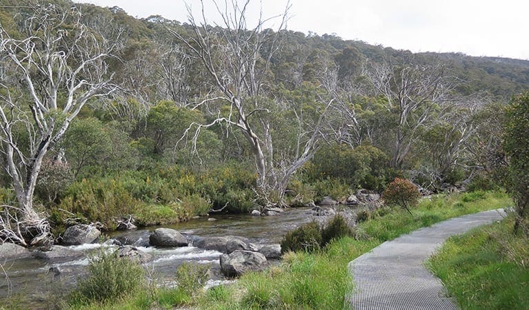
Starting from McKillop Bridge, the Silver Mine walk links fire access and other minor tracks in a varied and interesting route, including a section of the bank of the Snowy River. The path is broad, well graded and carefully benched where it sidles steep hillsides.
The initial walk up the Deddick 4WD track includes a couple of steep sections but is otherwise well graded. As you climb Deddick track you will pass the junction where the Silver Mine Walk exists back onto the 4WD track. The management vehcile only track which you follow from Deddick trail down to river, past several mine sites, is also easy to follow. There is a campsite with fire-pit at the junction of this vehcile track and the river. When you are near the highest point of the walk on the main track, be vigilant to avoid missing the turn-off to Silver Mine Track. There is currently a large tree branch at the beginning of this track, so you may need to walk a couple of meters further to get onto the track. Missing this turn can take you off route, as we experienced. The views along this next stage are incredible.
The segment of the walk which follows beside the Snowy River is impacted by post-fire re-growth. Parks Victoria advise to walk along the foot of the slope where it meets the flood plain, rather than to follow the water's edge. To this end, new signposts have been erected along the trail. There are also signposts where the walking track deviates away from the river and up an old driving track. This junction could be difficult to find if following the riverbank rather than the marked trail. Once you are at the river, heading back to the bridge, follow the signposts carefully, and you will have no trouble making it back to Deddick Trail. Possibly new signposts have been erected since the last update. There are also signposts where the walking track deviates away from the river and up an old driving track. This junction could be difficult to find if following the riverbank rather than the marked trail.
From this point the track follows a dry creek bed for approximately one kilometre and there are many fallen trees across the path which will need to be negotiated. Once the track does start to climb out of the creek bed, it passes through several switch backs while traversing over a steep ridge. The track then crosses over another dry creek bed before climbing to an intersection with the Deddick Trail. This dry creek crossing is another location where walkers may have difficulties in finding the path. At this location, the path follows the creek bed for a short distance of no more than 20 metres before branching away again. Walkers should not proceed along the dry creek bed at this point. To do so will result in eventually re-emerging on the bank of the Snowy River at a location some kilometres south of McKillop Bridge. To try to walk back to the bridge from here will be very arduous.
Tips
- Parks Victoria state the walk should be undertaken by seasoned walkers, however on our overnight trip (Easter 2018) we found the trail to be easily identifiable and well sign-posted.
- Shade is quite limited along the entire trail so sun protection is a must if walking in warm weather.
- It's a long drive from Melbourne. Buchan is a great place to stop, refuel and enjoy a break before the drive into the national park. Along McKillops Road you will drive past a few short walks, including Little River Falls and Little River Gorge. Little River Gorge has a great viewing platform.
- There is a large car camping area with river access, picnic tables and fire-pits just before you reach the bridge. There is a single composting toilet at this site.
- There are many great spots for swimming at the car campsite as well as the day visitor area just across the bridge (which is where the walk starts). There is also a composting toilet at the day visitor area.
Contributed by Mick Woods
Gallery
Got some great shots from this hike? Upload your photos here to inspire others and show off the beauty of the trail!
Click to view form >>
Submitting your photos doesn’t mean you lose ownership. You can be credited for your contributions, and you can request removal at any time.
Content use
Please don’t copy GPX files or content from this site to AllTrails or other platforms. Each trail has been personally mapped, documented, and refined to support Australia’s bushwalking and hiking community. While some details come from land managers, every listing reflects significant personal effort. This is a free, community-driven initiative—your respect helps keep it that way.
Walk map and GPX file
Max elevation: 585 m
Min elevation: 173 m
Total climbing: 773 m
Total descent: -770 m
Getting there
Getting to the trailhead: Snowy River National Park.
From Melbourne take the Princes Highway to Bairnsdale, then the (B500) Great Alpine Road to Bruthen. From Bruthen, follow the (C620) Bruthen-Nowa Nowa Road until the intersection with (C608) Bruthen-Buchan Road. Turn left at this intersection and head to Buchan. Buchan is the last opportunity to obtain fuel. From Buchan follow the C608, now called Gelantipy Road to the intersection with McKillops Road (C611). This intersection is also well-signposted.
Shortly after entering Snowy River National Park you will see signs for Little River Falls (a short 400m walk). From about here the road is predominately gravel, with some sealed sections. The last 11km before reaching McKillops bridge is a single lane gravel road that winds down to the river valley. Some parts of this section run along a steep cliff-face with limited passing opportunities – reversing may be required if faced with an oncoming vehicle. The road is in good condition and completely 2WD accessible, though a AWD or 4WD would be better during wet weather conditions.
Closest towns to this walk: Bendoc, Bonang, Buchan, Delegate, Ensay, Goongerah, Marlo, Orbost, Tubbut, Tubbutt
About the region
Snowy River National Park, located 390 kilometres east of Melbourne in Victoria, is renowned for its dramatic river landscapes, deep gorges, and diverse forests. Covering 98,700 hectares, the park safeguards one of Victoria’s largest forested areas. The park’s northern region is dominated by the Bowen Range and Gelantipy Plateau, while the rugged waterways of Mountain Creek and Rodger River flow southward into the Snowy River.
Established in 1992, the park encompasses two significant wilderness areas: Bowen and Snowy River. These protected regions offer exceptional conservation value and opportunities for solitary exploration. Visitors can engage in a range of self-reliant outdoor activities, although vehicular access to wilderness areas is restricted.
The park provides diverse experiences for outdoor enthusiasts. McKillops Bridge offers one of the few road access points to the Snowy River, where visitors can enjoy swimming in the river's clear pools or enjoy exciting canoeing or rafting adventures through rugged gorges and rapids. For those seeking a different kind of challenge, the 18-kilometre Silver Mine Walking Track and the shorter Snowy River Trail commence at McKillops Bridge.
Little River Gorge, Victoria’s deepest gorge, is a short drive from McKillops Bridge. A walking track leads to a lookout offering breathtaking views of the gorge. While the road to McKillops Bridge is not suitable for larger vehicles, visitors can explore the area by car under favourable conditions. The Yalmy Road winds through magnificent forests to Waratah Flat, providing opportunities for walks and hikes.
Raymond Falls, a stunning 20-metre waterfall, is accessible year-round from Orbost via Moresford Track. The park also features the 43-kilometre Deddick Trail, a four-wheel-drive route traversing the park's heart. Several camping grounds with varying amenities are available throughout the park.
Snowy River National Park is rich in natural and cultural heritage. Evidence of Aboriginal occupation has been found, suggesting that the Kruatungulung people of the Kurnai nation once thrived in the area. European settlement began in the 1840s with cattle grazing and mining activities. Despite early proposals, the park was not officially protected until 1979.
The park boasts exceptional biodiversity, with over 900 native plant species across 20 vegetation communities. Many of these species are rare or threatened. Wildlife enthusiasts may encounter superb lyrebirds along the Raymond Falls track, while azure kingfishers and even platypus can be spotted at the base of the falls.
Want to find the best trails in Snowy River National Park for an adventurous hike, casual walk, or a family trip? Trail Hiking Australia has the best trails for walking, hiking, running and more.
Similar walks nearby
Looking for more walks in or near Snowy River National Park? Try these trails with a similar difficulty grade.
Track grade
Grade 4 (Hard) - Challenging Walks for Experienced Walkers: Grade 4 on the AWTGS signifies challenging walking tracks. Bushwalking experience is recommended for these tracks, which may be long, rough, and very steep. Directional signage may be limited, requiring a good sense of navigation. These walks are suited for experienced walkers who are comfortable with steeper inclines, rougher terrain, and potentially longer distances.
Explore safe
Plan ahead and hike safely! Carry enough water, pack layers for changing conditions, and bring safety gear like a torch, PLB, and reliable communication device. Check official sources for trail updates, closures, and access requirements, and review local weather and bushfire advice. Most importantly, share your plans with someone before you go. Being prepared makes for a safer and more enjoyable hike! Stay Safe, Explore More, and Always #ExploreSafe.
Packing checklists
What you carry in your pack depends on factors like weather, terrain, and your adventure type. Not sure what to bring? My free planning, food, and packing checklists are a great starting point, covering day hikes, overnight trips, and multi-day adventures. Use them to customise your kit and always prioritise safety.
Let someone know
Before heading out, take a moment to fill out your trip intentions form. It’s a quick way to share your hike details with family or friends. If something goes wrong, they can notify emergency services, ensuring a faster response and peace of mind. Stay safe and enjoy your adventure
Suggest an edit
Spotted a change on this trail? Maybe there are new features, the route has shifted, or the trail is permanently closed. Whatever the update, I’d love your input. Your feedback helps fellow hikers stay informed and ensures that our trail info stays fresh and reliable.
Acknowledgement of Country
Trail Hiking Australia acknowledges the Traditional Owners of the lands on which we hike and pay respects to their Elders, past and present, and we acknowledge the First Nations people of other communities who may be here today.


6 Reviews on “Silver Mine Walk (16.5km)”
Note sent to me via email: Suggest following the GPX map very closely. On the main track, when you are near the highest point of the walk, you need to be looking carefully to ensure you don’t miss the turn off to Silver mine track. There is currently a large tree branch at the beginning of this track, so you need to walk up maybe a couple of meters more, to get onto the track. We walked past it, then realised we were no longer on the route. The views along this next stage are incredible.
Once you are at the river, heading back to the bridge, follow the sign posts carefully, and you will have no trouble making it back to Deddick Trail. Possibly new sign posts erected since the last update.