Hike at a Glance
Max elevation: 409m
Min elevation: 252m
Total Ascent: 287m
Hike overview
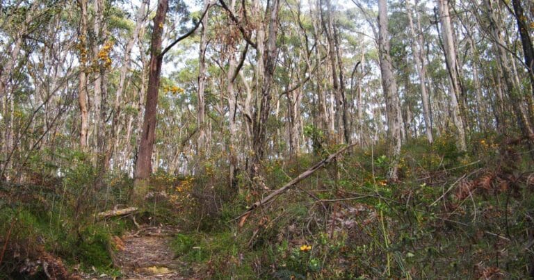
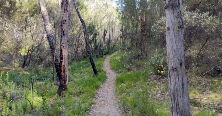
Explore the natural beauty of Scott Creek Conservation Park with the Scott Creek Eastern Circuit. This moderately challenging (grade 3) 8.5-kilometre loop winds through the park's eastern reaches, offering a rewarding experience for those seeking a more remote wilderness adventure.
Unlike other areas of the park, the eastern section lacks designated walking trails. However, a well-established network of signposted fire tracks provides a clear route for exploration. The circuit commences at Gate 14, conveniently located at the intersection of Matthews Road and Scott Creek Road. While the absence of marked trails allows for a more independent exploration, be sure to plan your route carefully and ensure you have a map and compass for navigation. Allow approximately 3 hours to complete the circuit, keeping in mind the distance and potential uneven terrain.
Bushwalkers are encouraged to explore the park via the fire track network. Please stick to designated tracks and take care as these trail include steep sections and rocky, uneven surfaces that may be slippery when wet. A good level of fitness and experience is advised.
For more information on this hiking trail, please visit Walking SA
Gallery
Got some great shots from this hike? Upload your photos here to inspire others and show off the beauty of the trail!
Click to view form >>
Submitting your photos doesn’t mean you lose ownership. You can be credited for your contributions, and you can request removal at any time.
Content use
Please don’t copy GPX files or content from this site to AllTrails or other platforms. Each trail has been personally mapped, documented, and refined to support Australia’s bushwalking and hiking community. While some details come from land managers, every listing reflects significant personal effort. This is a free, community-driven initiative—your respect helps keep it that way.
Walk map and GPX file
Max elevation: 409 m
Min elevation: 252 m
Total climbing: 287 m
Total descent: -287 m
Getting there
Getting to the trailhead: Scott Creek Conservation Park.
Accessible by car, Scott Creek Conservation Park lies approximately 30 kilometres south of Adelaide. Drivers can reach the park via two main roads: Dorset Vale Road or Scott Creek Road, both leading to the park entrance in the township of Scott Creek.
Closest towns to this walk: Aldgate, Bridgewater, Crafers, Scott Creek, Stirling
About the region
Immerse yourself in the natural and cultural heritage of the Mount Lofty Ranges at Scott Creek Conservation Park, located near Adelaide. This significant conservation area shelters a diverse range of native plants and animals, including threatened species.
Originally a key travel route for the Kaurna People, the park also boasts historical significance. From the 1850s onwards, the area was mined for copper and silver, leaving behind remnants like engine houses and mine shafts that you can explore along the park's interpretive walking trails.
Previously cleared for grazing, the park is now undergoing restoration efforts to return native vegetation. Today, nearly 400 plant species thrive here, including most of the eucalypt varieties found in the Mount Lofty Ranges. Dense stringybark scrub with a diverse understorey dominates the landscape, providing habitat for over 125 bird species and a variety of mammals like koalas, echidnas, and kangaroos.
Keep your eyes peeled for these shy creatures as you explore the park's walking trails, suitable for a range of fitness levels. The park offers a great escape for those seeking a connection with nature and South Australia's rich history.
Similar walks nearby
Looking for more walks in or near Scott Creek Conservation Park? Try these trails with a similar difficulty grade.
Track grade
Grade 3 (Moderate) - Walks for Most Fitness Levels: Grade 3 on the AWTGS represents moderate walking tracks. These are ideal for walkers with some fitness who are comfortable with some hills and uneven terrain. While suitable for most ages, some bushwalking experience is recommended to ensure a safe and enjoyable experience. Tracks may have short, steep hill sections, a rough surface, and many steps. The total distance of a Grade 3 walk can be up to 20 kilometers.
Explore safe
Plan ahead and hike safely! Carry enough water, pack layers for changing conditions, and bring safety gear like a torch, PLB, and reliable communication device. Check official sources for trail updates, closures, and access requirements, and review local weather and bushfire advice. Most importantly, share your plans with someone before you go. Being prepared makes for a safer and more enjoyable hike! Stay Safe, Explore More, and Always #ExploreSafe.
Packing checklists
What you carry in your pack depends on factors like weather, terrain, and your adventure type. Not sure what to bring? My free planning, food, and packing checklists are a great starting point, covering day hikes, overnight trips, and multi-day adventures. Use them to customise your kit and always prioritise safety.
Let someone know
Before heading out, take a moment to fill out your trip intentions form. It’s a quick way to share your hike details with family or friends. If something goes wrong, they can notify emergency services, ensuring a faster response and peace of mind. Stay safe and enjoy your adventure
Suggest an edit
Spotted a change on this trail? Maybe there are new features, the route has shifted, or the trail is permanently closed. Whatever the update, I’d love your input. Your feedback helps fellow hikers stay informed and ensures that our trail info stays fresh and reliable.
Acknowledgement of Country
Trail Hiking Australia acknowledges the Traditional Owners of the lands on which we hike and pay respects to their Elders, past and present, and we acknowledge the First Nations people of other communities who may be here today.


