Hike at a Glance
Max elevation: 471m
Min elevation: 375m
Total Ascent: 172m
Hike overview
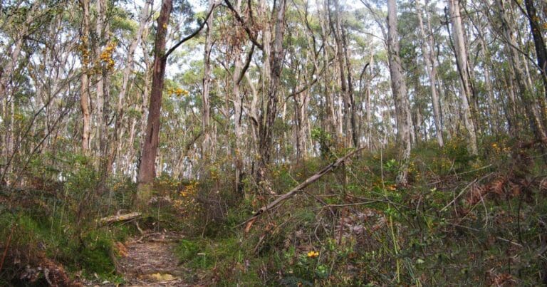
The Mark Oliphant Conservation Circuit offers a scenic 4-kilometer hike through the stringybark forests of Mark Oliphant Conservation Park in South Australia. This moderate, 1.5-hour loop trail combines three smaller hikes for a more comprehensive exploration of the park.
While the park entrance may appear unassuming, don't be discouraged. Well-marked trails and fire tracks named after streets guide visitors throughout the park. Though trail information isn't available directly at the carpark, a modern shelter stands near the oval, offering a convenient resting spot. Beyond the oval, however, the park is largely devoid of amenities.
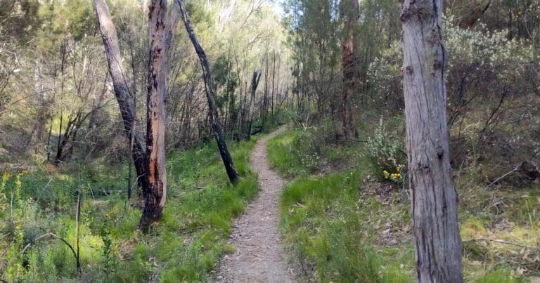
Begin your hike by heading clockwise from the carpark at Gate 1 on Scott Creek Road. Follow Loftia Track, a fire track, past the oval and shelter. You'll encounter the Bandicoot Trail about 100 meters after the junction with Nioka Track. For this suggested loop, however, continue along the fire track until you reach the single walking trail known as the Skink Trail.
Upon reaching the intersection of the Skink and Bandicoot Trails, turn left and follow the Bandicoot Trail. A portion of the Bandicoot Trail (roughly 650 meters) follows the quiet dirt Evans Drive. Both the entrance and exit of this section are clearly marked, so resist the allure of any indistinct side trails that may appear.
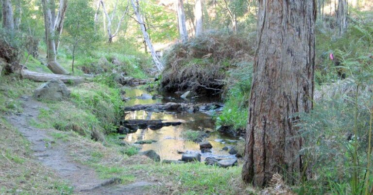
As the Bandicoot Trail descends back into the gully, you'll meet Camp Track near a prominent water tank. Turn left here and follow Camp Track to the next junction. Take another left turn, and within 100 meters, the fire track transitions into a single walking trail known as the Waterfall Trail. While the head-height vegetation along this trail may be overgrown at times, the path itself remains easy to follow.
Tips
- Dogs are not permitted in this park.
- There are no facilities in the park. Please ensure you carry sufficient water, food and supplies for your entire visit.
- It is also a good idea to let a responsible person know of your intended movements and when you expect to return.
- This park is closed on days of Catastrophic Fire Danger and may also be closed on days of Extreme Fire Danger.
Gallery
Got some great shots from this hike? Upload your photos here to inspire others and show off the beauty of the trail!
Click to view form >>
Submitting your photos doesn’t mean you lose ownership. You can be credited for your contributions, and you can request removal at any time.
Content use
Please don’t copy GPX files or content from this site to AllTrails or other platforms. Each trail has been personally mapped, documented, and refined to support Australia’s bushwalking and hiking community. While some details come from land managers, every listing reflects significant personal effort. This is a free, community-driven initiative—your respect helps keep it that way.
Walk map and GPX file
Max elevation: 471 m
Min elevation: 375 m
Total climbing: 172 m
Total descent: -172 m
Getting there
Getting to the trailhead: Mark Oliphant Conservation Park.
The Mark Oliphant Conservation Circuit is accessible from Adelaide via the South-Eastern Freeway, approximately 22 kilometers southeast of the city. The hike begins at Gate 1 on Scott Creek Road, which serves as the trailhead for this specific circuit.
Closest towns to this walk: Burton, Callington, Craigmore, Elizabeth, Green Fields, Mannum, Mawson Lakes, Murray Bridge, Nairne, Oakbank, Palmer, Parafield, Paralowie, Salisbury, Swan Reach, Virginia
About the region
The Mark Oliphant Conservation Park, named after former state Governor Sir Mark Oliphant for his conservation efforts, offers a haven for bushwalkers with its scenic forest landscapes. Keep an eye out for the park's abundant birdlife, including the scarlet robin, golden whistler, and Adelaide rosellas. The park holds particular significance as a critical habitat for the nationally endangered southern brown bandicoot.
Prior to European settlement, the area served as a vital source of food, shelter, and wood for the Kaurna people. It also functioned as a major pathway connecting the hills and plains.
Messmate stringybark and brown stringybark dominate the park's forest canopy. A rare stand of candlebark gums, known for their white bark and limited to high-rainfall regions of the Adelaide Hills, can be found near the oval. Scattered pockets of pink gum, manna gum, and blue gum also contribute to the park's diverse flora. The forest understory boasts a vibrant display of spring-flowering shrubs like myrtle-leaved wattle, beaked hakea, and large-leaved bush-pea. While bushfires in 1980 and 1995 impacted the park's plant life, weeds pose the most significant current threat.
The park provides refuge for elusive creatures such as the southern brown bandicoot and yellow-footed antechinus, alongside various lizard, snake, and frog species. Birdwatchers will delight in spotting the superb fairy-wren, scarlet robin, golden whistler, Adelaide rosella, and numerous honeyeater species. While invertebrates represent the park's most abundant and diverse animal group, their small size makes them less conspicuous. Visitors are encouraged to take a closer look to appreciate the fascinating shapes, colors, and behaviors of ants, beetles, and butterflies.
Similar walks nearby
Looking for more walks in or near Mark Oliphant Conservation Park? Try these trails with a similar difficulty grade.
Track grade
Grade 3 (Moderate) - Walks for Most Fitness Levels: Grade 3 on the AWTGS represents moderate walking tracks. These are ideal for walkers with some fitness who are comfortable with some hills and uneven terrain. While suitable for most ages, some bushwalking experience is recommended to ensure a safe and enjoyable experience. Tracks may have short, steep hill sections, a rough surface, and many steps. The total distance of a Grade 3 walk can be up to 20 kilometers.
Explore safe
Plan ahead and hike safely! Carry enough water, pack layers for changing conditions, and bring safety gear like a torch, PLB, and reliable communication device. Check official sources for trail updates, closures, and access requirements, and review local weather and bushfire advice. Most importantly, share your plans with someone before you go. Being prepared makes for a safer and more enjoyable hike! Stay Safe, Explore More, and Always #ExploreSafe.
Packing checklists
What you carry in your pack depends on factors like weather, terrain, and your adventure type. Not sure what to bring? My free planning, food, and packing checklists are a great starting point, covering day hikes, overnight trips, and multi-day adventures. Use them to customise your kit and always prioritise safety.
Let someone know
Before heading out, take a moment to fill out your trip intentions form. It’s a quick way to share your hike details with family or friends. If something goes wrong, they can notify emergency services, ensuring a faster response and peace of mind. Stay safe and enjoy your adventure
Suggest an edit
Spotted a change on this trail? Maybe there are new features, the route has shifted, or the trail is permanently closed. Whatever the update, I’d love your input. Your feedback helps fellow hikers stay informed and ensures that our trail info stays fresh and reliable.
Acknowledgement of Country
Trail Hiking Australia acknowledges the Traditional Owners of the lands on which we hike and pay respects to their Elders, past and present, and we acknowledge the First Nations people of other communities who may be here today.


