Hike at a Glance
Max elevation: 219m
Min elevation: 80m
Total Ascent: 301m
Hike overview
This hike extends the Red Hands Cave walking track, offering a deeper exploration of the Blue Mountains National Park's cultural and natural wonders.
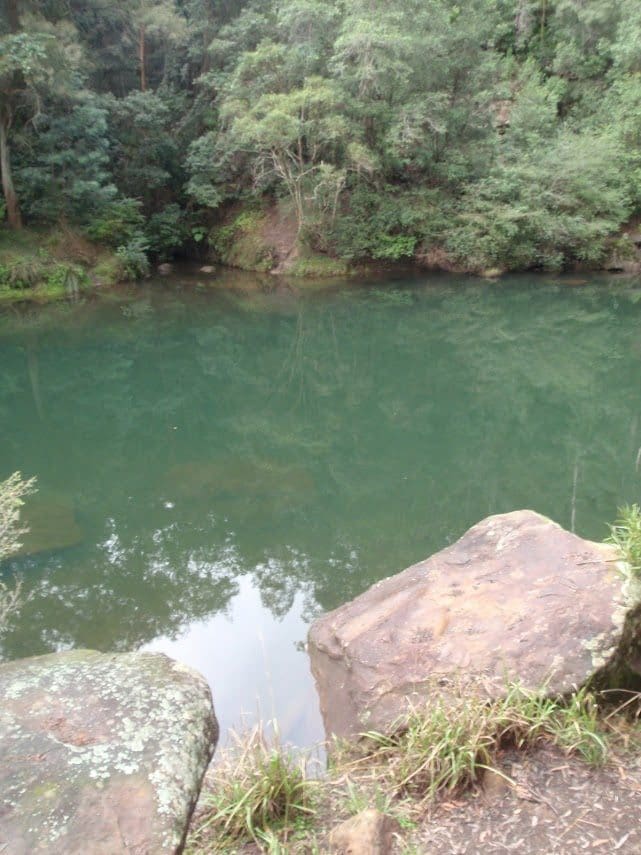
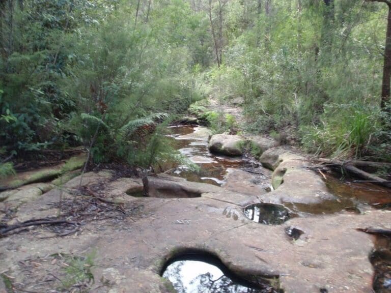
Your adventure starts at Glenbrook Causeway. Follow the Campfire Creek track, known for its moderate challenge and scenic beauty. Look closely for the ancient axe grinding grooves etched on the creek bed - silent testaments to Aboriginal tool creation. As you reach a fork, take a right and keep an eye out for basking eastern water dragons. The track winds its way through a gully, gradually climbing until you reach the magnificent Red Hands Cave, a towering sandstone overhang.
Red Hands Cave will leave you spellbound with its layers of hand stencils – a powerful display of Aboriginal art and cultural significance. Take a moment to appreciate the stories these artworks tell and the connection they offer to the past.
After immersing yourself in history, enjoy a picnic lunch nestled amidst the pristine bushland. Breathe in the fresh air and listen to the melodious calls of rainbow lorikeets and gang gangs.
Tips
- Remember to respect this precious site and help protect it by not touching the art and avoiding flash photography. The Aboriginal artworks are incredibly significant and irreplaceable.
- Park entry fees applyToilets are located at Red Hands Cave carpark.
- This walk passes through very remote areas and sections have no visible track.
Gallery
Got some great shots from this hike? Upload your photos here to inspire others and show off the beauty of the trail!
Click to view form >>
Submitting your photos doesn’t mean you lose ownership. You can be credited for your contributions, and you can request removal at any time.
Content use
Please don’t copy GPX files or content from this site to AllTrails or other platforms. Each trail has been personally mapped, documented, and refined to support Australia’s bushwalking and hiking community. While some details come from land managers, every listing reflects significant personal effort. This is a free, community-driven initiative—your respect helps keep it that way.
Walk map and GPX file
Max elevation: 219 m
Min elevation: 80 m
Total climbing: 301 m
Total descent: -301 m
Getting there
Getting to the trailhead: Blue Mountains National Park.
If you’re driving into the Glenbrook area, the gates are open:
- First Sunday in October to first Sunday in April 8.30am to 7pm
- Rest of year 8.30am to 6pm
Red Hands Cave walking track, starts at the causeway, in the Glenbrook area of Blue Mountains National Park. To get there: Turn off Great Western Highway at Glenbrook on to Ross Street. Turn on to Burfitt Street, which becomes Bruce Road Park at the national park entry station, or continue past the park entry gate to the carpark on the southern side of Glenbrook causeway. There’s no parking at the causeway. The track starts at the causeway.
Parking is available at Glenbrook entry station, the Blue Pools and Jellybean Pools carparks or south of the causeway.
It can be a busy place on the weekend, so parking might be limited.
Closest towns to this walk: Blackheath, Bullaburra, Hazelbrook, Katoomba, Lawson, Leura, Lithgow, Mount Victoria, Springwood, Wentworth Falls, Woodford
About the region
Glenbrook, the eastern gateway to Blue Mountains National Park, beckons nature lovers. This haven, ideal for families, locals, and daytrippers, boasts stunning scenery, Aboriginal history, and activities – all near the city.
Unwind by Pristine Waters: Picnic on sandy shores of Jellybean Pool or secluded Blue Pool (both car-accessible) and cool off in calm waters.
- Embrace Adventure: Challenge yourself on car-free trails like Bennetts Ridge fire trail or Woodford-Oaks trail, catering to runners, cyclists, and mountain bikers. Explore the shared mountain bike and 4WD trail along Murphys Road.
- Explore Nature's Wonders: Hike the family-friendly Nepean River track, conquer the challenging Glenbrook Gorge track, or discover Aboriginal culture at Red Hands Cave.
- Camp Under the Stars: Make Euroka campground your base to explore. Pitch your tent and sleep beneath the gum trees.
- Witness Panoramic Vistas: Conclude your visit with a scenic drive to wheelchair-accessible Mount Portal lookout for breathtaking views where the Blue Mountains meet Sydney.
Glenbrook offers an unforgettable escape, blending nature and adventure. Explore Sydney's mountain paradise!
Similar walks nearby
Looking for more walks in or near Blue Mountains National Park? Try these trails with a similar difficulty grade.
Track grade
Grade 5 (Difficult) - Walks for the Most Experienced: Grade 5 represents the most challenging walking tracks on the AWTGS. These are only recommended for very experienced and fit walkers with specialised skills, including navigation and emergency first aid. Tracks are likely to be very rough, very steep, and unmarked. Walks may be more than 20 kilometers. These challenging walks demand a high level of fitness and experience to navigate difficult terrain, significant elevation changes, and potentially unformed paths.
Explore safe
Plan ahead and hike safely! Carry enough water, pack layers for changing conditions, and bring safety gear like a torch, PLB, and reliable communication device. Check official sources for trail updates, closures, and access requirements, and review local weather and bushfire advice. Most importantly, share your plans with someone before you go. Being prepared makes for a safer and more enjoyable hike! Stay Safe, Explore More, and Always #ExploreSafe.
Packing checklists
What you carry in your pack depends on factors like weather, terrain, and your adventure type. Not sure what to bring? My free planning, food, and packing checklists are a great starting point, covering day hikes, overnight trips, and multi-day adventures. Use them to customise your kit and always prioritise safety.
Let someone know
Before heading out, take a moment to fill out your trip intentions form. It’s a quick way to share your hike details with family or friends. If something goes wrong, they can notify emergency services, ensuring a faster response and peace of mind. Stay safe and enjoy your adventure
Suggest an edit
Spotted a change on this trail? Maybe there are new features, the route has shifted, or the trail is permanently closed. Whatever the update, I’d love your input. Your feedback helps fellow hikers stay informed and ensures that our trail info stays fresh and reliable.
Acknowledgement of Country
Trail Hiking Australia acknowledges the Traditional Owners of the lands on which we hike and pay respects to their Elders, past and present, and we acknowledge the First Nations people of other communities who may be here today.


