Hike at a Glance
Max elevation: 518m
Min elevation: 247m
Total Ascent: 1824m
Important info
This hike is only for experienced, self-sufficient hikers who have first registered at the visitor centre and have a personal locator beacon (PLB). Temperatures within the park and on the walk trails can reach 40°C (104°F) and radiant heat can increase the temperature to over 50°C (122°F).¯ As a minimum carry and drink 1 litre of water per hour of walking, per person, even in the winter months.
Hike overview
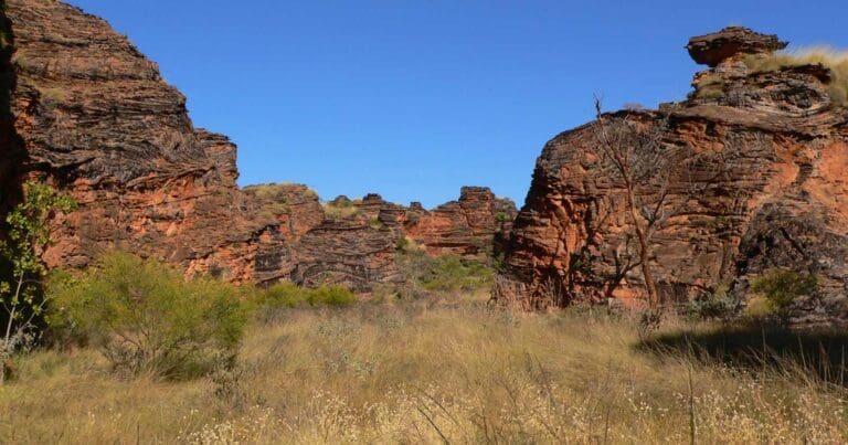
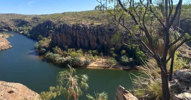
Journey into the heart of the magnificent Bungle Bungle Range and experience up close the impressive deeply cut gorges, and formations of Piccaninny Creek. This overnight trek is along an uneven, stony, and sandy creek bed with large potholes, boulders and occasionally through pools of water. This is an unmarked route with no facilities or directional signage.
The walk into Piccaninny Gorge has no marked track and no defined endpoint so hikers must rely on their own navigational skills to complete the walk. The walk to the gorge entrance (the Elbow) is around 10km and takes at least half a day so if you didn't want to venture into the entire gorge system, turn around before or at this point for an excellent but long day hike.
From the Elbow of Piccaninny Gorge it's approximately 4km into the first of the five fingers (side gorges). The fingers terrain changes considerably as you head further up each gorge. Great care must be taken when exploring.
To explore the entire gorge system, a total of more than 40km, hikers need to camp for at least a night, 2 would be better. The track is moderately easy up to the gorge entrance. It then becomes moderately difficult in the gorge itself, with hikers having to negotiate around fallen boulders, loose rocks and along creek beds.
Those planning to camp overnight must register at the visitor centre before setting out and on their return. There is no permanent water, however during the wet season and early in the dry, waterholes may be present. Black Rock Pool is the most reliable source of water. Water must be treated before drinking. To preserve the water quality and the natural eco-system, do NOT swim at Black Rock.
Carry plenty of water (5-8 litres of water per person per day) and a fuel stove for cooking as campfires are not permitted and take a first aid kit, PLB, map, compass and GPS.
Walkers must be prepared and take adequate food, water and clothing. There is no reliable drinking water in the gorge. Hikers must register at the visitors centre and a satellite phone or Personal Locator Beacon (PLB) must be carried at all times. Take warm clothing and sleeping gear - temperatures can go below freezing at night. Flash flooding may occur in the gorge between December and April. Carry out all rubbish including toilet paper. Bury human waste at least 150mm deep and 30m from the water.
Tips
This hike is only for experienced, self-sufficient hikers who have first registered at the visitor centre. Carry plenty of water (5-8 litres of water per person per day) and a fuel stove for cooking as campfires are not permitted and take a first aid kit, PLB, map, compass and GPS.
Content use
Please don’t copy GPX files or content from this site to AllTrails or other platforms. Each trail has been personally mapped, documented, and refined to support Australia’s bushwalking and hiking community. While some details come from land managers, every listing reflects significant personal effort. This is a free, community-driven initiative—your respect helps keep it that way.
Walk map and GPX file
Max elevation: 518 m
Min elevation: 247 m
Total climbing: 1824 m
Total descent: -1824 m
Getting there
Getting to the trailhead: Purnululu National Park.
Access to the park by road is via Spring Creek Track, from the Great Northern Highway approximately 250 km south of Kununurra, to the track’s end at the Purnululu National Park Visitor Centre. The track is 53 km long and is usable only in the dry season (April 1 to December 31), and only by four-wheel-drive (4WD) high clearance vehicles and off-road trailers. Safely navigating it takes approximately three hours. From the Purnululu National Park Visitor Centre, the trail head is then located a further 27 kilometres drive south.
Closest towns to this walk: Balgo, Billiluna, Fitzroy Crossing, Halls Creek, Kununurra, Marble Bar, Turkey Creek, Warmun, Wyndham
About the region
The Bungle Bungle Range in Purnululu National Park is one of the most striking geological landmarks in Western Australia, offering a remote wilderness experience. Purnululu attracts visitors for a whole range of reasons; the sheer grandeur of the sandstone massif, watching it change to a golden colour late in the day, walking through some of the marvellous gorges and for the really well-prepared, a walk along Piccaninny Creek for an overnight camping experience.
Other walks include the Echidna Chasm Trail, Mini Palms Gorge Trail, the walk to Kungkalanayi Lookout, Cathedral Gorge, the Domes Walk, Homestead Valley Trail, Piccaninny Creek Lookout, Whip Snake Gorge and the Northern Escarpment Trail.
Similar walks nearby
Looking for more walks in or near Purnululu National Park? Try these trails with a similar difficulty grade.
Track grade
Grade 5 (Difficult) - Walks for the Most Experienced: Grade 5 represents the most challenging walking tracks on the AWTGS. These are only recommended for very experienced and fit walkers with specialised skills, including navigation and emergency first aid. Tracks are likely to be very rough, very steep, and unmarked. Walks may be more than 20 kilometers. These challenging walks demand a high level of fitness and experience to navigate difficult terrain, significant elevation changes, and potentially unformed paths.
Explore safe
Plan ahead and hike safely! Carry enough water, pack layers for changing conditions, and bring safety gear like a torch, PLB, and reliable communication device. Check official sources for trail updates, closures, and access requirements, and review local weather and bushfire advice. Most importantly, share your plans with someone before you go. Being prepared makes for a safer and more enjoyable hike! Stay Safe, Explore More, and Always #ExploreSafe.
Packing checklists
What you carry in your pack depends on factors like weather, terrain, and your adventure type. Not sure what to bring? My free planning, food, and packing checklists are a great starting point, covering day hikes, overnight trips, and multi-day adventures. Use them to customise your kit and always prioritise safety.
Let someone know
Before heading out, take a moment to fill out your trip intentions form. It’s a quick way to share your hike details with family or friends. If something goes wrong, they can notify emergency services, ensuring a faster response and peace of mind. Stay safe and enjoy your adventure
Suggest an edit
Spotted a change on this trail? Maybe there are new features, the route has shifted, or the trail is permanently closed. Whatever the update, I’d love your input. Your feedback helps fellow hikers stay informed and ensures that our trail info stays fresh and reliable.
Acknowledgement of Country
Trail Hiking Australia acknowledges the Traditional Owners of the lands on which we hike and pay respects to their Elders, past and present, and we acknowledge the First Nations people of other communities who may be here today.
/Piccaninny-Gorge-Bungle-Bungles%20(1).jpg)
/Piccaninny-Gorge-Bungle-Bungles%20(7).jpg)
/Piccaninny-Gorge-Bungle-Bungles%20(2).jpg)
/Piccaninny-Gorge-Bungle-Bungles%20(6).jpg)
/Piccaninny-Gorge-Bungle-Bungles%20(3).jpg)
/Piccaninny-Gorge-Bungle-Bungles%20(5).jpg)
/Piccaninny-Gorge-Bungle-Bungles%20(4).jpg)
/Piccaninny-Gorge-Bungle-Bungles%20(8).jpg)


