Hike at a Glance
Max elevation: 931m
Min elevation: 583m
Total Ascent: 1207m
Hike overview
The track from Perrys Lookdown to the Blue Gum Forest offers a short but memorable journey into one of the most significant and scenic areas of the Blue Mountains. Covering 5.4 kilometres return, this Grade 4 walk typically takes around two hours to complete, though it’s worth allowing extra time to soak up the beauty of the forest once you’ve reached the valley floor. The descent is steep and can be demanding on the legs, but the reward at the bottom is more than worth the effort.
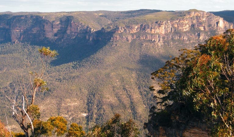
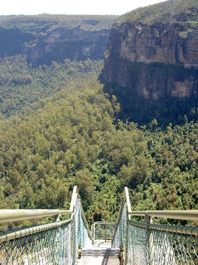
Starting from the Perrys Lookdown car park, the walk begins with a well-formed path that leads past a railed lookout offering sweeping views across the Grose Valley. From this elevated point, you can look down towards the dense canopy of the Blue Gum Forest and across to Lockleys Pylon. The lookout is believed to be named after Captain William Perry, who served as Deputy Surveyor General under Sir Thomas Mitchell.
A short distance into the descent, a side track branches off to Docker’s Lookout. This detour is well worth taking. Perched on the edge of the cliff line, Docker’s Lookout provides another angle on the valley below, with Mt Banks standing prominently to the north. After soaking in the view, return to the main trail and continue the descent.
The track soon narrows and zigzags its way down a rugged spur, cutting across exposed sections of cliff and slipping through shaded gaps in the rock. Handrails and steps help with the steeper sections, but care is needed, especially in damp or loose conditions. As you descend, the forest gradually thickens and the sound of birdlife becomes more noticeable, marking your transition from cliff-top to valley floor.
Eventually, the track flattens out, guiding you into the cool, shaded world of the Blue Gum Forest. This remarkable grove of Eucalyptus deanei rises tall and straight above the valley floor, creating an almost cathedral-like atmosphere. The forest is a powerful symbol of conservation in Australia. In 1931, during the Great Depression, bushwalking pioneer Myles Dunphy and a group of like-minded individuals raised £130 to protect the area from logging—a significant sum at the time. Their efforts ensured the forest was preserved, and today it forms part of the greater Blue Mountains National Park.
If you feel like lingering a little longer, the Acacia Flats camping area lies just 500 metres beyond the forest. The track to the campsite veers gently away from the Grose River, passing over a small creek before arriving at a quiet, open area well-suited to overnight stays. It’s a peaceful spot, surrounded by bush and within easy reach of the forest’s towering gums.
To return, simply retrace your steps back up the spur to Perrys Lookdown. While the climb is steep and can be challenging, taking it slowly and enjoying the changing views as you ascend helps make it a more manageable return. Whether you're drawn by the history, the natural beauty, or the challenge of the terrain, this track offers a deeply rewarding hike into one of the Blue Mountains’ most iconic landscapes.
Perrys Lookdown Campground
Perrys Lookdown Campground offers a basic but well-situated spot for walkers planning to explore the Grose Valley. Just a short walk from the car park, this small campsite has five tent sites and a non-flush toilet. There’s no water available here, so you’ll need to bring your own supply. Only fuel stoves are permitted, as open fires are not allowed. While facilities are minimal, the location makes up for it, with easy access to nearby lookouts and walking tracks. It’s ideal for an overnight stay before heading deeper into the valley, though stays are limited to one night and sites cannot be reserved.
Acacia Flats Campground
Further into the valley, Acacia Flats Campground offers a more remote and peaceful setting on the valley floor, nestled between Perrys Lookdown and Lockleys Pylon. Located about 500 metres upstream from the Blue Gum Forest and around 50 metres from Govetts Creek, this site is surrounded by a dense cluster of acacias, giving the area its name. The campground is spacious, with level grass clearings shaded by tall Blue Gums, making it a comfortable place to pitch a tent. A pit toilet is available, along with simple seating logs. Water can be sourced from Govetts Creek, but should be treated before drinking. Acacia Flats is well suited to both solo hikers and larger groups looking to experience a quiet night deep in the bush.
Gallery
Got some great shots from this hike? Upload your photos here to inspire others and show off the beauty of the trail!
Uploading your photos doesn’t mean you lose ownership. You can be credited for your contributions, and you can request removal at any time.
Content use
Please don’t copy GPX files or content from this site to AllTrails or other platforms. Each trail has been personally mapped, documented, and refined to support Australia’s bushwalking and hiking community. While some details come from land managers, every listing reflects significant personal effort. This is a free, community-driven initiative—your respect helps keep it that way.
Walk map and GPX file
Max elevation: 931 m
Min elevation: 583 m
Total climbing: 1207 m
Total descent: -1206 m
Getting there
Getting to the trailhead: Blue Mountains National Park.
Perrys Lookdown is located near Blackheath in the Blue Mountains National Park. To reach the trailhead, take the Great Western Highway to Blackheath, then turn east onto Hat Hill Road and follow the signs to Perrys Lookdown. The access road includes both sealed and unsealed sections but is suitable for 2WD vehicles in all weather conditions. Free parking is available at the picnic area and campground.
Closest towns to this walk: Blackheath, Bullaburra, Hazelbrook, Katoomba, Lawson, Leura, Lithgow, Mount Victoria, Springwood, Wentworth Falls, Woodford
About the region
Just two hours west of Sydney, Blue Mountains National Park is a UNESCO World Heritage Site and the most visited national park in New South Wales. Its dramatic escarpments, deep valleys, and diverse ecosystems offer something for every kind of visitor.
Katoomba is a great place to start, with Echo Point’s famous views of the Three Sisters and the nearby Blue Mountains Heritage Centre providing insight into the park’s natural and cultural heritage. From here, a wide range of walking tracks are easily accessible.
For those keen to explore on foot, the park offers everything from short walks past Aboriginal rock art near Glenbrook to more challenging options like Mount Banks or the multi-day Grand Cliff Top Walk between Wentworth Falls and Katoomba. Natural pools and waterfalls, including the striking Wentworth Falls, offer places to cool off along the way.
Lookouts such as Govetts Leap, Narrow Neck, and those at Scenic World provide sweeping views over rugged wilderness, while adventure seekers can enjoy mountain biking, canyoning, or rock climbing.
Camping options range from easily accessed sites near town to more remote bush settings like Acacia Flat, offering a quieter night under the stars.
Whether you're after a peaceful escape or high-energy adventure, the Blue Mountains has plenty to offer.
Similar walks nearby
Looking for more walks in or near Blue Mountains National Park? Try these trails with a similar difficulty grade.
Track grade
Grade 4 (Hard) - Challenging Walks for Experienced Walkers: Grade 4 on the AWTGS signifies challenging walking tracks. Bushwalking experience is recommended for these tracks, which may be long, rough, and very steep. Directional signage may be limited, requiring a good sense of navigation. These walks are suited for experienced walkers who are comfortable with steeper inclines, rougher terrain, and potentially longer distances.
Explore safe
Plan ahead and hike safely! Carry enough water, pack layers for changing conditions, and bring safety gear like a torch, PLB, and reliable communication device. Check official sources for trail updates, closures, and access requirements, and review local weather and bushfire advice. Most importantly, share your plans with someone before you go. Being prepared makes for a safer and more enjoyable hike! Stay Safe, Explore More, and Always #ExploreSafe.
Packing checklists
What you carry in your pack depends on factors like weather, terrain, and your adventure type. Not sure what to bring? My free planning, food, and packing checklists are a great starting point, covering day hikes, overnight trips, and multi-day adventures. Use them to customise your kit and always prioritise safety.
Let someone know
Before heading out, take a moment to fill out your trip intentions form. It’s a quick way to share your hike details with family or friends. If something goes wrong, they can notify emergency services, ensuring a faster response and peace of mind. Stay safe and enjoy your adventure
Suggest an edit
Spotted a change on this trail? Maybe there are new features, the route has shifted, or the trail is permanently closed. Whatever the update, I’d love your input. Your feedback helps fellow hikers stay informed and ensures that our trail info stays fresh and reliable.
Acknowledgement of Country
Trail Hiking Australia acknowledges the Traditional Owners of the lands on which we hike and pay respects to their Elders, past and present, and we acknowledge the First Nations people of other communities who may be here today.