Hike at a Glance
Max elevation: 38m
Min elevation: 17m
Total Ascent: 42m
Hike overview
Nestled alongside the Murray River near Renmark, Paringa Paddocks offers a range of walking and cycling experiences for visitors of all abilities. The park boasts a network of well-marked trails, catering to both casual strollers and those seeking a more challenging hike.
The Paringa Goat Island Track is a shorter 3.5km grade 2 loop, ideal for those looking for a more leisurely walk. This 1.5-hour circuit takes in stunning river scenery and provides a taste of the park's natural beauty.
The Paringa Paddocks Trail is the park's central feature, offering two main loops for exploration. The yellow-marked loops provide clear direction, making them ideal for independent navigation. Be aware that trail conditions can change after heavy rain or high water events, so adjust your plans accordingly.
Option 2: The Paringa Paddocks Circuit is a 5.8km grade 2 hike, taking roughly 2.5 hours to complete. This loop winds through the park's diverse landscapes, offering a rewarding experience for those seeking a more substantial walk.
Both options can be combined for a more extensive walk around the park.
Gallery
Got some great shots from this hike? Upload your photos here to inspire others and show off the beauty of the trail!
Click to view form >>
Submitting your photos doesn’t mean you lose ownership. You can be credited for your contributions, and you can request removal at any time.
Content use
Please don’t copy GPX files or content from this site to AllTrails or other platforms. Each trail has been personally mapped, documented, and refined to support Australia’s bushwalking and hiking community. While some details come from land managers, every listing reflects significant personal effort. This is a free, community-driven initiative—your respect helps keep it that way.
Walk map and GPX file
Max elevation: 38 m
Min elevation: 17 m
Total climbing: 42 m
Total descent: -42 m
Getting there
Getting to the trailhead: Lions Park Paringa.
Access Paringa Paddocks from the Sturt Highway, which traverses the area between Renmark and Paringa townships. Look for signage for the park along this route. Alternatively, cyclists and walkers can access the park via Lions Park next to the Big 4 Caravan Park in Renmark, using the underpass beneath the Sturt Highway. For those arriving by boat, access is also available directly from the Murray River.
Closest towns to this walk: Barmera, Berri, Lyrup, Monash, Paringa, Renmark
About the region
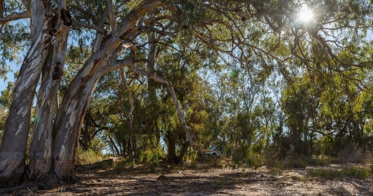
Nestled alongside the Murray River near Renmark, Paringa Paddocks offers a taste of a riverside national park with the convenience of close proximity to town. This recently incorporated section of the Murray River National Park boasts easy access from the Sturt Highway between Renmark and Paringa.
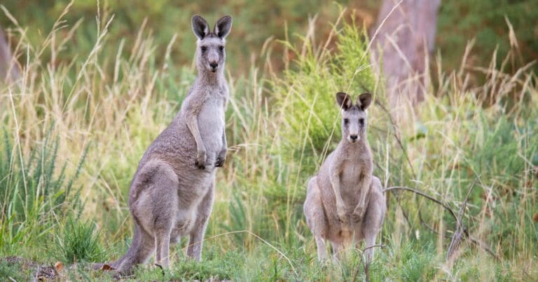
The park's flat terrain, characteristic of a river floodplain, makes it ideal for walking and mountain biking. Explore the extensive network of trails, challenge yourself with a DIY permanent orienteering course, or simply enjoy a scenic drive with views of Paringa Bridge and Lock 5. Keen birdwatchers and anglers will also find plenty to discover here.
Environmental water flows are released from the Murray River at specific times, thanks to recent works and a regulator construction. This vital practice sustains the unique plants, animals, and iconic landscapes of the river ecosystem, while ensuring most water continues downstream to benefit the wider river system.
While dogs are welcome, responsible pet ownership is essential. They must be kept on a leash no longer than 2 metres and remain under control at all times.
Similar walks nearby
Looking for more walks in or near Lions Park Paringa? Try these trails with a similar difficulty grade.
Track grade
Grade 2 (Easy) - A Gentle Introduction to Inclines: Grade 2 on the AWTGS represents easy walking tracks that offer a slightly more challenging experience compared to Grade 1. Similar to Grade 1, no prior bushwalking experience is required. The track surface is typically hardened or compacted and may have gentle hill sections or occasional steps. The total distance of a Grade 2 walk is typically no greater than 10 kilometers. These walks are still suitable for families with a bit more experience or those seeking a gentle introduction to some inclines.
Explore safe
Plan ahead and hike safely! Carry enough water, pack layers for changing conditions, and bring safety gear like a torch, PLB, and reliable communication device. Check official sources for trail updates, closures, and access requirements, and review local weather and bushfire advice. Most importantly, share your plans with someone before you go. Being prepared makes for a safer and more enjoyable hike! Stay Safe, Explore More, and Always #ExploreSafe.
Packing checklists
What you carry in your pack depends on factors like weather, terrain, and your adventure type. Not sure what to bring? My free planning, food, and packing checklists are a great starting point, covering day hikes, overnight trips, and multi-day adventures. Use them to customise your kit and always prioritise safety.
Let someone know
Before heading out, take a moment to fill out your trip intentions form. It’s a quick way to share your hike details with family or friends. If something goes wrong, they can notify emergency services, ensuring a faster response and peace of mind. Stay safe and enjoy your adventure
Suggest an edit
Spotted a change on this trail? Maybe there are new features, the route has shifted, or the trail is permanently closed. Whatever the update, I’d love your input. Your feedback helps fellow hikers stay informed and ensures that our trail info stays fresh and reliable.
Acknowledgement of Country
Trail Hiking Australia acknowledges the Traditional Owners of the lands on which we hike and pay respects to their Elders, past and present, and we acknowledge the First Nations people of other communities who may be here today.


