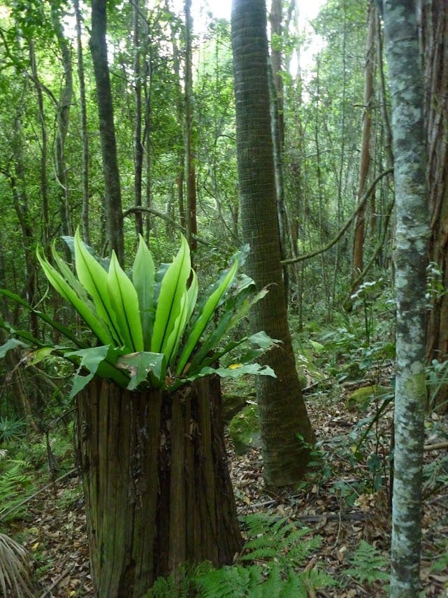
This pleasant walk explores the rural valleys and a beautiful section of Jilliby State Conservation Area. Starting at Ourimbah Valley Trackhead you walk into Hidden valley along the dirt road to then follow a trail beside Ourimbah Creek to Stringy Bark Point. This is a pleasant mossy area with many ferns and near a wide sandy section of Ourimbah Creek. A bit further on you cross Ourimbah Creek then walk up the ridge to the dirt Tooheys Road. From here you walk along the little used dirt road to Forest Road passing through the tall eucalypt forest and through the Tuggerah Lake Field Archers club area. A side trip at the end of this walk gives you the option of staying at Forest Park.
Download maps and tracknotes for Ourimbah Valley Trackhead to Forest Road hiking track from wildwalks.com.
Got some great shots from this hike? Upload your photos here to inspire others and show off the beauty of the trail!
Submitting your photos doesn’t mean you lose ownership. You can be credited for your contributions, and you can request removal at any time.
Please don’t copy GPX files or content from this site to AllTrails or other platforms. Each trail has been personally mapped, documented, and refined to support Australia’s bushwalking and hiking community. While some details come from land managers, every listing reflects significant personal effort. This is a free, community-driven initiative—your respect helps keep it that way.
It looks like I don’t have a GPX file for this trail yet. If you have one to share, please email it to me! I’ll verify it against official maps before adding it to help other hikers have a safer, easier experience. Thanks for contributing to a better hiking resource.
Getting there
Getting to the trailhead: Jilliby State Conservation Area.
Closest towns to this walk: Doonbi, Hamlyn Terrace, Holgate, Jilliby, Kanwal, Mardi, Tacoma, Tuggerah, Warnervale, Watanobbi, Wyong, Wyongah, Yarramalong
About the region
Located near Central Coast, Jilliby State Conservation Area is a popular place for 4WD touring, mountain biking, horse riding and long bush walks through the forest. Explore many of the trails throughout the landscape and when you feel like a rest, set up a picnic at any of the two picturesque picnic areas located at Muirs lookout or Stoney Ridge. From Muirs lookout, scenic views stretch out to Lake Macquarie and Lake Munmorah, with a glimpse of the coastline and Bird Island in the far distance.
Similar walks nearby
Looking for more walks in or near Jilliby State Conservation Area? Try these trails with a similar difficulty grade.
Favourite

Jilliby State Conservation Area
Favourite

Jilliby State Conservation Area
Favourite

Jilliby State Conservation Area
Favourite

Track grade
Grade 4 (Hard) -
Challenging Walks for Experienced Walkers: Grade 4 on the
AWTGS signifies challenging walking tracks. Bushwalking experience is recommended for these tracks, which may be long, rough, and very steep. Directional signage may be limited, requiring a good sense of navigation. These walks are suited for experienced walkers who are comfortable with steeper inclines, rougher terrain, and potentially longer distances.
Explore safe
Plan ahead and hike safely! Carry enough water, pack layers for changing conditions, and bring safety gear like a torch, PLB, and reliable communication device. Check official sources for trail updates, closures, and access requirements, and review local weather and bushfire advice. Most importantly, share your plans with someone before you go. Being prepared makes for a safer and more enjoyable hike! Stay Safe, Explore More, and Always #ExploreSafe.
Packing checklists
What you carry in your pack depends on factors like weather, terrain, and your adventure type. Not sure what to bring? My free planning, food, and packing checklists are a great starting point, covering day hikes, overnight trips, and multi-day adventures. Use them to customise your kit and always prioritise safety.
Let someone know
Before heading out, take a moment to fill out your trip intentions form. It’s a quick way to share your hike details with family or friends. If something goes wrong, they can notify emergency services, ensuring a faster response and peace of mind. Stay safe and enjoy your adventure
Suggest an edit
Spotted a change on this trail? Maybe there are new features, the route has shifted, or the trail is permanently closed. Whatever the update, I’d love your input. Your feedback helps fellow hikers stay informed and ensures that our trail info stays fresh and reliable.


