Hike at a Glance
Max elevation: 130m
Min elevation: 32m
Total Ascent: 133m
Hike overview
The Nepean River walking track is a family-friendly medium difficulty walking track, Nepean River walk offers wildlife, swimming and picnicking in Blue Mountains National Park, near Glenbrook.
An enchanting walk through delightful woodlands and rainforest in the eastern reaches of Blue Mountains National Park. Starting from the Darug area in Euroka campground, the medium difficulty Nepean River walk offers a great introduction to the wonders of nature for families with some bushwalking experience.
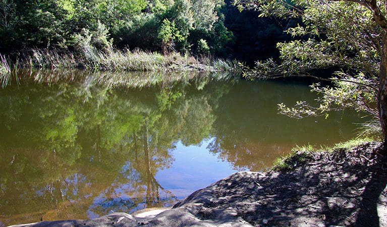
From the grassy clearing, the track leads east through a narrow canyon where the sheer walls create a rainforest hothouse for lush ferns with towering lilli-pilli and coachwood. The track descends steeply with some obstacles into Fairlight Gorge before arriving at the river, where you might see water dragons sunning themselves along the banks. In spring the wildflowers blanket the surrounds with a dazzling display of scent and colour.
Adventurers might be tempted with a swim before enjoying a leisurely riverside picnic. Eat up as you'll need some energy for the steep climb out before joining Bennets Ridge walking track.
Euroka campground is your best base to explore the area's tracks, trails, lookouts and waterholes. Pitch your tent among the grassy clearings and tall gums as the local kangaroos look on, and fall asleep to the sounds of the bush.
Tips
After heavy rain, Glenbrook Causeway may be closed. Contact the Visitor Information Centre, Glenbrook infoline on (02) 4720 6200. Check the weather before you set out and ensure you're well prepared. Weather can be unpredictable and extreme in this area and the track can become boggy when it rains. Fill in the free trip intention form and hire a PLB before you set out. It's a good idea to bring a topographic map and compass, or a GPS.
Visit NSW National Parks and Wildlife Service for more information on this trail.
The longitude and latitude of the start and end points are approximately only and should not be used for navigation purposes. Please contact me if you know the correct coordinates.
Gallery
Got some great shots from this hike? Upload your photos here to inspire others and show off the beauty of the trail!
Click to view form >>
Submitting your photos doesn’t mean you lose ownership. You can be credited for your contributions, and you can request removal at any time.
Content use
Please don’t copy GPX files or content from this site to AllTrails or other platforms. Each trail has been personally mapped, documented, and refined to support Australia’s bushwalking and hiking community. While some details come from land managers, every listing reflects significant personal effort. This is a free, community-driven initiative—your respect helps keep it that way.
Walk map and GPX file
Max elevation: 130 m
Min elevation: 32 m
Total climbing: 133 m
Total descent: -132 m
Getting there
Getting to the trailhead: Blue Mountains National Park.
Nepean River walking track is in the Glenbrook precinct of Blue Mountains National Park. To get there, follow the signs from Great Western Highway to Glenbrook. Drive along Ross Street and then Bruce Road. Euroka campground is 4.2km past the entry gates. The entry gate is locked by 6pm (7pm daylight savings). For late exits, phone 0421 529 001. A fee applies for non-emergencies. Parking Parking is available at Euroka campground.
Closest towns to this walk: Blackheath, Bullaburra, Hazelbrook, Katoomba, Lawson, Leura, Lithgow, Mount Victoria, Springwood, Wentworth Falls, Woodford
About the region
Glenbrook area is a favourite nature escape for families, locals and Sydney daytrippers.
Pack a picnic and head to the sandy beach at Jellybean Pool or the more secluded Blue Pool, both a short stroll from the carpark. Tuck into a leisurely lunch then cool off in the calm waters as currawongs and rainbow lorikeets chatter above.
If you're feeling active, the car-free Bennetts Ridge fire trail or Woodford-Oaks trail offer safe, well-maintained trails for trail runners, casual cyclists and pro riders. Mountain bikers can also ride the purpose-built 1.5km section of Woodford-Oaks trail, with its graded technical challenges. A shorter option is the mountain bike and 4WD trail along Murphys Road from Woodford to peaceful Murphys Glen campground.
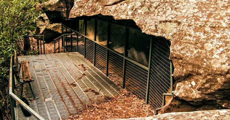
Get a fix of the outdoors along the family-friendly Nepean River walking track. Try the short but challenging Glenbrook Gorge track or intrepid Jack Evans walking track. A visit to the hand stencil rock art at Red Hands Cave is one of the best ways to experience the fascinating Aboriginal culture of the Blue Mountains.
Similar walks nearby
Looking for more walks in or near Blue Mountains National Park? Try these trails with a similar difficulty grade.
Track grade
Grade 3 (Moderate) - Walks for Most Fitness Levels: Grade 3 on the AWTGS represents moderate walking tracks. These are ideal for walkers with some fitness who are comfortable with some hills and uneven terrain. While suitable for most ages, some bushwalking experience is recommended to ensure a safe and enjoyable experience. Tracks may have short, steep hill sections, a rough surface, and many steps. The total distance of a Grade 3 walk can be up to 20 kilometers.
Explore safe
Plan ahead and hike safely! Carry enough water, pack layers for changing conditions, and bring safety gear like a torch, PLB, and reliable communication device. Check official sources for trail updates, closures, and access requirements, and review local weather and bushfire advice. Most importantly, share your plans with someone before you go. Being prepared makes for a safer and more enjoyable hike! Stay Safe, Explore More, and Always #ExploreSafe.
Packing checklists
What you carry in your pack depends on factors like weather, terrain, and your adventure type. Not sure what to bring? My free planning, food, and packing checklists are a great starting point, covering day hikes, overnight trips, and multi-day adventures. Use them to customise your kit and always prioritise safety.
Let someone know
Before heading out, take a moment to fill out your trip intentions form. It’s a quick way to share your hike details with family or friends. If something goes wrong, they can notify emergency services, ensuring a faster response and peace of mind. Stay safe and enjoy your adventure
Suggest an edit
Spotted a change on this trail? Maybe there are new features, the route has shifted, or the trail is permanently closed. Whatever the update, I’d love your input. Your feedback helps fellow hikers stay informed and ensures that our trail info stays fresh and reliable.
Acknowledgement of Country
Trail Hiking Australia acknowledges the Traditional Owners of the lands on which we hike and pay respects to their Elders, past and present, and we acknowledge the First Nations people of other communities who may be here today.


