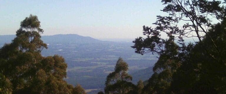
Hike at a Glance
Max elevation: 1252m
Min elevation: 1069m
Total Ascent: 185m
Hike overview
Along with the Rainforest Gallery at the junction of the Acheron Way and the Donna Buang Road, this short Mount Donna Buang - 10 Mile Turntable to Summit hike is a pleasant introduction to Mount Donna Buang.
Park your car at the large car park at the 10 mile turntable and walk back down the road for 20 metres. There you will see a track heading up hill with a couple of posts to prevent vehicle access. Walk up this gently climbing track for 400 metres to a signposted junction. Turn left and continue uphill through mixed beech and eucalypt forest for another 600 metres to the summit area. Have a look around and if the weather is clear, it is well worth climbing the lookout tower which has stunning views in all directions.
For the return trip, head down the stairs next to the toilet block to the toboggan run. When you reach a former road, turn left along the track, climbing over a gate to cross the toboggan run. Continue walking along the old road until you reach the track you climbed earlier. Head down the track for about 400 metres to the junction. Turn right and walk another 400 metres to the 10 mile car park.
If you wish to extend the walk by an hour to Mount Victoria, on the return trip take the signposted track to Mount Victoria and follow the directions for the walk below.
Background
Mount Donna Buang (1250 metres) is the nearest snowfield to Melbourne. The tall ash forests on it's slopes were harvested at the turn of the 20th century and the timber was moved by a network of tramlines and cable haulages. The industry took off in 1901 with the completion of the railway to Warburton.. Before the Second World War, Doona was also a minor ski resort with cleared runs, a huge ski jump and four ski lodges. In 1935 12,000 watched ski races on Donna. However the snow was never terribly reliable and after the war, two of the lodges that survived the 1939 fires were moved to the more dependable snowfield at Mount Buller, while the ruins of another can be seen at the foot of an old ski run.
Today most of the mountain is parkland. It is a accessed by a sealed road and is a popular tourist destination. In winter it attracts families to play in the snow. There is a 21 metre high lookout tower on the summit accessed by a strange double helix staircase. From the top there are impressive views of the mountains and forests, as well as the farmlands and towns of the Yarra Valley.
While you can drive to the top, there are a number of walking tracks up the mountain. One is a long day hike from Dom Dom Saddle, another begins at the aptly named Martyr Road in Warburton while a third starts half way up, near the Cement Creek Rainforest Gallery. There is also an easier option of a scenic walk near the summit.
Summary provided by: David Sisson | www.australianmountains.com
Gallery
Got some great shots from this hike? Upload your photos here to inspire others and show off the beauty of the trail!
Click to view form >>
Submitting your photos doesn’t mean you lose ownership. You can be credited for your contributions, and you can request removal at any time.
Content use
Please don’t copy GPX files or content from this site to AllTrails or other platforms. Each trail has been personally mapped, documented, and refined to support Australia’s bushwalking and hiking community. While some details come from land managers, every listing reflects significant personal effort. This is a free, community-driven initiative—your respect helps keep it that way.
Walk map and GPX file
Max elevation: 1252 m
Min elevation: 1069 m
Total climbing: 185 m
Total descent: -185 m
Getting there
Getting to the trailhead: Mount Donna Buang.
Drive through Warburton until the highway, B 380, crosses the Yarra River. Shortly afterwards turn left onto The Acheron Way, C 507. The road climbs steadily for 7 km to the Cement Creek junction. Park here and spend 15 minutes inspecting the impressive Rainforest Gallery, a 350 metre walking circuit that starts high in the canopy before descending to the forest floor. Then drive up the Donna Buang Road, C 505, for 6 km to the 10 Mile picnic area and park. This is the most attractive place on the road and much nicer than the rather bleak summit area.
Closest towns to this walk: Badger Creek, Big Pats Creek, East Warburton, Gladysdale, Healesville, Launching Place, Marysville, Millgrove, Olinda, Reefton, Warburton, Yarra Junction
Access conditions
- 2WD Access
- Bitumen Road
- Steep Road
- Winding Road
- Large Car Park
- Public Toilets
- Untreated Water
- Picnic Shelter
- Picnic Table
About the region
Mount Donna Buang is a mountain in the southern reaches of the Victorian Alps of the Great Dividing Range, Victoria. Approximately 80 kilometres from Melbourne with an elevation of 1,245 metres, Mount Donna Buang is the closest snowfield to Melbourne. The summit features a lookout tower which is 21 metres high and offers panoramic views over Melbourne, the Yarra Valley, Dandenong and Cathedral Ranges, Mount Baw Baw and the Alps. It is also a popular picnic area and starting point for walks on the mountain.
The picnic area has gas barbecues, fireplaces, picnic tables, toilets and a lookout.
Similar walks nearby
Looking for more walks in or near Mount Donna Buang? Try these trails with a similar difficulty grade.
Track grade
Grade 2 (Easy) - A Gentle Introduction to Inclines: Grade 2 on the AWTGS represents easy walking tracks that offer a slightly more challenging experience compared to Grade 1. Similar to Grade 1, no prior bushwalking experience is required. The track surface is typically hardened or compacted and may have gentle hill sections or occasional steps. The total distance of a Grade 2 walk is typically no greater than 10 kilometers. These walks are still suitable for families with a bit more experience or those seeking a gentle introduction to some inclines.
Explore safe
Plan ahead and hike safely! Carry enough water, pack layers for changing conditions, and bring safety gear like a torch, PLB, and reliable communication device. Check official sources for trail updates, closures, and access requirements, and review local weather and bushfire advice. Most importantly, share your plans with someone before you go. Being prepared makes for a safer and more enjoyable hike! Stay Safe, Explore More, and Always #ExploreSafe.
Packing checklists
What you carry in your pack depends on factors like weather, terrain, and your adventure type. Not sure what to bring? My free planning, food, and packing checklists are a great starting point, covering day hikes, overnight trips, and multi-day adventures. Use them to customise your kit and always prioritise safety.
Let someone know
Before heading out, take a moment to fill out your trip intentions form. It’s a quick way to share your hike details with family or friends. If something goes wrong, they can notify emergency services, ensuring a faster response and peace of mind. Stay safe and enjoy your adventure
Suggest an edit
Spotted a change on this trail? Maybe there are new features, the route has shifted, or the trail is permanently closed. Whatever the update, I’d love your input. Your feedback helps fellow hikers stay informed and ensures that our trail info stays fresh and reliable.
Acknowledgement of Country
Trail Hiking Australia acknowledges the Traditional Owners of the lands on which we hike and pay respects to their Elders, past and present, and we acknowledge the First Nations people of other communities who may be here today.


