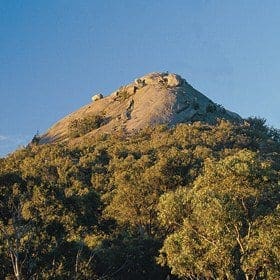
The final approach to the summit is steep and rock climbing experience is needed to reach the absolute top. Do not attempt to rock-climb alone.
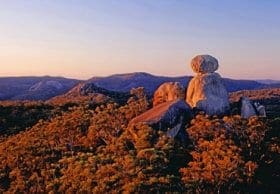
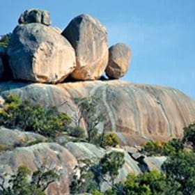
Begin the walk to Mount Norman, Girraween's National Park's longest walk, from the southern side of Pyramids Road opposite the Girraween information centre carpark. Continue past Castle Rock and trek to the rocky slabs below Mount Norman, where the gradient varies from gentle to moderate. See the Eye of the Needle on Mount Norman's northern face. The track ends at the base of the Mount Norman monolith.
Got some great shots from this hike? Upload your photos here to inspire others and show off the beauty of the trail!
Submitting your photos doesn’t mean you lose ownership. You can be credited for your contributions, and you can request removal at any time.
Please don’t copy GPX files or content from this site to AllTrails or other platforms. Each trail has been personally mapped, documented, and refined to support Australia’s bushwalking and hiking community. While some details come from land managers, every listing reflects significant personal effort. This is a free, community-driven initiative—your respect helps keep it that way.
It looks like I don’t have a GPX file for this trail yet. If you have one to share, please email it to me! I’ll verify it against official maps before adding it to help other hikers have a safer, easier experience. Thanks for contributing to a better hiking resource.
Getting there
Getting to the trailhead: Girraween National Park.
Closest towns to this walk: Applethorpe, Ballandean, Granite Belt, Pozieres, Stanthorpe, Thulimbah, Wallangarra
About the region
Girraween National Park is an area of the Granite Belt in the Darling Downs region of Queensland, Australia reserved as a national park. Girraween is known for its spectacular flowers, dramatic landscapes and unique wildlife. Bushwalking and rock climbing are the most popular activities in the park.
The park is situated 40 km south of Stanthorpe. The southern boundary of the park is the state border between Queensland and New South Wales. It is a twin park with Bald Rock National Park, which lies across the border in New South Wales, and features Bald Rock, the second-largest monolith (after Uluru) on the continent. Curiously, South Bald Rock and West Bald Rock lie in Girraween National Park in Queensland, not in Bald Rock National Park in New South Wales.
For more information on this hiking trail, please visit Queensland.com
Similar walks nearby
Looking for more walks in or near Girraween National Park? Try these trails with a similar difficulty grade.
Favourite

Favourite

Favourite

Favourite

Torrington State Conservation Area
Track grade
Grade 4 (Hard) -
Challenging Walks for Experienced Walkers: Grade 4 on the
AWTGS signifies challenging walking tracks. Bushwalking experience is recommended for these tracks, which may be long, rough, and very steep. Directional signage may be limited, requiring a good sense of navigation. These walks are suited for experienced walkers who are comfortable with steeper inclines, rougher terrain, and potentially longer distances.
Explore safe
Plan ahead and hike safely! Carry enough water, pack layers for changing conditions, and bring safety gear like a torch, PLB, and reliable communication device. Check official sources for trail updates, closures, and access requirements, and review local weather and bushfire advice. Most importantly, share your plans with someone before you go. Being prepared makes for a safer and more enjoyable hike! Stay Safe, Explore More, and Always #ExploreSafe.
Packing checklists
What you carry in your pack depends on factors like weather, terrain, and your adventure type. Not sure what to bring? My free planning, food, and packing checklists are a great starting point, covering day hikes, overnight trips, and multi-day adventures. Use them to customise your kit and always prioritise safety.
Let someone know
Before heading out, take a moment to fill out your trip intentions form. It’s a quick way to share your hike details with family or friends. If something goes wrong, they can notify emergency services, ensuring a faster response and peace of mind. Stay safe and enjoy your adventure
Suggest an edit
Spotted a change on this trail? Maybe there are new features, the route has shifted, or the trail is permanently closed. Whatever the update, I’d love your input. Your feedback helps fellow hikers stay informed and ensures that our trail info stays fresh and reliable.


