Hike at a Glance
Max elevation: 1237m
Min elevation: 727m
Total Ascent: 709m
Important info
The Mount Meharry Summit Walk is in the remote Karijini National Park. During summer, temperatures frequently top 40°C. Drink plenty of water at all times and make sure you are well prepared.
Hike overview
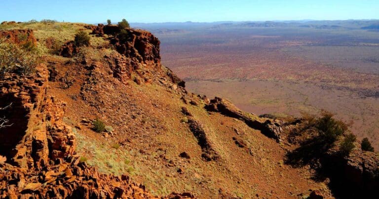
Nestled within the Hamersley Range, Mount Meharry rises as a beacon of ancient history and breathtaking views. Its red cliffs and gorges whisper tales of a time when miners carved their mark on the Western Australian landscape. For geologists and adventurers alike, this peak offers a chance to explore the raw beauty of the outback and witness the power of time etched in stone.
The climb to the top is no walk in the park. It's a rugged affair, testing your endurance and rewarding you with unforgettable panoramas. As you ascend, the landscape unfolds beneath you, transforming into a vast tapestry of ochre desert stretching towards the distant coast. Each step brings you closer to the breathtaking views that make the journey worthwhile.
Mount Meharry bears the name of William Thomas Meharry, the State's Chief Geodetic Surveyor from 1959 to 1967. His dedication to mapping the vast expanse of Western Australia led to the discovery of this hidden gem in 1967. Standing at 1,248 meters above sea level, it claims the title of the highest point in the state.
Reaching the summit doesn't require scaling sheer cliffs. A 4WD track winds its way up the mountainside, offering an enjoyable alternative to traditional hiking. This track, starting along Packsadle Road near Karijini National Park, transforms into a rugged adventure suitable for high-clearance vehicles. While driving to the peak might be tempting, remember that the true explorer's spirit lies in hiking the final stretch on foot. Park at the Karijini National Park boundary and enjoy an 8-kilometer hike to claim your victory at the summit.
Whether you choose to drive or hike, remember that Mount Meharry is more than just a destination. It's an experience, a chance to connect with the rugged beauty of Western Australia and feel the thrill of reaching new heights. So lace up your boots, fire up your engine, and prepare to be awestruck by the magic of Mount Meharry.
Note: The GPX file provides the entire 42km route from Packsadle Road to the summit and back. The suggested hike length of 16km has been calculated from the National Park Boundary.
Tips
- Road conditions can vary, so be prepared for a bumpy ride.
- Choose appropriate footwear for the walk to the top.
- Leave no trace and respect the natural environment.
Gallery
Got some great shots from this hike? Upload your photos here to inspire others and show off the beauty of the trail!
Click to view form >>
Submitting your photos doesn’t mean you lose ownership. You can be credited for your contributions, and you can request removal at any time.
Content use
Please don’t copy GPX files or content from this site to AllTrails or other platforms. Each trail has been personally mapped, documented, and refined to support Australia’s bushwalking and hiking community. While some details come from land managers, every listing reflects significant personal effort. This is a free, community-driven initiative—your respect helps keep it that way.
Walk map and GPX file
Max elevation: 1237 m
Min elevation: 727 m
Total climbing: 709 m
Total descent: -709 m
Getting there
Getting to the trailhead: Karijini National Park.
This off-road adventure takes you through the rugged outback of Western Australia, offering stunning views and a sense of exploration. Be prepared for a mix of driving and walking as you navigate dirt roads and climb a scenic ridge. Start in Newman, WA: This small town in the Pilbara region serves as your gateway to the adventure. Take some time to fuel up and stock up on supplies before heading out. Head north on the Great Northern Highway: Enjoy the scenic drive through the outback, keeping an eye out for kangaroos and other wildlife. Turn onto Packsaddle Road, then Juna Downs Road: These dirt roads will lead you deeper into the wilderness, offering glimpses of the rugged landscape.
Choose your parking spot near the National Park boundary: As the road quality deteriorates, find a safe spot to park your vehicle based on its capabilities. Remember, the further you park, the longer your hike will be. Walk the road to the top: Enjoy the fresh air and stunning views as you make your way up the ridge. Be prepared for a moderate to challenging hike on uneven terrain.
Closest towns to this walk: Marble Bar, Newman, Nullagine, Onslow, Pannawonica, Paraburdoo, Port Hedland, South Hedland, Tom Price
About the region
Karijini National Park is one of those places that leaves you in awe, where the landscape seems to whisper stories of ancient times. Described by many as breathtaking and rugged, it’s often hailed as the crown jewel of Western Australia. Stretching across the Pilbara region, Karijini is home to the Banyjima, Innawonga, and Kurrama people, who have been the Traditional Owners of this land for thousands of years. With rock formations that date back over 2.5 billion years, the park offers a stunning blend of natural history, adventure, and beauty.
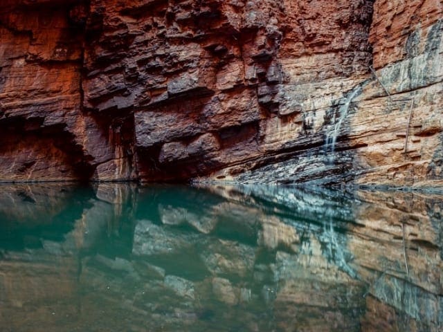
Before you begin your journey, it’s a good idea to stop by the Karijini Visitor Centre, where the friendly locals can point you in the direction of the best spots to explore. Once you’ve gathered your information, it’s time to dive into the park’s striking landscapes. Wander through the ancient gorges, where the layers of red rock tell stories of erosion and time. The freshwater falls and secluded swimming holes, surrounded by lush ferns, are a sight to behold, and you’ll quickly understand why this place captures so many hearts.
For the full experience, it’s worth staying a couple of nights. Camping under the wide open sky will allow you to take in the full wonder of the park, with the stars coming alive as the sun sets. If you prefer a more comfortable stay, the Karijini Eco Retreat offers glamping options and guided adventure tours. The park’s beauty shifts with the seasons, and after the rains, the landscape comes alive with vibrant yellow cassias and wattles, as well as northern bluebells and purple mulla-mullas, creating a spectacular contrast against the rust-red rock.
As you explore, keep an eye out for the various wildlife that call this place home. Large termite mounds dot the grasslands, and you might spot birds, rock wallabies, echidnas, red kangaroos, goannas, and even snakes. The park is an ideal place for those who enjoy both adventure and nature, with plenty of opportunities to cool off in sparkling rock pools after scrambling over rocks and climbing through gorges.
To reach Karijini National Park, you can travel from Tom Price, Roebourne, Port Hedland, or Newman, but be mindful of the distances in the area. Fuel stations are over 80 kilometres away from Dales Campground at Munjina Roadhouse or Tom Price, and the Karijini Eco Retreat is about 70 kilometres from Tom Price. If you're planning to explore different parts of the park, a trip from Dales to Weano Gorge and back is approximately 112 kilometres. It’s important to plan your visit carefully as the southern half of the park is inaccessible and distances can add up quickly when touring the area.
From June to September, Karijini bursts into colour, with wildflowers in bloom, making it an ideal time for hiking. Whether you're navigating the walking trails or simply taking in the views from one of the lookout points, like Oxer Lookout, you'll be mesmerised by the vastness and beauty of the landscape. As the day winds down, the night sky offers another spectacle, with shooting stars and meteor showers lighting up the heavens. This ancient land, with its stunning gorges, rock pools, and waterfalls, is a truly enchanting place to visit. Before heading out, be sure to check for any alerts, incidents, or road closures to ensure a smooth adventure.
Similar walks nearby
Looking for more walks in or near Karijini National Park? Try these trails with a similar difficulty grade.
Track grade
Grade 5 (Difficult) - Walks for the Most Experienced: Grade 5 represents the most challenging walking tracks on the AWTGS. These are only recommended for very experienced and fit walkers with specialised skills, including navigation and emergency first aid. Tracks are likely to be very rough, very steep, and unmarked. Walks may be more than 20 kilometers. These challenging walks demand a high level of fitness and experience to navigate difficult terrain, significant elevation changes, and potentially unformed paths.
Explore safe
Plan ahead and hike safely! Carry enough water, pack layers for changing conditions, and bring safety gear like a torch, PLB, and reliable communication device. Check official sources for trail updates, closures, and access requirements, and review local weather and bushfire advice. Most importantly, share your plans with someone before you go. Being prepared makes for a safer and more enjoyable hike! Stay Safe, Explore More, and Always #ExploreSafe.
Packing checklists
What you carry in your pack depends on factors like weather, terrain, and your adventure type. Not sure what to bring? My free planning, food, and packing checklists are a great starting point, covering day hikes, overnight trips, and multi-day adventures. Use them to customise your kit and always prioritise safety.
Let someone know
Before heading out, take a moment to fill out your trip intentions form. It’s a quick way to share your hike details with family or friends. If something goes wrong, they can notify emergency services, ensuring a faster response and peace of mind. Stay safe and enjoy your adventure
Suggest an edit
Spotted a change on this trail? Maybe there are new features, the route has shifted, or the trail is permanently closed. Whatever the update, I’d love your input. Your feedback helps fellow hikers stay informed and ensures that our trail info stays fresh and reliable.
Acknowledgement of Country
Trail Hiking Australia acknowledges the Traditional Owners of the lands on which we hike and pay respects to their Elders, past and present, and we acknowledge the First Nations people of other communities who may be here today.


