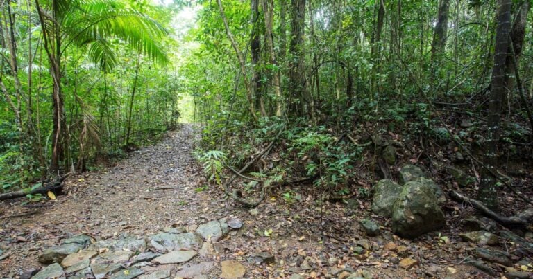
Located in the rainforest-clad Conway National Park, the Kingfisher Circuit walk will reveal the forest wildlife and ancient tropical rainforests. Look for orange eyed tree frogs or spangled drongos and enjoy the coolness provided by the overhead canopy.
The circuit starts from the Forestry Road car park and you can pick up a self-guide brochure at the start of this two kilometre walk. The trail takes you down into a moist rainforest valley and then ascends to an old logging road. Turn right to return to the car park or left to continue on Wompoo Walk. The walk is a moderate grade and will take about 30 minutes to complete.
Please don’t copy GPX files or content from this site to AllTrails or other platforms. Each trail has been personally mapped, documented, and refined to support Australia’s bushwalking and hiking community. While some details come from land managers, every listing reflects significant personal effort. This is a free, community-driven initiative—your respect helps keep it that way.
Total distance: 1957 m
Max elevation: 237 m
Min elevation: 154 m
Total climbing: 105 m
Total descent: -105 m
Getting there
Getting to the trailhead: Conway National Park.
Take Shute Harbour Road to Brandy Creek Road and then Forestry Road car park at the start of the Conway National Park.
Closest towns to this walk: Airlie Beach, Bowen, Cannonvale, Hamilton Island, Jubilee Pocket, Proserpine, Shute Harbour
About the region
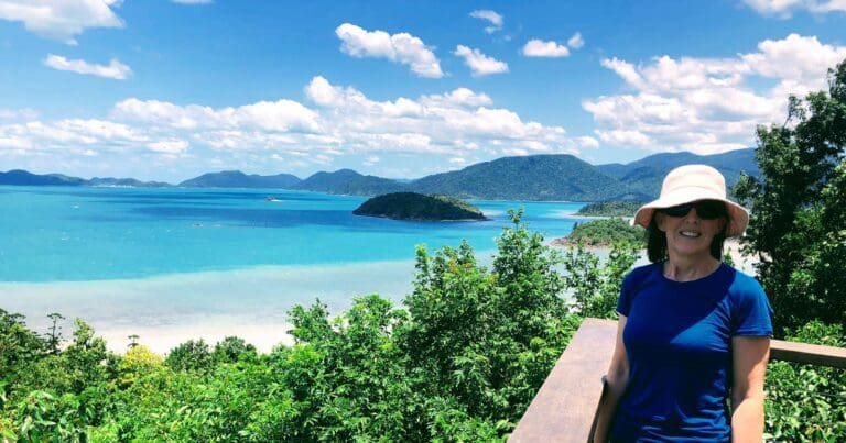
Conway National Park spans approximately 75km of coastline, taking in the entire Cape Conway peninsula. The park includes the rainforest-clad Conway Range, which protects the largest area of lowland tropical rainforest in Queensland outside Tropical North Queensland. Hoop pines grow on coastal ridges and in damp gullies, emerging above the rainforest canopy. Rugged, steep, rocky cliffs provide a spectacular 35km-long backdrop to the Whitsunday Passage and islands.
Dry vine thicket, mangroves, open forests with a grasstree understorey, paperbark and pandanus woodlands, and patches of lowland rainforest with twisted vines grow in the park. It is home to 2 of Australia's mound-building birds, the Australian brush-turkey and the orange-footed scrubfowl.
Rising steeply behind busy coastal settlements, the Conway Range appears impenetrable. Through climate fluctuations over tens of thousands of years, the rainforest has persisted here, providing a continuous refuge for wildlife.
The park's vegetation is very similar to that on the Whitsunday islands because thousands of years ago the sea level rose, drowning coastal valleys and creating the islands. For thousands of years, the Ngaro and Gia people roamed these forests, harvesting riches of the land and the adjoining sea country. Today the adjacent waters are protected in the Great Barrier Reef Marine Park
Similar walks nearby
Looking for more walks in or near Conway National Park? Try these trails with a similar difficulty grade.
Favourite

Favourite

Favourite

Favourite

Molle Islands National Park
Track grade
Grade 3 (Moderate) - Walks for Most Fitness Levels: Grade 3 on the
AWTGS represents moderate walking tracks. These are ideal for walkers with some fitness who are comfortable with some hills and uneven terrain. While suitable for most ages, some bushwalking experience is recommended to ensure a safe and enjoyable experience. Tracks may have short, steep hill sections, a rough surface, and many steps. The total distance of a Grade 3 walk can be up to 20 kilometers.
Explore safe
Plan ahead and hike safely! Carry enough water, pack layers for changing conditions, and bring safety gear like a torch, PLB, and reliable communication device. Check official sources for trail updates, closures, and access requirements, and review local weather and bushfire advice. Most importantly, share your plans with someone before you go. Being prepared makes for a safer and more enjoyable hike! Stay Safe, Explore More, and Always #ExploreSafe.
Packing checklists
What you carry in your pack depends on factors like weather, terrain, and your adventure type. Not sure what to bring? My free planning, food, and packing checklists are a great starting point, covering day hikes, overnight trips, and multi-day adventures. Use them to customise your kit and always prioritise safety.
Let someone know
Before heading out, take a moment to fill out your trip intentions form. It’s a quick way to share your hike details with family or friends. If something goes wrong, they can notify emergency services, ensuring a faster response and peace of mind. Stay safe and enjoy your adventure
Suggest an edit
Spotted a change on this trail? Maybe there are new features, the route has shifted, or the trail is permanently closed. Whatever the update, I’d love your input. Your feedback helps fellow hikers stay informed and ensures that our trail info stays fresh and reliable.
/Kingfisher-Circuit-Walk%20(12).jpg)
/Kingfisher-Circuit-Walk%20(16).jpg)
/Kingfisher-Circuit-Walk%20(3).jpg)
/Kingfisher-Circuit-Walk%20(2).jpg)
/Kingfisher-Circuit-Walk%20(1).jpg)
/Kingfisher-Circuit-Walk%20(5).jpg)
/Kingfisher-Circuit-Walk%20(7).jpg)
/Kingfisher-Circuit-Walk%20(14).jpg)
/Kingfisher-Circuit-Walk%20(6).jpg)
/Kingfisher-Circuit-Walk%20(17).jpg)
/Kingfisher-Circuit-Walk%20(10).jpg)
/Kingfisher-Circuit-Walk%20(11).jpg)
/Kingfisher-Circuit-Walk%20(9).jpg)
/Kingfisher-Circuit-Walk%20(13).jpg)
/Kingfisher-Circuit-Walk%20(4).jpg)


