Hike at a Glance
Max elevation: 933m
Min elevation: 921m
Total Ascent: 18m
Hike overview
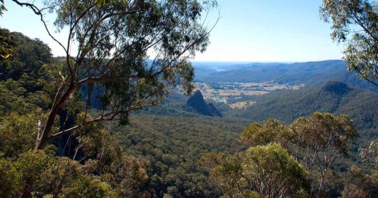
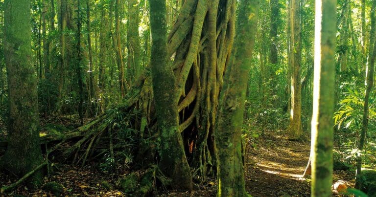
Immerse yourself in the ancient wonders of Lamington National Park on the Green Mountains Rainforest Walk. This short, 1.4km grade 2 loop track is perfect for visitors of most ages and fitness levels, taking approximately 45 minutes to complete. The first 700 meters of the track are even wheelchair accessible with some assistance.
This walk transcends the boundaries of a simple hike, transforming into a captivating journey through time. As you wander beneath the towering canopy, take a moment to imagine the landscape 23 million years ago. Picture the colossal boulders as silent witnesses to Australia's ice age, and ponder the possibility of encountering the largest marsupial to have ever walked the earth. The informative signage along the track will bring the region's geological history to life, allowing you to visualize the dramatic lava flows from the ancient Tweed Volcano.
Beyond its historical significance, the Green Mountains Rainforest Walk is a haven for birdlife. Keep your eyes peeled for the vibrant yellow-throated scrubwrens flitting through the foliage, or listen for the tell-tale calls of the elusive Albert's lyrebird or the Australian longrunner as they forage amongst the leaf litter.
Gallery
Got some great shots from this hike? Upload your photos here to inspire others and show off the beauty of the trail!
Click to view form >>
Submitting your photos doesn’t mean you lose ownership. You can be credited for your contributions, and you can request removal at any time.
Content use
Please don’t copy GPX files or content from this site to AllTrails or other platforms. Each trail has been personally mapped, documented, and refined to support Australia’s bushwalking and hiking community. While some details come from land managers, every listing reflects significant personal effort. This is a free, community-driven initiative—your respect helps keep it that way.
Walk map and GPX file
Max elevation: 933 m
Min elevation: 921 m
Total climbing: 18 m
Total descent: -18 m
Getting there
Getting to the trailhead: Lamington National Park.
Conveniently situated within Lamington National Park’s Green Mountains section, roughly 110 kilometers south of Brisbane, the Green Mountains Rainforest Walk is easily accessible. The trailhead can be found at the Green Mountains day-use area, which itself is located at the conclusion of Lamington National Park Road, just 5.7 kilometers from the park entrance.
Lamington National Park consists of two distinct areas: Green Mountains and Binna Burra. Green Mountains lies on the western side of the Lamington Plateau, while Binna Burra encompasses the eastern section.
Reaching Green Mountains: If travelling from the Gold Coast, drive approximately 40 kilometres to Canungra via Nerang. From the north, take exit 34 on the Pacific Motorway to Beenleigh, followed by route 92 to Tamborine and route 90 to Canungra. The final 36 kilometres from Canungra to Green Mountains is a winding and often narrow bitumen road. Allow at least 50 minutes for this journey and drive with caution. This route is unsuitable for large recreational vehicles (longer than 4 metres) and vehicles towing caravans or camper trailers.
Reaching Binna Burra: Allow approximately 70 minutes for the drive from Broadbeach to Binna Burra. Travel 38 kilometres to Beechmont via Nerang. Coming from the north, take exit 69 on the Pacific Motorway and follow signage westward towards Lamington National Park (Binna Burra section). The last 1.8 kilometres of the drive is particularly narrow and winding.
Public transport: Public transport is not available within the park. Taxis and ride-sharing services may also be difficult to obtain for pick-up from Lamington National Park.
Closest towns to this walk: Beaudesert, Beechmont, Binna Burra, Canungra, Mount Barney, Mount Tamborine, Nerang, North Tamborine, O'Reilly's, Tamborine Mountain, Warwick, Willow Vale, Wongawallan, Wonglepong
About the region
Immerse yourself in the captivating World Heritage rainforests of Lamington National Park, established in 1915 and spanning over 21,176 hectares. Located in south-east Queensland, close to Gold Coast, the park is part of the McPherson Range within the Scenic Rim mountain chain.
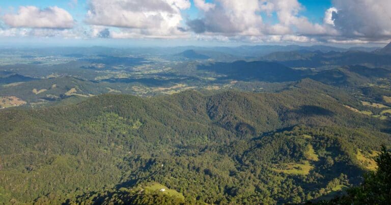
Lamington's extensive network of walking tracks caters to all abilities, from leisurely strolls to challenging hikes that delve deep into the heart of the rainforest. These tracks wind through lush valleys, past ancient trees and cascading waterfalls, leading you to dramatic lookouts offering panoramic views across the Gold Coast, south-east Queensland and even into northern New South Wales.
The park's significance extends beyond its beauty. Lamington is part of the Gondwana Rainforests of Australia World Heritage Area, renowned for its diverse ecosystems. Here you'll find some of the world's most extensive subtropical rainforests, warm temperate rainforests and the most northerly reaches of cool temperate Antarctic beech forests. This unique environment provides a vital habitat for a multitude of plant and animal life, including many threatened and endemic species.
Similar walks nearby
Looking for more walks in or near Lamington National Park? Try these trails with a similar difficulty grade.
Track grade
Grade 2 (Easy) - A Gentle Introduction to Inclines: Grade 2 on the AWTGS represents easy walking tracks that offer a slightly more challenging experience compared to Grade 1. Similar to Grade 1, no prior bushwalking experience is required. The track surface is typically hardened or compacted and may have gentle hill sections or occasional steps. The total distance of a Grade 2 walk is typically no greater than 10 kilometers. These walks are still suitable for families with a bit more experience or those seeking a gentle introduction to some inclines.
Explore safe
Plan ahead and hike safely! Carry enough water, pack layers for changing conditions, and bring safety gear like a torch, PLB, and reliable communication device. Check official sources for trail updates, closures, and access requirements, and review local weather and bushfire advice. Most importantly, share your plans with someone before you go. Being prepared makes for a safer and more enjoyable hike! Stay Safe, Explore More, and Always #ExploreSafe.
Packing checklists
What you carry in your pack depends on factors like weather, terrain, and your adventure type. Not sure what to bring? My free planning, food, and packing checklists are a great starting point, covering day hikes, overnight trips, and multi-day adventures. Use them to customise your kit and always prioritise safety.
Let someone know
Before heading out, take a moment to fill out your trip intentions form. It’s a quick way to share your hike details with family or friends. If something goes wrong, they can notify emergency services, ensuring a faster response and peace of mind. Stay safe and enjoy your adventure
Suggest an edit
Spotted a change on this trail? Maybe there are new features, the route has shifted, or the trail is permanently closed. Whatever the update, I’d love your input. Your feedback helps fellow hikers stay informed and ensures that our trail info stays fresh and reliable.
Acknowledgement of Country
Trail Hiking Australia acknowledges the Traditional Owners of the lands on which we hike and pay respects to their Elders, past and present, and we acknowledge the First Nations people of other communities who may be here today.


