Hike at a Glance
Max elevation: 669m
Min elevation: 609m
Total Ascent: 260m
Hike overview
The Gorge Rim Walk offers an unforgettable experience along the edge of Dales Gorge in Karijini National Park, a location known for its striking landscapes and rugged beauty. This 2-kilometre track, graded as moderate (Grade 3), is perfect for those seeking an accessible hike that still delivers on spectacular views. The walk typically takes around 1.25 hours to complete, making it a manageable and rewarding adventure for visitors of various fitness levels.
As you traverse the walk, you'll be treated to panoramic views of the gorge, with one of the highlights being the Circular Pool Lookout. From here, the sight of the deep gorge below can be both exhilarating and humbling. For those feeling more adventurous, the steep descent to the floor of Dales Gorge is well worth the effort. The Circular Pool, nestled in a serene setting, is a crystal-clear haven surrounded by lush ferns and a gentle waterfall cascading down sheer rock faces. Continuing on, you can follow the path towards Fortescue Falls, where a refreshing swim awaits in tranquil waters. The journey to the falls takes you across smooth, flat rocks and through vibrant glades of reeds and paperbarks, crossing shallow streams along the way.
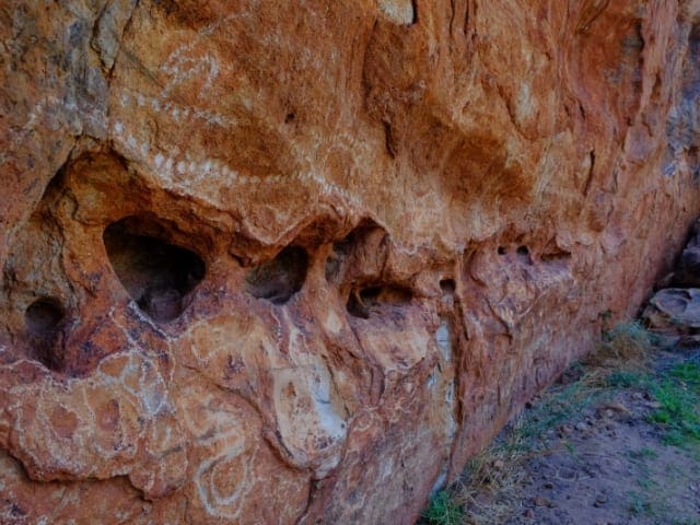
Beyond the falls, the trail leads to Fern Pool, another peaceful waterhole steeped in cultural significance for the local Indigenous people. The shady trail that winds around the falls provides a cool respite, and the surrounding landscape only adds to the sense of wonder. If you wish to return to the top of the gorge, a climb up the steps near the falls brings you back to the car park. Along the way, you’ll encounter fascinating features like ochre grinding holes and the diverse ecosystems of the Pilbara region. The area is also teeming with wildlife, from birds and fish to kangaroos and dingoes.
For those seeking to extend their hike, the Gorge Rim Walk is part of a larger loop, marked with yellow, red, and green trail markers. The full loop covers approximately 5 kilometres and takes around four hours to complete. However, be aware that certain sections of the track are located near cliff edges that drop up to 100 metres, so it’s important to stay well back from the edge, especially as loose rocks can pose a risk. The rocks in the gorges can also be slippery when wet, and visitors should exercise caution, particularly after rain. Flash floods are a real danger, so it’s best to avoid the gorges if rainfall is expected.
If you’re visiting Karijini, don’t miss out on other nearby walks such as Knox Lookout, Joffre Lookout, Joffre Falls, and Handrail Pool. Camping is available at Dales Campground, which is accessible via a sealed road. There are sites for caravans, tents, buses, and generators, although all sites are unpowered, and bookings are not required. During peak season (June to August), it’s advisable to arrive early to secure a spot. Camp hosts are on-site during these months, and facilities include toilets and BBQs. Be mindful that heavy rain can lead to road closures, so it’s always a good idea to check travel conditions with the Department of Parks and Wildlife or the Shire of Ashburton before your trip.
Gallery
Got some great shots from this hike? Upload your photos here to inspire others and show off the beauty of the trail!
Click to view form >>
Submitting your photos doesn’t mean you lose ownership. You can be credited for your contributions, and you can request removal at any time.
Content use
Please don’t copy GPX files or content from this site to AllTrails or other platforms. Each trail has been personally mapped, documented, and refined to support Australia’s bushwalking and hiking community. While some details come from land managers, every listing reflects significant personal effort. This is a free, community-driven initiative—your respect helps keep it that way.
Walk map and GPX file
Max elevation: 669 m
Min elevation: 609 m
Total climbing: 260 m
Total descent: -260 m
Getting there
Getting to the trailhead: Karijini National Park.
To reach the trailhead for the Gorge Rim Walk, start by heading to the Fortescue Falls Car Park, located within Dales Gorge in Karijini National Park. The park is around 105 kilometres from Tom Price, the nearest town, which sits 1,500 kilometres (about 16 hours) north of Perth. While much of the southern half of the park remains inaccessible, visitors typically focus on the stunning northern gorges, known for their rock pools, waterfalls, and unique wildlife. Karijini National Park can be accessed from Tom Price, Roebourne, Port Hedland, or Newman.
Keep in mind that distances between key points in the park can be quite vast. The nearest fuel stations are located over 80 kilometres away at Munjina Roadhouse or Tom Price, and if you’re staying at the Karijini Eco Retreat, fuel is about 70 kilometres away in Tom Price. For those planning to explore multiple areas, a trip from Dales Campground to Weano Gorge and back is about 112 kilometres, so it’s important to plan your visit carefully and ensure you’re well-prepared for the journey.
Closest towns to this walk: Marble Bar, Newman, Nullagine, Onslow, Pannawonica, Paraburdoo, Port Hedland, South Hedland, Tom Price
About the region
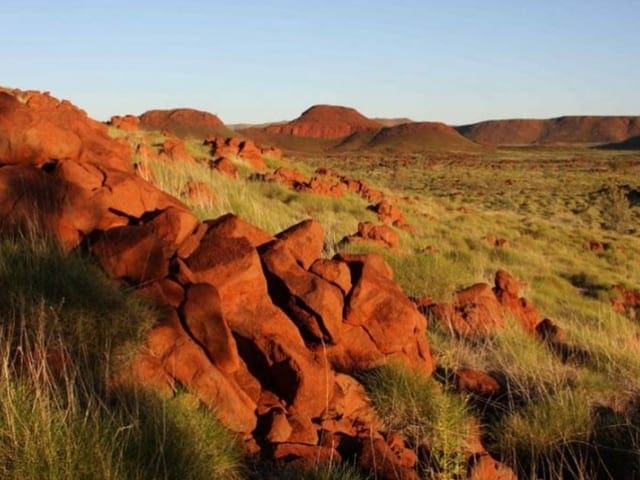
Karijini National Park is one of those places that leaves you in awe, where the landscape seems to whisper stories of ancient times. Described by many as breathtaking and rugged, it’s often hailed as the crown jewel of Western Australia. Stretching across the Pilbara region, Karijini is home to the Banyjima, Innawonga, and Kurrama people, who have been the Traditional Owners of this land for thousands of years. With rock formations that date back over 2.5 billion years, the park offers a stunning blend of natural history, adventure, and beauty.
Before you begin your journey, it’s a good idea to stop by the Karijini Visitor Centre, where the friendly locals can point you in the direction of the best spots to explore. Once you’ve gathered your information, it’s time to dive into the park’s striking landscapes. Wander through the ancient gorges, where the layers of red rock tell stories of erosion and time. The freshwater falls and secluded swimming holes, surrounded by lush ferns, are a sight to behold, and you’ll quickly understand why this place captures so many hearts.
For the full experience, it’s worth staying a couple of nights. Camping under the wide open sky will allow you to take in the full wonder of the park, with the stars coming alive as the sun sets. If you prefer a more comfortable stay, the Karijini Eco Retreat offers glamping options and guided adventure tours. The park’s beauty shifts with the seasons, and after the rains, the landscape comes alive with vibrant yellow cassias and wattles, as well as northern bluebells and purple mulla-mullas, creating a spectacular contrast against the rust-red rock.
As you explore, keep an eye out for the various wildlife that call this place home. Large termite mounds dot the grasslands, and you might spot birds, rock wallabies, echidnas, red kangaroos, goannas, and even snakes. The park is an ideal place for those who enjoy both adventure and nature, with plenty of opportunities to cool off in sparkling rock pools after scrambling over rocks and climbing through gorges.
To reach Karijini National Park, you can travel from Tom Price, Roebourne, Port Hedland, or Newman, but be mindful of the distances in the area. Fuel stations are over 80 kilometres away from Dales Campground at Munjina Roadhouse or Tom Price, and the Karijini Eco Retreat is about 70 kilometres from Tom Price. If you're planning to explore different parts of the park, a trip from Dales to Weano Gorge and back is approximately 112 kilometres. It’s important to plan your visit carefully as the southern half of the park is inaccessible and distances can add up quickly when touring the area.
From June to September, Karijini bursts into colour, with wildflowers in bloom, making it an ideal time for hiking. Whether you're navigating the walking trails or simply taking in the views from one of the lookout points, like Oxer Lookout, you'll be mesmerised by the vastness and beauty of the landscape. As the day winds down, the night sky offers another spectacle, with shooting stars and meteor showers lighting up the heavens. This ancient land, with its stunning gorges, rock pools, and waterfalls, is a truly enchanting place to visit. Before heading out, be sure to check for any alerts, incidents, or road closures to ensure a smooth adventure.
Similar walks nearby
Looking for more walks in or near Karijini National Park? Try these trails with a similar difficulty grade.
Track grade
Grade 3 (Moderate) - Walks for Most Fitness Levels: Grade 3 on the AWTGS represents moderate walking tracks. These are ideal for walkers with some fitness who are comfortable with some hills and uneven terrain. While suitable for most ages, some bushwalking experience is recommended to ensure a safe and enjoyable experience. Tracks may have short, steep hill sections, a rough surface, and many steps. The total distance of a Grade 3 walk can be up to 20 kilometers.
Explore safe
Plan ahead and hike safely! Carry enough water, pack layers for changing conditions, and bring safety gear like a torch, PLB, and reliable communication device. Check official sources for trail updates, closures, and access requirements, and review local weather and bushfire advice. Most importantly, share your plans with someone before you go. Being prepared makes for a safer and more enjoyable hike! Stay Safe, Explore More, and Always #ExploreSafe.
Packing checklists
What you carry in your pack depends on factors like weather, terrain, and your adventure type. Not sure what to bring? My free planning, food, and packing checklists are a great starting point, covering day hikes, overnight trips, and multi-day adventures. Use them to customise your kit and always prioritise safety.
Let someone know
Before heading out, take a moment to fill out your trip intentions form. It’s a quick way to share your hike details with family or friends. If something goes wrong, they can notify emergency services, ensuring a faster response and peace of mind. Stay safe and enjoy your adventure
Suggest an edit
Spotted a change on this trail? Maybe there are new features, the route has shifted, or the trail is permanently closed. Whatever the update, I’d love your input. Your feedback helps fellow hikers stay informed and ensures that our trail info stays fresh and reliable.
Acknowledgement of Country
Trail Hiking Australia acknowledges the Traditional Owners of the lands on which we hike and pay respects to their Elders, past and present, and we acknowledge the First Nations people of other communities who may be here today.


