Hike at a Glance
Max elevation: 1832m
Min elevation: 1351m
Total Ascent: 1403m
Hike overview
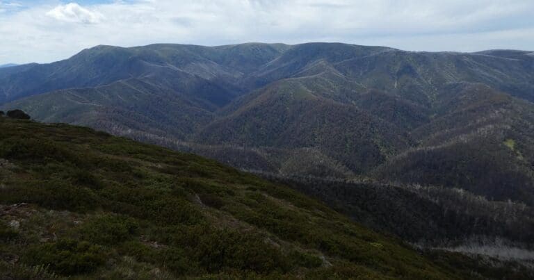
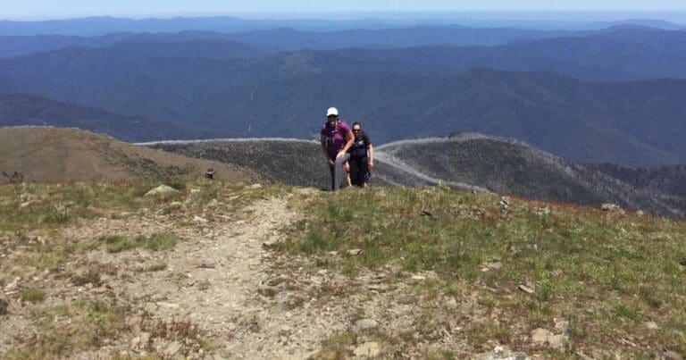
The Falls to Hotham Alpine Crossing is a 37km three-day hike through the Alpine National Park from Falls Creek to Mt Hotham. Enjoy spectacular views of mountain ridges from 2,000m above sea level, walk through beautiful Snow Gum woodland and camp near two historic huts.
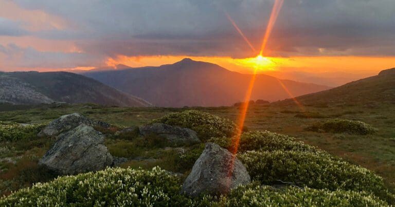
Winding its way along alpine ridges through snow gum woodlands and snow grass plains, over rocky summits and past historic huts, this memorable hike rewards walkers with a spectacular view at every step. By night, see thousands of twinkling stars against some of the darkest skies in the world far from light pollution.
Suggested itinerary
Day 1: Falls Creek to Cope Hut, 14km
Highlights include lookouts at Heathy Spur, historic Wallace Hut and Cope Hut - and swathes of pink, gold and white wildflowers in spring and summer.
Day 2: Cope Hut to Dibbins Hut, 14km
There are stunning panoramas from Pole 333 and unforgettable views of Mount Feathertop, Victoria's second-highest mountain.
Day 3: Dibbins Hut to Mt Hotham, 9km
Highlights include abandoned Quintet Mine, charming Derricks Hut - and of course a well-deserved coffee and cake at Mt Hotham.
Campsites
There are two campsites on the Falls to Hotham Alpine Crossing.
Cope Hut Camping Area, among the Snow Gums on the Bogong High Plains, is 14km from the trailhead and usually the first night's campsite.
GPS Coordinates: -36.9054927,147.2893636
Dibbins Hut Camping Area, on a snow plain near the headwaters of the Cobungra River, is 9km from Mount Hotham.
GPS Coordinates: -36.9482505,147.1822681
Each campsite has five sites on tent platforms. There are four 3m x 3.7m platforms and one larger platform that is 4.5m x 3m. The platforms are designed to fit a 2-3 person hiking tent.
The tent platforms are designed for you to pitch your tent directly on the platform. Each platform has eyelets around the edge to hook tent peg loops or guy ropes over. As well as these there are movable pegs that slot into the mesh, allowing tents of all shapes to be set up.
Bookings are required to so be sure to check availability and make a booking prior to your trip.
When to go
Summer is a great time to walk the Falls to Hotham Alpine Crossing. Wildflowers are in bloom and the temperature at 2000m is a welcome relief from the warmer climate at lower altitudes.
The Falls to Hotham Crossing is not recommended between June and October. The route is likely to be under snow and should only be attempted by experienced hikers.
If you tackle the Falls to Hotham Crossing in spring, you can expect to see swathes of wildflowers. Enjoy!
More information
For more information, visit Park Victoria or download the Falls to Hotham brochure.
Gallery
Got some great shots from this hike? Upload your photos here to inspire others and show off the beauty of the trail!
Uploading your photos doesn’t mean you lose ownership. You can be credited for your contributions, and you can request removal at any time.
Content use
Please don’t copy GPX files or content from this site to AllTrails or other platforms. Each trail has been personally mapped, documented, and refined to support Australia’s bushwalking and hiking community. While some details come from land managers, every listing reflects significant personal effort. This is a free, community-driven initiative—your respect helps keep it that way.
Walk map and GPX file
Max elevation: 1832 m
Min elevation: 1351 m
Total climbing: 1403 m
Total descent: -1191 m
Getting there
Getting to the trailhead: Alpine National Park.
From Falls Creek the trail starts from the Heathy Spur carpark, on the eastern side of the Rocky Valley dam wall in the Alpine National Park. Heathy Spur carpark is 3km from the Falls Creek Information Centre via road, or walk from the Falls Creek village bowl via the aqueduct track. The trail finishes at the Mt Loch carpark at Mt Hotham.
Falls to Hotham is a point-to-point walk, so you’ll need transport to the start and a way to get home at the end. The drive between trailheads takes approximately two-and-a-half hours.
Using two vehicles in a car shuffle is a popular option. Drive in convoy to the end of the walk, drop off one vehicle, then return to the start of the walk in the other vehicle. Vehicles can be left at the Heathy Spur or Mt Loch car parks at either end.
If you’re staying at Falls Creek, Mt Hotham or Dinner Plain before your walk, some accommodation providers can offer transport or assist with a car shuffle.
Falls Creek to Hotham Shuttle Bus
Hamish from Snow Dog operates a shuttle bus to take hikers to the start of the trail at Falls Creek to hike back toward Hotham. Complete the 25km single day route (Trail notes available) or pack gear to complete the 37km route over 2 or 3 days. Booking essential to secure shuttle service.
Visit Alpine Crossing | Services | Snow Dog Transport to book shuttles or visit Parks Victoria to book camping platforms at Cope Hut & Dibbins Hut sites.
Closest towns to this walk: Benalla, Bright, Dinner Plain, Falls Creek, Harrietville, Hotham Heights, Mansfield, Mitta Mitta, Mount Beauty, Mount Hotham, Myrtleford, Omeo, Porepunkah, Tawonga South, Wangaratta
About the region
Alpine National Park is part of an Aboriginal cultural landscape that includes traditional Country of the Taungurung and Gunaikurnai Peoples. The Alpine National Park is a national park in the Central Highlands and Alpine regions of Victoria, Australia. The 646,000-hectare national park is located northeast of Melbourne. It is the largest National Park in Victoria, and covers much of the higher areas of the Great Dividing Range in Victoria, including Victoria's highest point, Mount Bogong at 1,986 metres and the associated subalpine woodland and grassland of the Bogong High Plains. The park's north-eastern boundary is along the border with New South Wales, where it abuts the Kosciuszko National Park.
Similar walks nearby
Looking for more walks in or near Alpine National Park? Try these trails with a similar difficulty grade.
Track grade
Grade 4 (Hard) - Challenging Walks for Experienced Walkers: Grade 4 on the AWTGS signifies challenging walking tracks. Bushwalking experience is recommended for these tracks, which may be long, rough, and very steep. Directional signage may be limited, requiring a good sense of navigation. These walks are suited for experienced walkers who are comfortable with steeper inclines, rougher terrain, and potentially longer distances.
Explore safe
Plan ahead and hike safely! Carry enough water, pack layers for changing conditions, and bring safety gear like a torch, PLB, and reliable communication device. Check official sources for trail updates, closures, and access requirements, and review local weather and bushfire advice. Most importantly, share your plans with someone before you go. Being prepared makes for a safer and more enjoyable hike! Stay Safe, Explore More, and Always #ExploreSafe.
Packing checklists
What you carry in your pack depends on factors like weather, terrain, and your adventure type. Not sure what to bring? My free planning, food, and packing checklists are a great starting point, covering day hikes, overnight trips, and multi-day adventures. Use them to customise your kit and always prioritise safety.
Let someone know
Before heading out, take a moment to fill out your trip intentions form. It’s a quick way to share your hike details with family or friends. If something goes wrong, they can notify emergency services, ensuring a faster response and peace of mind. Stay safe and enjoy your adventure
Suggest an edit
Spotted a change on this trail? Maybe there are new features, the route has shifted, or the trail is permanently closed. Whatever the update, I’d love your input. Your feedback helps fellow hikers stay informed and ensures that our trail info stays fresh and reliable.
Acknowledgement of Country
Trail Hiking Australia acknowledges the Traditional Owners of the lands on which we hike and pay respects to their Elders, past and present, and we acknowledge the First Nations people of other communities who may be here today.


5 Reviews on “Falls to Hotham Alpine Crossing Hike (37km)”
Live this hike. The Fainters fire trail circuit is also excellent
Zoe Belfield would love to do this again?
any tips for how to get between Falls and Hotham if you leave your car at one end? are there transfers at all do you know?
Hey everyone, has anyone done this hike in winter? Thanks 🙂
Has anyone done this or has any views on doing this hike Falls to Dibbins Hut (2 nights) and then turn around on day 3 and return to Falls in a day (Light-ish pack)? Avoiding transfer logistics 🙂 Cheers
Brenda Belfield very true! I might relocate!!
Brenda Belfield yes one day ¸
Cassandra Meehan Easter options ‘Truckie and Midge go walking’ ????
Did this a couple of weeks ago as a return from/to Falls, skipping the last bit between Dibbins and Hotham which I find the least beautiful bit anyway. Followed the official map from Falls to Cope (first night), then from pole 333 to Weston, Blair and then to Dibbins (2nd night), then Dibbins back to pole 333 and the shortcut to Falls creek. You can either make a straight line to Pretty Valley Pondage and then Falls or from 333 to Tawomba huts and then Falls (which is the official shortcut the Falls Creek Visitor Center had recommended – they also have a map showing this, they were really helpful). That was a stunning way to go because you don’t really backtrack anywhere and on the way to Weston Hut (great place to camp, probably the cutest hut I’ve seen) you get amazing views of Feathertop. The track to Blair from Weston requires lots of fallen-tree-climbing, do make the small detour to Blair’s hut, it’s such a beautiful place next to the stream, perfect for a cuppa. Bit of a slog uphill from Blair to Dibbins.
Hi Larissa,
Thanks for the great insight.
Do you remember approx how far in km the revised last leg was (replacing the 9km on the standard trail)? Or if not, how it compared to the first two days..
Looks a fair bit further on the map.
We are interested in following your lead but just want to make sure the last leg is still palatable in terms of distance/effort.
Thanks,
Mike
Forest Air Helicopters operate a transfer service from either Falls to Hotham or Hotham to Falls. So you can leave your car at one end or the other. The helicopter ride is about 8 minutes.
Hey Laura – we have the same issue. Shuttle transfer only operates in peak summer. There is a taxi service for $300 (will take 6 people). Otherwise u have to take two cars. Cheers
Hey Laura. You can arrange a shuttle transfer. Best bet is to check out the details in the falls creek website. http://www.fallscreek.com.au/attractions/falls-to-hotham-crossing-shuttle
Hi Larisaa,
What are the approximate times it took you to walk between Cope Hut and Dibbins via Weston and Blair? Also from Dibbins back to Falls via Tawomba huts?
Hi Larissa,
We are doing falls to hotham next month but we are contemplating hiking to dibbins hut and back next day to falls. We are only doing one night so will park at cope hut and walk from there. You could maybe park at Langford Gap carpark which will save a bit of walking on the return.
I so want to do this hike !
I want to do this!! soooon
Kerryn!!! YES!!!
Marion Roberts I have no cars, boo. 🙁
Michael Neal
My wife and I will doing this in December. So looking forward to it!
thanks guys
thanks Marion