Trail Fast Facts
Donaghys Hill Wilderness Walk is a 2.2km, grade 2 hike in the Wild Rivers National Park, Tasmania. This hike typically takes 1 hr to complete.
Hike Overview
Enjoy wilderness views of mountain tops and the Franklin River after this short walk. The track climbs a small hill at an easy grade and lands you perched and protected on a rocky lookout point.
Highlights
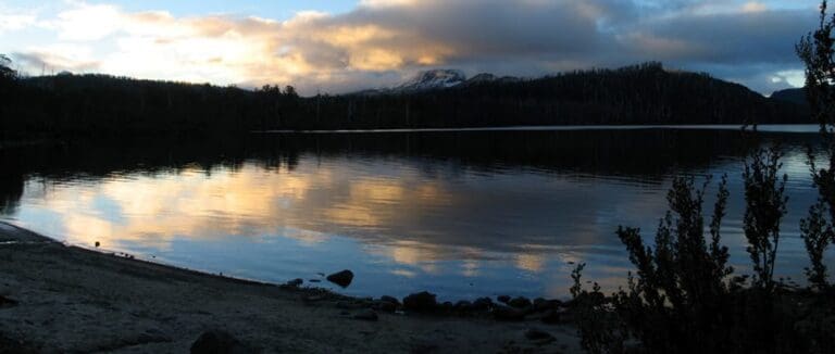
Donaghys Lookout offers a spectacular window into the wilderness of the Wild Rivers National Park. Dominating the skyline is the quartzite half dome of Frenchmans Cap, a challenging bushwalk. Below is the junction of the Collingwood and Franklin Rivers.
Frenchmans Cap
The magnificent white quartzite dome of Frenchmans Cap (1446 m) is the most prominent mountain peak in the Franklin-Gordon Wild Rivers National Park. The silvery Precambrian quartzite is some of Australia’s oldest exposed rock.
The summit can be reached by a walking track that passes through buttongrass plains, unusual rainforest where Huon pine grows alongside King Billy pine, and spectacular glacial valleys, up to Lake Tahune, perched under the huge and spectacular cliff face of Frenchmans Cap. The track is considerably more arduous than many other Tasmanian walks, including the Overland Track. To do the summit climb you must have good weather and a good head for heights and exposure. Most walkers spend between 3 and 5 days completing the return trip, a distance of about 23 km each way.
Track Grade
Grade 2 (Easy) - A Gentle Introduction to Inclines: Grade 2 on the AWTGS represents easy walking tracks that offer a slightly more challenging experience compared to Grade 1. Similar to Grade 1, no prior bushwalking experience is required. The track surface is typically hardened or compacted and may have gentle hill sections or occasional steps. The total distance of a Grade 2 walk is typically no greater than 10 kilometers. These walks are still suitable for families with a bit more experience or those seeking a gentle introduction to some inclines.
Tips
Park entry fees apply. (Lake St Clair or Queenstown are the closest places to obtain a pass.)
Picnic and toilet facilities located at the Franklin River 9km away.
Supervise children, unprotected track edges.
No pets, firearms or bicycles.
Map and GPX file
Max elevation: 516 m
Min elevation: 459 m
Total climbing: 87 m
Total descent: -87 m
For more information about this hiking trail please visit Parks and Wildlife Service Tasmania
Trail Location (trailhead)
Sorry, no records were found. Please adjust your search criteria and try again.
Sorry, unable to load the Maps API.
Photo gallery
If you have any photos from this hike and are happy to share them, please upload your .jpg files here.
Please note: Uploading photos does not transfer ownership of copyright away from you. If requested, you will be credited for any photos you provide and can ask they be deleted at any time.
Similar trails nearby
Explore Safe
While planning your hike, it’s important to check official government sources for updated information, temporary closures and trail access requirements. Before hitting the trail, check local weather and bushfire advice for planned burns and bushfire warnings and let someone know before you go. Plan ahead and hike safely.
Let someone know
Adventure with peace of mind: Fill out your trip intentions form. Before you hit the trail, fill out an online form to privately send important details about your hike to your family or friends. If you don’t return on time, they can easily alert emergency services, preventing worry and ensuring a swift response. Hike with peace of mind and enjoy your outdoor adventure to the fullest. Be smart, be safe: Register your plans here.
Gear to consider
What you carry in your pack will depend on the weather, terrain, time of year, type of adventure, and personal preferences. Having trouble deciding what gear’s right for you? My free planning, food and packing checklists provide an introduction to things your could consider (as well as the Ten Essentials) on your day, overnight and multi-day adventures. Customise your kit according to your personal needs, always considering safety first.
Suggest an edit
Trail changed? New features discovered? Has the route changed? Trail permanently closed? Help fellow hikers by suggesting edits! Click above to update route descriptions, GPX file, trail features (like boardwalks), or access conditions (like parking availability). Help me keep the trails info fresh!
Weather
Acknowledgement of Country
Trail Hiking Australia acknowledges the Traditional Owners of the lands on which we hike and pay respects to their Elders, past and present, and we acknowledge the First Nations people of other communities who may be here today.


