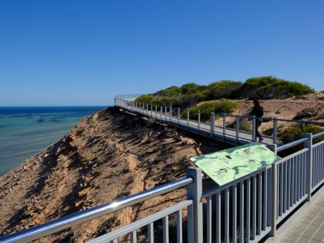
Direction Island Heritage Trail is a 3.5km, grade 1 hike located in Direction Island, Western Australia. The hike should take around 1.5 hours to complete.
Hike overview
As with most other islands in the Keeling group, Direction Island has a fascinating history. This easy 3.5 kilometer trail takes walkers from end to end and past interpretive panels telling its story.
Direction Island sits to the north east of the atoll and is accessible twice a week by the local ferry service from West and Home Islands. The jetty sits adjacent to the Commemorative Sydney Emden 100 Interpretive Gazebo and the Trail Head. The Trail has a west and east loop, intersected by the Trail Head and Gazebo. The Direction Island Heritage Trail has 25 interpretive panels along its 3.5km course. The island is very flat and well shaded, however the west end of the trail may have palm frond litter. Direction Island has a wood BBQ, covered picnic tabels and drop toilets. A great place to swim, snorkel and relax, the trail allows walkers a chance to learn about the establishment of the Cable Station, life and times of the Station, the Emden and Sydney WWI story, the Ayesha story, WWII history, military units based on the islands, Catalina flights and more recent history associated with international yachts mooring at the islands. An easy trail with each loop taking approximately 1 hour, suitable for families and those with moderate fitness levels and abilities. There is no drinking water on Direction Island, and always cover well from the effects of the sun and mosquitos.
Route and GPX file
Help fellow hikers navigate with confidence. Share your GPX or KML file for this trail and help build a more comprehensive resource with precise waypoints and elevation profiles. Your contribution will empower adventurers with details they need for a safer and more enjoyable experience. I meticulously verify every file using official maps and surveys, ensuring the highest level of accuracy and reliability. Submit your file now and become a trailblazer for your fellow outdoor enthusiasts.
Tips
Start Point: The Direction Island Heritage Trail starts and finishes at the Commemorative Sydney Emden 100 Gazebo, adjacent to the jetty.
End Point: The Direction Island Heritage Trail starts and finishes at the Commemorative Sydney Emden 100 Gazebo, adjacent to the jetty.
Region: Direction Island, Indian Ocean Islands
For more information, a location map and GPS file please visit Trails WA.
Trail location
Sorry, no records were found. Please adjust your search criteria and try again.
Sorry, unable to load the Maps API.
Gallery
If you have any photos from this hike and are happy to share them, please upload your .jpg files here.
Please note: Uploading photos does not transfer ownership of copyright away from you. If requested, you will be credited for any photos you provide and can ask they be deleted at any time.
About the region
Direction Island is the second largest of a group of ten islands and atolls unofficially called the Mackerel Islands. Two of the islands, Thevenard Island and Direction Island, have accommodation for tourists. It is one of the few places in the world where people can rent their own island for a holiday or vacation stay. Direction Island can be reached by a ferry service operating from the mainland at Onslow or by recreational boats. For vessels under 6 metres in length, there is a private boat mooring at the island.
Similar trails nearby
Explore Safe
While planning your hike, it’s important to check official government sources for updated information, temporary closures and trail access requirements. Before hitting the trail, check local weather and bushfire advice for planned burns and bushfire warnings and let someone know before you go. Plan ahead and hike safely.
Let someone know
Adventure with peace of mind: Fill out your trip intentions form. Before you hit the trail, fill out an online form to privately send important details about your hike to your family or friends. If you don’t return on time, they can easily alert emergency services, preventing worry and ensuring a swift response. Hike with peace of mind and enjoy your outdoor adventure to the fullest. Be smart, be safe: Register your plans here.
Gear to consider

My free planning, food and packing checklists provide an introduction to things your could consider (as well as the Ten Essentials) on your day, overnight and multi-day adventures. Customise your kit according to your personal needs, always considering safety first.
Suggest an edit
Does this hikes information need updating? Sometimes the route, trail features or access conditions change.
Acknowledgement of Country
Trail Hiking Australia acknowledges the Traditional Owners of the lands on which we hike and pay respects to their Elders, past and present, and we acknowledge the First Nations people of other communities who may be here today.


