Trail Fast Facts
Deep Pass Split Rock is a 3km, grade 3 hike in the Wollemi National Park, New South Wales. This hike typically takes 2 hours to complete.
Warning
Many of the walks in this area require rock scrambling and abseiling skills. You should be certain of your capabilities, and always walk in a group.
Hike Overview
The trail to Split Rock follows the initial section of the Deep Pass Canyon Loop, leading you to the charming Deep Pass campground. Here, the real magic begins.
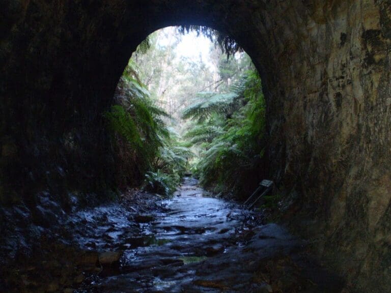
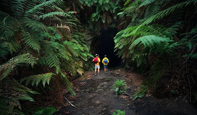
On the southern side of the campground lies Split Rock, a majestic sandstone formation that begs exploration. Scramble around its back and discover a narrow, dry canyon offering a unique perspective. Feeling adventurous? Squeeze through a U-shaped cave/tunnel, but be sure to pack a head torch! This hidden gem often twinkles with glowworms, creating a mesmerizing spectacle for those willing to adjust their eyes to the darkness.
The hike itself takes roughly 2 hours to complete. The first half follows a well-maintained rocky fire trail, offering an easy and scenic walk. The remainder transitions to a dirt path with a few loose sections, but nothing too challenging when dry.
The final approach to Split Rock involves a short scramble, but the reward is well worth the effort. Once inside, navigate the narrow slot canyon with ease and marvel at the geological wonders surrounding you. This adventure is perfect for those seeking a taste of challenge and a dose of natural wonder. Just remember to be prepared and prioritize safety throughout your exploration.
If you wanted to stay in the area and explore Deep canyon, pitch a tent at the Deep Pass walk-in campsite.
Deep Pass walk-in campsite
Set up camp at remote Deep Pass campground in World Heritage-listed Wollemi National Park. With unmarked sites suitable for tents only, this walk-in campground is near scenic walks, rockpools and canyons.
Track Grade
Grade 3 (Moderate) - Walks for Most Fitness Levels: Grade 3 on the AWTGS represents moderate walking tracks. These are ideal for walkers with some fitness who are comfortable with some hills and uneven terrain. While suitable for most ages, some bushwalking experience is recommended to ensure a safe and enjoyable experience. Tracks may have short, steep hill sections, a rough surface, and many steps. The total distance of a Grade 3 walk can be up to 20 kilometers.
Map and GPX file
Max elevation: 982 m
Min elevation: 853 m
Total climbing: 177 m
Total descent: -177 m
Trail Location (trailhead)
Sorry, no records were found. Please adjust your search criteria and try again.
Sorry, unable to load the Maps API.
Photo gallery
If you have any photos from this hike and are happy to share them, please upload your .jpg files here.
Please note: Uploading photos does not transfer ownership of copyright away from you. If requested, you will be credited for any photos you provide and can ask they be deleted at any time.
About the region
Deep Pass, a saddle located on the western end of Railmotor Ridge near Mount Norris, beckons exploration. Accessible via Glowworm Tunnel Road, Eastern Boundary Road, and the Deep Pass Trail, this historical landmark was designated a Rural Place in 1997. You can even spot it on the 1882 map of the Parish of Rock Hill. A small creek named Deep Pass Creek, stemming from the south side of the saddle, flows for 2.1km before meeting Dingo Creek.
Just a few hours northwest of Sydney lies Wollemi National Park, a World Heritage site that will leave you breathless. Immerse yourself in the vast Wollemi Wilderness, the largest declared Wilderness Area in New South Wales. Towering cliffs, wild rivers, canyons, and serene forests provide endless opportunities for scenic walks, drives, wildlife spotting, canoeing, and camping.
Wollemi National Park offers diverse experiences across different regions. Near Windsor, discover the beauty of the Colo River and its gorges, perfect for hiking, picnics, riverside camping, and canoeing. Explore historic mining ruins and the magical Glow Worm Tunnel near Newnes campground in the Wolgan Valley. Hike or rock climb the magnificent escarpments that rise from the valley floor.
Seeking tranquility? Escape to Gunguddy (Dunns Swamp) in the Mudgee Region. Here, you can camp, swim, and canoe while marveling at the remarkable pagoda rock formations on easy walking tracks. The park's northeast region, bordering the Upper Hunter Valley, is best explored on a scenic drive or 4WD adventure. Discover remote camping options near Sheepskin Hut and historical remnants from the area's mining and pastoral past.
Whether you're seeking a challenging hike through Deep Pass or a relaxing escape within a specific region of Wollemi National Park, there's something for everyone. Remember to check park regulations and plan your trip accordingly. T
Similar trails nearby
Explore Safe
While planning your hike, it’s important to check official government sources for updated information, temporary closures and trail access requirements. Before hitting the trail, check local weather and bushfire advice for planned burns and bushfire warnings and let someone know before you go. Plan ahead and hike safely.
Let someone know
Adventure with peace of mind: Fill out your trip intentions form. Before you hit the trail, fill out an online form to privately send important details about your hike to your family or friends. If you don’t return on time, they can easily alert emergency services, preventing worry and ensuring a swift response. Hike with peace of mind and enjoy your outdoor adventure to the fullest. Be smart, be safe: Register your plans here.
Gear to consider
What you carry in your pack will depend on the weather, terrain, time of year, type of adventure, and personal preferences. Having trouble deciding what gear’s right for you? My free planning, food and packing checklists provide an introduction to things your could consider (as well as the Ten Essentials) on your day, overnight and multi-day adventures. Customise your kit according to your personal needs, always considering safety first.
Suggest an edit
Trail changed? New features discovered? Has the route changed? Trail permanently closed? Help fellow hikers by suggesting edits! Click above to update route descriptions, GPX file, trail features (like boardwalks), or access conditions (like parking availability). Help me keep the trails info fresh!
Weather
Acknowledgement of Country
Trail Hiking Australia acknowledges the Traditional Owners of the lands on which we hike and pay respects to their Elders, past and present, and we acknowledge the First Nations people of other communities who may be here today.


