Trail Fast Facts
Cape Baily Coastal Walk is a 12km, grade 3 hike in Kamay Botany Bay National Park, New South Wales. The hike typically takes 3-4 hours to complete.
Hike Overview
If you love the panoramic ocean views from the sandstone cliffs of Kamay Botany Bay National Park, Cape Baily walking track is for you. Close to Cronulla, it's a great place to spot whales, dolphins and native birds.
The Cape Baily Coastal Walk is a moderate 12km return hike within Kamay Botany Bay National Park, New South Wales. Expect to spend 3-4 hours enjoying the stunning coastal scenery.
The trail begins at the carpark near the whale watching platform at the end of Cape Solander Drive in Kurnell. Following the Cape Baily Track southward, the path winds along clifftops, offering panoramic views of the ocean and dramatic sandstone formations. Your journey explores diverse features like gaps, sand dunes, and unique hanging swamps – pockets of wetland vegetation sustained by rainwater seepage. Keep an eye out for a variety of birdlife and marine creatures throughout the trek.
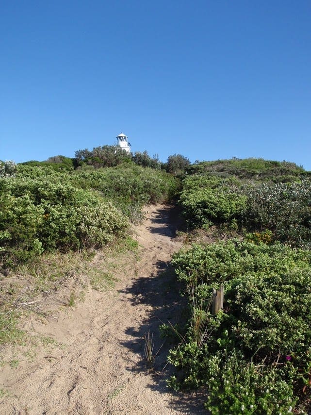
A highlight is Cape Baily Lighthouse, a historic landmark built in 1950. This scenic stop boasts a unique combination of a mid-20th-century concrete tower and a 19th-century lantern, still operational today.
The trail continues for 6km before reaching Boat Harbour Aquatic Reserve. This protected area encompasses diverse marine habitats and provides feeding grounds for various shorebirds, including threatened species. If you prefer a shorter one-way walk, you can conclude your hike here and arrange return transportation. Otherwise, simply retrace your steps along the cliffs to return to the starting point.
Reaching the trailhead requires driving or arranging a drop-off, as public transport options are limited. Located at the end of Cape Solander Drive in Kurnell, the trailhead is accessible via Captain Cook Drive, which connects to major roads from Sydney and surrounding areas. Ample parking is available near the starting point, and clear signage will guide you to the beginning of the hike.
Depending on how much time you’ve got, either do the shorter 4km one-way walk finishing at Potter Point, or the 9km return Cape Baily Walking Track, which takes about 3 hours.
Track Grade
Grade 3 (Moderate) - Walks for Most Fitness Levels: Grade 3 on the AWTGS represents moderate walking tracks. These are ideal for walkers with some fitness who are comfortable with some hills and uneven terrain. While suitable for most ages, some bushwalking experience is recommended to ensure a safe and enjoyable experience. Tracks may have short, steep hill sections, a rough surface, and many steps. The total distance of a Grade 3 walk can be up to 20 kilometers.
Tips
- You can visit any time of year as there are no weather restrictions.
- Relatively flat with a few steps over elevated boardwalk and sections of natural sandstone.
- Occasional step up/down on sections of natural sandstone and boardwalks.
- Bring drinking water, sturdy shoes, suitable clothing, hat, sunscreen, snacks
- Park entry fees apply
- No wheelchair access
- There are no water fountains or shaded areas along the track.
- The nearest toilet is at Commemoration flat and there’s an external toilet at Kurnell Visitor Centre, 2km north and a 3min drive from Cape Solander carpark.
Map and GPX file
Max elevation: 45 m
Min elevation: 3 m
Total climbing: 312 m
Total descent: -311 m
Trail Location (trailhead)
Sorry, no records were found. Please adjust your search criteria and try again.
Sorry, unable to load the Maps API.
Getting there
Cape Baily walking track starts at the south end of Cape Solander carpark in Kamay Botany Bay National Park. The drive from Sydney is straightforward. Follow Captain Cook Drive towards Kurnell. At the T-intersection, turn left and take the next right onto Cape Solander Drive. Continue past the visitor center and follow the road until you reach the carpark at the end.
The roads are all sealed and suitable for 2WD vehicles. Parking is available at Cape Solander lookout, with a designated area for accessible parking. However, be aware that this area can get very busy, especially on weekends and during whale watching season (May to October). To secure a spot, aim to arrive early. If you're not planning on doing the full 8km return walk, you can arrange to be dropped off and picked up later at Potter Point carpark.
Public transport is also an option for reaching the Kurnell area. While specific details on buses or trains are beyond the scope of this guide, a quick online search will provide timetables and help you plan your journey.
Photo gallery
If you have any photos from this hike and are happy to share them, please upload your .jpg files here.
Please note: Uploading photos does not transfer ownership of copyright away from you. If requested, you will be credited for any photos you provide and can ask they be deleted at any time.
About the region
Located at La Perouse and Kurnell in Sydney, Kamay Botany Bay National Park offers a captivating blend of natural beauty, rich Aboriginal culture, and historical significance. Whether you're interested in exploring Captain Cook's landing site, spotting native plants on a scenic bushwalk, or searching for whales breaching offshore, this park has something for everyone.
Kamay Botany Bay National Park is a treasure trove of significant sites and heritage-listed attractions, making it a perfect day trip destination in Sydney's south. Separated by the historic waters of Botany Bay, the park's northern and southern headlands, La Perouse and Kurnell, boast a unique combination of natural and cultural heritage.
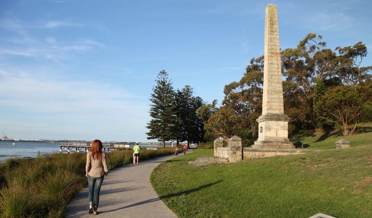
Explore the southern Kurnell area, where in 1770, local Aboriginal people witnessed the arrival of Captain Cook's crew on the Endeavour, marking a pivotal moment in Australian history. The northern La Perouse region is equally fascinating, holding the last known sighting of French explorer Comte de Laperouse in 1788.
Beyond its historical significance, Kamay Botany Bay National Park is a haven for outdoor enthusiasts. Several sheltered coves and beaches provide idyllic spots for swimming in calm waters. The park's diverse marine environment offers a paradise for snorkelers and scuba divers of all experience levels. Explore the vibrant rocky reefs guarding the entrance to Botany Bay or delve into the underwater seagrass meadows that carpet the bay's interior.
Exploring the Park's Two Distinct Areas
- La Perouse: Situated near Maroubra, La Perouse forms the park's northern headland. This area is a haven for outdoor activities, with fantastic walking tracks, exceptional diving spots, and historical sites all within easy reach of Sydney's city center.
- Kurnell: Located near Cronulla, Kurnell occupies the park's southern headland. Here, you can embark on a whale-watching adventure or explore some of New South Wales' most significant heritage sites. The Kurnell Peninsula headland was rightfully included on the National Heritage List in 2004 in recognition of its rich historical importance.
Similar trails nearby
Explore Safe
While planning your hike, it’s important to check official government sources for updated information, temporary closures and trail access requirements. Before hitting the trail, check local weather and bushfire advice for planned burns and bushfire warnings and let someone know before you go. Plan ahead and hike safely.
Let someone know
Adventure with peace of mind: Fill out your trip intentions form. Before you hit the trail, fill out an online form to privately send important details about your hike to your family or friends. If you don’t return on time, they can easily alert emergency services, preventing worry and ensuring a swift response. Hike with peace of mind and enjoy your outdoor adventure to the fullest. Be smart, be safe: Register your plans here.
Gear to consider
What you carry in your pack will depend on the weather, terrain, time of year, type of adventure, and personal preferences. Having trouble deciding what gear’s right for you? My free planning, food and packing checklists provide an introduction to things your could consider (as well as the Ten Essentials) on your day, overnight and multi-day adventures. Customise your kit according to your personal needs, always considering safety first.
Suggest an edit
Trail changed? New features discovered? Has the route changed? Trail permanently closed? Help fellow hikers by suggesting edits! Click above to update route descriptions, GPX file, trail features (like boardwalks), or access conditions (like parking availability). Help me keep the trails info fresh!
Weather
Acknowledgement of Country
Trail Hiking Australia acknowledges the Traditional Owners of the lands on which we hike and pay respects to their Elders, past and present, and we acknowledge the First Nations people of other communities who may be here today.


