Trail Fast Facts
Box Forest Circuit is a 10km, grade 4 hike in Lamington National Park, Queensland. The hike typically takes 4 hours to complete.
Hike Overview
The Box Forest Circuit is a rewarding 10km, grade 4 hike in Lamington National Park, Queensland. This loop trail, typically completed in 4 hours, takes you through stunning subtropical rainforest and past several picturesque waterfalls.
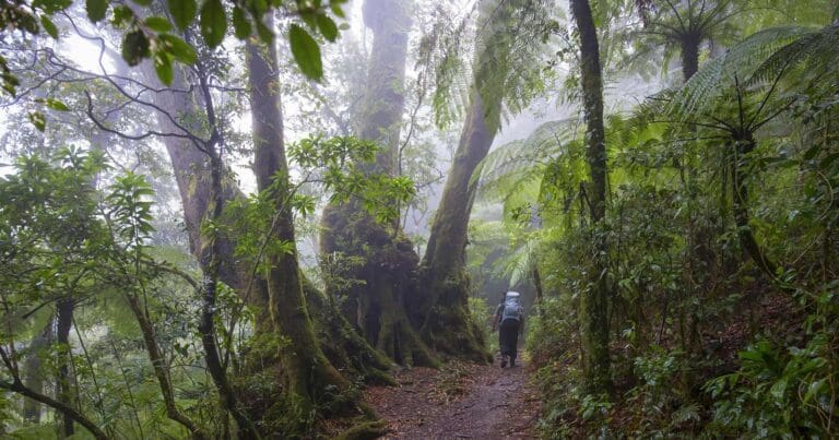
Begin by following the Border Track before branching off onto the Toolona Creek Circuit and finally the Box Forest Circuit itself. Walk anticlockwise through lush rainforest, encountering towering stands of smooth, pink-barked brush box (Lophostemon confertus) and a few scattered Antarctic beech trees. In spring, the delicate white flowers of box orchids adorn the fibrous branches and trunks of the brush box trees. Notably, some brush box trees in this World Heritage area have been identified as the oldest ever carbon-dated trees on mainland Australia, with estimates reaching 1,500 years old.
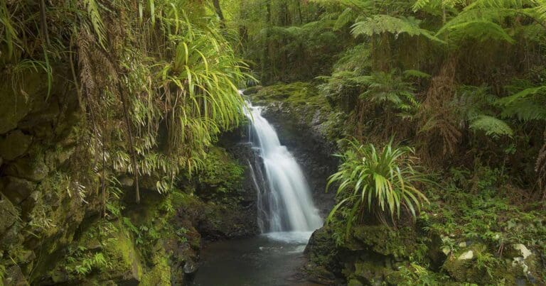
Enjoy a leisurely lunch break at Tullerigumai Falls (Box Log) or Picnic Rock, before continuing to the photogenic Elabana Falls. Witness the clear mountain water cascade from a high point in the rainforest, plunging into deep, swirling pools and cascading over rocky faces before descending further down the valley. This breathtaking scene is a must-capture for any nature photographer.
You can choose to return to the starting point by retracing your steps, or complete the entire circuit to take in views of additional waterfalls like Darragumai Falls and Yanbacoochie Falls.
Track Grade
Grade 4 (Hard) - Challenging Walks for Experienced Walkers: Grade 4 on the AWTGS signifies challenging walking tracks. Bushwalking experience is recommended for these tracks, which may be long, rough, and very steep. Directional signage may be limited, requiring a good sense of navigation. These walks are suited for experienced walkers who are comfortable with steeper inclines, rougher terrain, and potentially longer distances.
Map and GPX file
Max elevation: 958 m
Min elevation: 713 m
Total climbing: 585 m
Total descent: -585 m
Trailhead
Sorry, no records were found. Please adjust your search criteria and try again.
Sorry, unable to load the Maps API.
Getting there
To reach the Box Forest Circuit trailhead, follow Lamington National Park Road for 5.7km from the park entrance until you arrive at the Green Mountains day-use area. Park your car and proceed along the Border Track for approximately 3.2km. Look out for signage for the Box Forest Circuit which will mark the starting point of your adventure.
Lamington National Park consists of two distinct areas: Green Mountains and Binna Burra. Green Mountains lies on the western side of the Lamington Plateau, while Binna Burra encompasses the eastern section.
Reaching Green Mountains: If travelling from the Gold Coast, drive approximately 40 kilometres to Canungra via Nerang. From the north, take exit 34 on the Pacific Motorway to Beenleigh, followed by route 92 to Tamborine and route 90 to Canungra. The final 36 kilometres from Canungra to Green Mountains is a winding and often narrow bitumen road. Allow at least 50 minutes for this journey and drive with caution. This route is unsuitable for large recreational vehicles (longer than 4 metres) and vehicles towing caravans or camper trailers.
Reaching Binna Burra: Allow approximately 70 minutes for the drive from Broadbeach to Binna Burra. Travel 38 kilometres to Beechmont via Nerang. Coming from the north, take exit 69 on the Pacific Motorway and follow signage westward towards Lamington National Park (Binna Burra section). The last 1.8 kilometres of the drive is particularly narrow and winding.
Public transport: Public transport is not available within the park. Taxis and ride-sharing services may also be difficult to obtain for pick-up from Lamington National Park.
Photo gallery
Main image: Cameron Semple © High and Wide
If you have any photos from this hike and are happy to share them, please upload your .jpg files here.
Please note: Uploading photos does not transfer ownership of copyright away from you. If requested, you will be credited for any photos you provide and can ask they be deleted at any time.
About the region
Immerse yourself in the captivating World Heritage rainforests of Lamington National Park, established in 1915 and spanning over 21,176 hectares. Located in south-east Queensland, close to Gold Coast, the park is part of the McPherson Range within the Scenic Rim mountain chain.
Lamington's extensive network of walking tracks caters to all abilities, from leisurely strolls to challenging hikes that delve deep into the heart of the rainforest. These tracks wind through lush valleys, past ancient trees and cascading waterfalls, leading you to dramatic lookouts offering panoramic vistas across the Gold Coast, south-east Queensland and even into northern New South Wales.
The park's significance extends beyond its beauty. Lamington is part of the Gondwana Rainforests of Australia World Heritage Area, renowned for its diverse ecosystems. Here you'll find some of the world's most extensive subtropical rainforests, warm temperate rainforests and the most northerly reaches of cool temperate Antarctic beech forests. This unique environment provides a vital habitat for a multitude of plant and animal life, including many threatened and endemic species.
Similar trails nearby
Looking for things to do in Lamington National Park? Try these hikes or bushwalks.
Explore Safe
While planning your hike, it’s important to check official government sources for updated information, temporary closures and trail access requirements. Before hitting the trail, check local weather and bushfire advice for planned burns and bushfire warnings and let someone know before you go. Plan ahead and hike safely.
Let someone know
Adventure with peace of mind: Fill out your trip intentions form. Before you hit the trail, fill out an online form to privately send important details about your hike to your family or friends. If you don’t return on time, they can easily alert emergency services, preventing worry and ensuring a swift response. Hike with peace of mind and enjoy your outdoor adventure to the fullest. Be smart, be safe: Register your plans here.
Gear to consider
What you carry in your pack will depend on the weather, terrain, time of year, type of adventure, and personal preferences. Having trouble deciding what gear’s right for you? My free planning, food and packing checklists provide an introduction to things your could consider (as well as the Ten Essentials) on your day, overnight and multi-day adventures. Customise your kit according to your personal needs, always considering safety first.
Suggest an edit
Trail changed? New features discovered? Has the route changed? Trail permanently closed? Help fellow hikers by suggesting edits! Click above to update route descriptions, GPX file, trail features (like boardwalks), or access conditions (like parking availability). Help me keep the trails info fresh!
Weather
Acknowledgement of Country
Trail Hiking Australia acknowledges the Traditional Owners of the lands on which we hike and pay respects to their Elders, past and present, and we acknowledge the First Nations people of other communities who may be here today.


