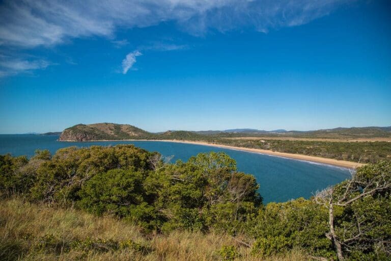
Striking rock formations, breathtaking views and a diverse range of plants and animals - these are just some of the highlights of the Capricorn Coast National Park. A good way to explore the area is by taking a walk along the Bluff Point Track in the Bluff Point section of the park. It's a 2.3 kilometre circuit that offers panoramic views of the coastline.
Got some great shots from this hike? Upload your photos here to inspire others and show off the beauty of the trail!
Submitting your photos doesn’t mean you lose ownership. You can be credited for your contributions, and you can request removal at any time.
Please don’t copy GPX files or content from this site to AllTrails or other platforms. Each trail has been personally mapped, documented, and refined to support Australia’s bushwalking and hiking community. While some details come from land managers, every listing reflects significant personal effort. This is a free, community-driven initiative—your respect helps keep it that way.
It looks like I don’t have a GPX file for this trail yet. If you have one to share, please email it to me! I’ll verify it against official maps before adding it to help other hikers have a safer, easier experience. Thanks for contributing to a better hiking resource.
Getting there
Getting to the trailhead: Capricorn Coast National Park.
Closest towns to this walk: Cawarral, Emu Park, Keppel Sands, Kinka Beach, Rocky Bay, Yeppoon, Zilzie
About the region
Capricorn Coast is a national park in the Shire of Livingstone, Queensland, Australia.
The park is 535 km northwest of Brisbane.
It covers about 114 hectares, and is divided into five sections: Vallis Park, Rosslyn Head, Double Head, Bluff Point, and Pinnacle Point. The five sections were amalgamated into a single national park in 1994.
For more information on this hiking trail, please visit Queensland.com
Similar walks nearby
Looking for more walks in or near Capricorn Coast National Park? Try these trails with a similar difficulty grade.
Favourite

Capricorn Coast National Park
Favourite

Byfield Conservation Park
Favourite

Favourite

Cania Gorge National Park
Track grade
Grade 3 (Moderate) - Walks for Most Fitness Levels: Grade 3 on the
AWTGS represents moderate walking tracks. These are ideal for walkers with some fitness who are comfortable with some hills and uneven terrain. While suitable for most ages, some bushwalking experience is recommended to ensure a safe and enjoyable experience. Tracks may have short, steep hill sections, a rough surface, and many steps. The total distance of a Grade 3 walk can be up to 20 kilometers.
Explore safe
Plan ahead and hike safely! Carry enough water, pack layers for changing conditions, and bring safety gear like a torch, PLB, and reliable communication device. Check official sources for trail updates, closures, and access requirements, and review local weather and bushfire advice. Most importantly, share your plans with someone before you go. Being prepared makes for a safer and more enjoyable hike! Stay Safe, Explore More, and Always #ExploreSafe.
Packing checklists
What you carry in your pack depends on factors like weather, terrain, and your adventure type. Not sure what to bring? My free planning, food, and packing checklists are a great starting point, covering day hikes, overnight trips, and multi-day adventures. Use them to customise your kit and always prioritise safety.
Let someone know
Before heading out, take a moment to fill out your trip intentions form. It’s a quick way to share your hike details with family or friends. If something goes wrong, they can notify emergency services, ensuring a faster response and peace of mind. Stay safe and enjoy your adventure
Suggest an edit
Spotted a change on this trail? Maybe there are new features, the route has shifted, or the trail is permanently closed. Whatever the update, I’d love your input. Your feedback helps fellow hikers stay informed and ensures that our trail info stays fresh and reliable.


