Trail Fast Facts
Bluff Knoll is a 6.5km, grade 4 hike in Stirling Range National Park, Western Australia. This hike typically takes 3 hours to complete.
Warning
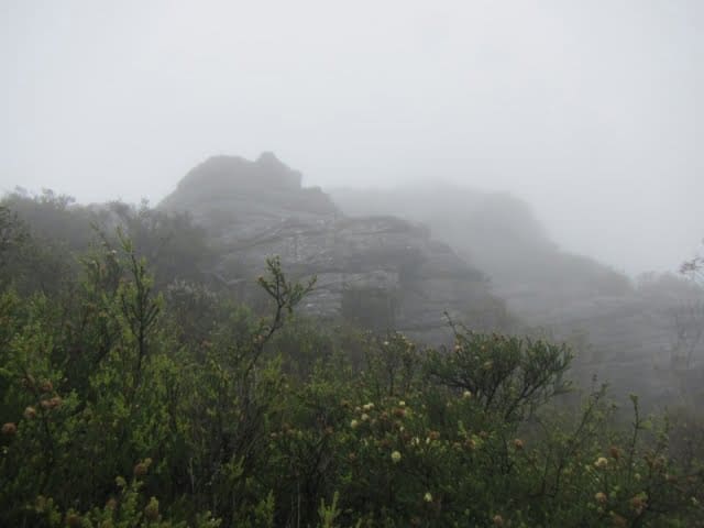
Consider travelling with a personal location beacon (PLB). In the event you need to be rescued it could save your life. Be prepared for changing weather conditions: Mountain weather can be unpredictable. Pack layers of clothing, including a warm jumper or jacket, as mists, wind chill, and rain are common.
Hike Overview
Bluff Knoll, the crown jewel of Stirling Range National Park in Western Australia, beckons with breathtaking 360-degree vistas from its summit. But the beauty doesn't stop there. Accessible lookouts near the parking area offer spectacular panoramas, while a covered picnic shelter with wheelchair-accessible toilets provides a comfortable spot to soak in the scenery.
For the adventurous, the Bluff Knoll summit trail begins on the south side. The initial, well-maintained section eases you in before ramping up as you turn towards the mountain. Brace yourself for a climb! The path follows a creek up the slope before traversing the mountainside with a gentler ascent to a saddle. Here, pause and be rewarded with stunning views stretching all the way to the south coast. The final leg along the ridge takes you to the triumphant summit.
As you ascend, admire the diverse flora, with wildflowers blooming vibrantly in spring and autumn. Keep an eye out for exposed rock outcrops – these are remnants of ancient history, revealing layers of fine sediment deposited on the seabed of a shallow sea millions of years ago.
Be prepared for unpredictable mountain weather. Pack layers for changing temperatures, as mists, wind chill, and rain are common.
Best time to climb Bluff Knoll: While the hike is doable year-round, spring (September-November) and autumn (April-May) offer the most favorable conditions. These seasons present moderate temperatures, less chance of extreme weather events, and beautiful wildflowers in spring. Avoid the peak of summer (December-February) due to scorching temperatures, and winter (June-August) can be unpredictable with rain and wind.
Track Grade
Grade 4 (Hard) - Challenging Walks for Experienced Walkers: Grade 4 on the AWTGS signifies challenging walking tracks. Bushwalking experience is recommended for these tracks, which may be long, rough, and very steep. Directional signage may be limited, requiring a good sense of navigation. These walks are suited for experienced walkers who are comfortable with steeper inclines, rougher terrain, and potentially longer distances.
Tips
- Standard park entry fees apply for Stirling Range National Park.
- The Stirling Range experiences unpredictable weather. Hikers should be aware of the possibility of sudden temperature drops, rain, or hail.
- Hikers planning to venture off marked trails, abseil, or rock climb should register at the shelter across from the Bluff Knoll Road entry station picnic area. This helps park rangers be aware of your location in case of emergencies.
- If you plan to hike the designated Bluff Knoll trail, registration is not necessary.
Map and GPX file
Max elevation: 1070 m
Min elevation: 447 m
Total climbing: 803 m
Total descent: -802 m
Trail Location (trailhead)
Sorry, no records were found. Please adjust your search criteria and try again.
Sorry, unable to load the Maps API.
Getting there
Bluff Knoll is situated within Stirling Range National Park, approximately 400 kilometers south of Perth. If you're traveling from the south coast, it's about 100 kilometers northeast of Albany.
Reaching the Bluff Knoll Trailhead:
- Drive south from Perth on Albany Highway (State Route 30).
- Turn off onto Frankland-Cranbrook Road and continue onto Chester Pass Road.
- Look for Bluff Knoll Road at the park entrance station and follow it to the car park.
Photo gallery
If you have any photos from this hike and are happy to share them, please upload your .jpg files here.
Please note: Uploading photos does not transfer ownership of copyright away from you. If requested, you will be credited for any photos you provide and can ask they be deleted at any time.
About the region
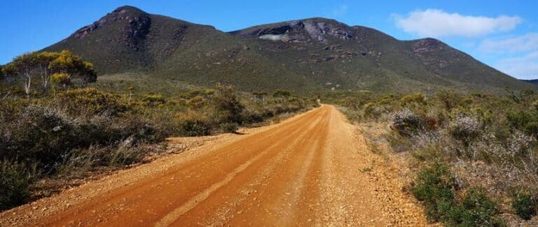
I acknowledge the Goreng and Menang people as the traditional owners of Stirling Range National Park, whose name for the range, Koi Kyenunu-ruff (meaning 'mist rolling around the mountains'), perfectly captures the park's character. This mountain range, the only major one in southern WA, rises above 1000 meters and offers challenging yet spectacular hikes.
Spring and early summer bring vibrant wildflowers and birdlife to the ranges, visible from the trails, lookouts, and picnic areas. For those who prefer exploring by car, a scenic 42km drive on mostly unsealed, graded roads winds through the heart of the park, offering opportunities to stop and take in the scenery.
Camp nearby at the Stirling Range Retreat or Mount Trio Bush Camping and Caravan Park on the northern boundary of the park.
Similar trails nearby
Explore Safe
While planning your hike, it’s important to check official government sources for updated information, temporary closures and trail access requirements. Before hitting the trail, check local weather and bushfire advice for planned burns and bushfire warnings and let someone know before you go. Plan ahead and hike safely.
Let someone know
Adventure with peace of mind: Fill out your trip intentions form. Before you hit the trail, fill out an online form to privately send important details about your hike to your family or friends. If you don’t return on time, they can easily alert emergency services, preventing worry and ensuring a swift response. Hike with peace of mind and enjoy your outdoor adventure to the fullest. Be smart, be safe: Register your plans here.
Gear to consider
What you carry in your pack will depend on the weather, terrain, time of year, type of adventure, and personal preferences. Having trouble deciding what gear’s right for you? My free planning, food and packing checklists provide an introduction to things your could consider (as well as the Ten Essentials) on your day, overnight and multi-day adventures. Customise your kit according to your personal needs, always considering safety first.
Suggest an edit
Trail changed? New features discovered? Has the route changed? Trail permanently closed? Help fellow hikers by suggesting edits! Click above to update route descriptions, GPX file, trail features (like boardwalks), or access conditions (like parking availability). Help me keep the trails info fresh!
Weather
Acknowledgement of Country
Trail Hiking Australia acknowledges the Traditional Owners of the lands on which we hike and pay respects to their Elders, past and present, and we acknowledge the First Nations people of other communities who may be here today.


