Hike at a Glance
Max elevation: 1708m
Min elevation: 553m
Total Ascent: 3191m
Hike overview
The Blowfly Spur and the Blue Rag Range circuit is a challenging three day hike along and then off the side of the Barry Mountains. It includes a full day river walk followed by a 1000m ascent out of the river and over the Blue Rag Range. In steep and scenic alpine country with lofty tops, high level ridge lines and a very deep valley in between. This is a seldom visited section of the Wongungarra River affectionately called "The Black Hole". One half day is off track in very steep terrain, another full day is spent walking down the river. You will need to be fit, experienced, well equipped and prepared for alpine conditions.
Day 1. Follow the AAWT over The Twins and Mount Murray before turning off onto The Blowfly Spur. The track (at around 15km from the start) ends and descends where few have gone before. Straight south down the ridge to the Wongungarra River. Fire regrowth may have impacted on the ease of the spur descent so be prepared for hours of bush bashing. The last 500m of the ridge drops 400m to the river below. This is a challenging descent. The campsite will have to be found along the riverbank. This is the biggest day so an early start is required.
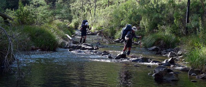
Day 2. The day is straightforward. Follow the gentle Wongungarra River downstream as it drops approximately 120m over this 11km section of the river. Easier camping on shelves by the riverbank near the exit track and a swim if your not sick of being in and out of water all day.
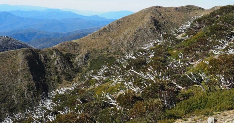
Day 3. Straight up north east out of the river on a very steep (1000m) ascent over 9kms along a 4wd track. Walk along its length to the Blue Rag Range high point of 1716m. Follow the ridge track which is above the treeline east to Dargo High Plains and the road Junction to finish.
Water Procurement
Water is available in the Wongungarra River. Be sure to collect as you exit the river at the beginning of day 3.
Warning
This hike is for experienced hikers only who are proficient in off trail, alpine navigation.
Tips
Over a third of the hike will off track through potentially dense scrub. There will be rock scrambling with packs, possible pack hauling, steep and very steep sections and walking through cliff lines. One full day day will be spent walking down the river.
Gallery
Got some great shots from this hike? Upload your photos here to inspire others and show off the beauty of the trail!
Uploading your photos doesn’t mean you lose ownership. You can be credited for your contributions, and you can request removal at any time.
Content use
Please don’t copy GPX files or content from this site to AllTrails or other platforms. Each trail has been personally mapped, documented, and refined to support Australia’s bushwalking and hiking community. While some details come from land managers, every listing reflects significant personal effort. This is a free, community-driven initiative—your respect helps keep it that way.
Walk map and GPX file
Max elevation: 1708 m
Min elevation: 553 m
Total climbing: 3191 m
Total descent: -3059 m
Getting there
Getting to the trailhead: Alpine National Park.
From Melbourne, take Hume Fwy/National Highway M31 to Snow Rd/C522 in Wangaratta South. Take the exit for C522 from Hume Fwy/National Highway M31. Follow C522 and Great Alpine Rd/B500 to Twins Rd in Hotham Heights. The start location is near Mount St Bernard at the Great Alpine Road intersection with The Dargo High Plains Road.
You will then need to drive a vehicle or vehicles south to the end point at the Dargo High Plains Road intersection with The Blue Rag Range Track.
Closest towns to this walk: Benalla, Bright, Dinner Plain, Falls Creek, Harrietville, Hotham Heights, Mansfield, Mitta Mitta, Mount Beauty, Mount Hotham, Myrtleford, Omeo, Porepunkah, Tawonga South, Wangaratta
About the region
The Alpine National Park is a national park in the Central Highlands and Alpine regions of Victoria, Australia. The 646,000-hectare national park is located northeast of Melbourne. It is the largest National Park in Victoria, and covers much of the higher areas of the Great Dividing Range in Victoria, including Victoria's highest point, Mount Bogong at 1,986 metres and the associated subalpine woodland and grassland of the Bogong High Plains. The park's north-eastern boundary is along the border with New South Wales, where it abuts the Kosciuszko National Park.
Similar walks nearby
Looking for more walks in or near Alpine National Park? Try these trails with a similar difficulty grade.
Track grade
Grade 5 (Difficult) - Walks for the Most Experienced: Grade 5 represents the most challenging walking tracks on the AWTGS. These are only recommended for very experienced and fit walkers with specialised skills, including navigation and emergency first aid. Tracks are likely to be very rough, very steep, and unmarked. Walks may be more than 20 kilometers. These challenging walks demand a high level of fitness and experience to navigate difficult terrain, significant elevation changes, and potentially unformed paths.
Explore safe
Plan ahead and hike safely! Carry enough water, pack layers for changing conditions, and bring safety gear like a torch, PLB, and reliable communication device. Check official sources for trail updates, closures, and access requirements, and review local weather and bushfire advice. Most importantly, share your plans with someone before you go. Being prepared makes for a safer and more enjoyable hike! Stay Safe, Explore More, and Always #ExploreSafe.
Packing checklists
What you carry in your pack depends on factors like weather, terrain, and your adventure type. Not sure what to bring? My free planning, food, and packing checklists are a great starting point, covering day hikes, overnight trips, and multi-day adventures. Use them to customise your kit and always prioritise safety.
Let someone know
Before heading out, take a moment to fill out your trip intentions form. It’s a quick way to share your hike details with family or friends. If something goes wrong, they can notify emergency services, ensuring a faster response and peace of mind. Stay safe and enjoy your adventure
Suggest an edit
Spotted a change on this trail? Maybe there are new features, the route has shifted, or the trail is permanently closed. Whatever the update, I’d love your input. Your feedback helps fellow hikers stay informed and ensures that our trail info stays fresh and reliable.
Acknowledgement of Country
Trail Hiking Australia acknowledges the Traditional Owners of the lands on which we hike and pay respects to their Elders, past and present, and we acknowledge the First Nations people of other communities who may be here today.


9 Reviews on “Blowfly Spur & the Blue Rag Range Hike (46.5km)”
Me too!!!!
Looks amazing!
This is not an easy hike. Days of slow going through dense scrub so be prepared for heaps of scratches, cuts and bruises and ensure you are equipped with a PLB
Samuel Jc