Hike at a Glance
Max elevation: 154m
Min elevation: 5m
Total Ascent: 426m
Hike overview
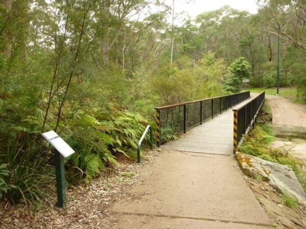
This hike commences at Short Street, Thornleigh and initially follows the Lane Cove Valley Walk which forms part of the Great North Walk. The trail twists and turns as it follows Lane Cover River south through to Buffalo Creek Reserve.
The Great North Walk is a mammoth multi-day hike and at 250km, it's not for the faint-hearted. Created in 1988 to celebrate Australia's bicentenary, the walk links Sydney with the Hunter Valley and Newcastle. It is a one-stop-shop for some of the best scenery New South Wales has to offer.
It takes about 16 days to walk the entire Great North walk and this section of the track passes through Lane Cove National Park from East Ryde to Thornleigh. You can extend your walk by starting from the Obelisk in Macquarie Place near Sydney Cove or continue on north by joining Great North walk - Berowra Valley National Park.
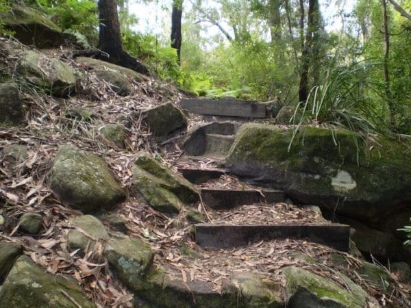
There are lots of scenic spots to stop for a picnic or break along the way and you'll be blown away by the sheer beauty of the landscape. Around each corner you'll see dramatic drops into the river valley below, rugged sandstone, dense mangrove swamps and plateaus with magnificent lookouts. You'll most likely catch a glimpse or two of some of our native wildlife. Walk quietly to increase your chances.
Tips
This section of the Great North Walk is well signposted. You can camp overnight or stay in a cabin at Lane Cove River Tourist Park. Camping is also available at Crosslands Reserve. Remember to take your binoculars if you want to birdwatch.
Track grade
Grade 3 (Moderate) - Walks for Most Fitness Levels: Grade 3 on the AWTGS represents moderate walking tracks. These are ideal for walkers with some fitness who are comfortable with some hills and uneven terrain. While suitable for most ages, some bushwalking experience is recommended to ensure a safe and enjoyable experience. Tracks may have short, steep hill sections, a rough surface, and many steps. The total distance of a Grade 3 walk can be up to 20 kilometers.
Walk map and GPX file
Max elevation: 154 m
Min elevation: 5 m
Total climbing: 426 m
Total descent: -560 m
Content use
Please don’t copy GPX files or content from this site to AllTrails or other platforms. Each trail has been personally mapped, documented, and refined to support Australia’s bushwalking and hiking community. While some details come from land managers, every listing reflects significant personal effort. This is a free, community-driven initiative—your respect helps keep it that way.
Gallery
Got any photos from this hike? Your photos can help others plan. Share shots from along the trail so fellow hikers know what to expect.
Click to add your photos >>
Getting there
Getting to the trailhead: Lane Cove National Park.
If beginning from Thornleigh: From Pennant Hills Road, turn into The Comenarra Parkway. Turn into Wood Street, first on the right. Turn left into Short Street and follow to the end.
From Epping Road, turn into Pittwater Road. Continue for approximately 2km. Sugarloaf carpark is located on the left shortly after the Rene Street roundabout.
Parking is available on Pittwater Road, East Ryde and Short Street, Thornleigh. It can be a busy place on the weekend, so parking might be limited.
Need a rental car to get you to the hike? Find one here.
About the region
Lane Cove National Park is not far from Sydney's city centre, is the perfect place for a family day out or school excursion. Explore historic sites along the Heritage walk or enjoy a picnic, canoe or go birdwatching.
Lane Cove National Park is a beautiful pocket of bushland that sits on either side of the peaceful Lane Cove River. It's in easy reach for Sydneysiders, extending from East Ryde to Pennant Hills and West Chatswood.
It's a great place for a day out with the family; there are lots of picnic areas to choose from, including those that offer picnic tables, barbecues, children's play equipment, flat grassy areas and easy access to walking tracks and places to ride your bike. Whatever activities you fancy, you're bound to find a perfect place to picnic for the day.
Find a place to stay
Wondering where to stay near this hike? Find accommodation close to the trailhead — hotels, cabins and campgrounds nearby. Click the button to view the interactive map.
Closest towns to this walk: Artarmon, Chatswood, East Lindfield, East Ryde, Epping, Gladesville, Gordon, Greenwich, Hunters Hill, Lane Cove, Lane Cove West, Lindfield, Longueville, Macquarie Park, Mount Colah, North Ryde, Pennant Hills, Riverview, Roseville, Thornleigh
Let someone know
Heading out? Fill in a trip intentions form so someone knows your plans. If things go wrong, they can raise the alarm fast, giving you peace of mind on the trail.
Similar walks nearby
Looking for more walks in or near Lane Cove National Park? Try these trails with a similar difficulty grade.
Suggest an edit
Notice something different about this trail? Whether it’s a new feature, a route change, or a closure, share your update so we can keep our info accurate and helpful for fellow hikers.
Click to suggest edits >>
Explore safe
Plan ahead and hike safely! Carry enough water, pack layers for changing conditions, and bring safety gear like a torch, PLB, and reliable communication device. Check official sources for trail updates, closures, and access requirements, and review local weather and bushfire advice. Most importantly, share your plans with someone before you go. Being prepared makes for a safer and more enjoyable hike! Stay Safe, Explore More, and Always #ExploreSafe.
Packing checklists
What you carry in your pack depends on factors like weather, terrain, and your adventure type. Not sure what to bring? My free planning, food, and packing checklists are a great starting point, covering day hikes, overnight trips, and multi-day adventures. Use them to customise your kit and always prioritise safety.
Acknowledgement of Country
Trail Hiking Australia acknowledges the Traditional Owners of the lands on which we hike and pay respects to their Elders, past and present, and we acknowledge the First Nations people of other communities who may be here today.


