Hike at a Glance
Max elevation: 0m
Min elevation: 0m
Total Ascent: 0m
Hike overview
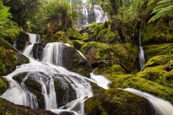
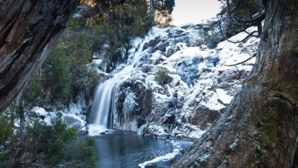
Nestled near the southern plateau of Ben Lomond National Park, Coal Falls cascades over a unique geological feature. Evidence of the region's mining history can be spotted near the falls, with remnants of a tunnel visible from the viewing point.
Accessing Coal Falls requires a challenging uphill hike. The journey typically begins on the Stacks Bluff track along Storys Creek. This route offers stunning panoramic views of the Fingal Valley, with a glimpse of Tranquil Tarn before reaching the plateau. For experienced hikers with a good pace uphill, adding a summit attempt on Stacks Bluff is a rewarding option.
The initial hour of the hike ascends steadily through the forest. Once above the tree line, expect to navigate large boulders that require some scrambling. While demanding, the track is well-marked all the way to the plateau.
Upon reaching the plateau, the terrain becomes easier and flatter. However, there's no defined trail beyond this point. Hikers need to head east for approximately 2 kilometers until reaching Storys Creek. Following the creek bed downhill, you'll encounter a smaller waterfall cascading into a rocky amphitheater.
Continuing downstream for another 200 meters with a 100-meter elevation drop leads you to Coal Falls. A short distance further downstream, another waterfall tumbles over darkened coal deposits into a shallow pool.
Hikers can either retrace their steps by climbing back to the plateau or continue downstream for 1.5-2 kilometers before exiting the creek bed. The final leg involves navigating through dry forest back to the carpark. While there's no official trail, pink ribbons may be present to guide your way back safely.
Important Note: This description is intended for experienced hikers comfortable with challenging terrain and route finding. Be sure to research current conditions and come prepared with appropriate gear and navigation skills.
Track grade
Grade 5 (Difficult) - Walks for the Most Experienced: Grade 5 represents the most challenging walking tracks on the AWTGS. These are only recommended for very experienced and fit walkers with specialised skills, including navigation and emergency first aid. Tracks are likely to be very rough, very steep, and unmarked. Walks may be more than 20 kilometers. These challenging walks demand a high level of fitness and experience to navigate difficult terrain, significant elevation changes, and potentially unformed paths.
Walk map and GPX file
Do you have a GPX file for this hike? Feel free to email it to me so I can add it to this hikes info.
Click to add your file >>
Content use
Please don’t copy GPX files or content from this site to AllTrails or other platforms. Each trail has been personally mapped, documented, and refined to support Australia’s bushwalking and hiking community. While some details come from land managers, every listing reflects significant personal effort. This is a free, community-driven initiative—your respect helps keep it that way.
Gallery
Got any photos from this hike? Your photos can help others plan. Share shots from along the trail so fellow hikers know what to expect.
Click to add your photos >>
Getting there
Getting to the trailhead: Ben Lomond National Park.
If you’re coming from Launceston, it’s a straightforward hour-long drive southeast. Take the C401 through White Hills and then turn right at Blessington onto Ben Lomond Road (C413).
The journey from Hobart takes a bit longer, roughly 3 hours north via the Midlands Highway (A1). Turn off to Evandale (B41) and take the partly sealed C413 towards Blessington. Here, navigate left onto C420 (Deddington Rd) and then right onto C401 (Blessington Rd). Continue towards Upper Blessington before making a final right turn onto Ben Lomond Road (C432).
Keep in mind that the park boundary is 8 kilometers from the turn-off onto Ben Lomond Road. The road itself is unsealed for the remaining 18 kilometers to the alpine village. The final climb up Jacobs Ladder to the plateau is particularly steep and winding. Be sure to observe the 30 kilometer speed limit and always yield to downhill traffic.
Driving conditions can be unpredictable, especially in winter. Between June and September, all vehicles must carry properly fitted snow chains. Antifreeze is also recommended. There are no snow chains available for rent at the mountain, so plan accordingly if you’re visiting during this time period.
During the ski season, a shuttle bus operates from the Ben Lomond lower carpark, offering an alternative to driving up the mountain.
Be aware of winter road closures: The road to Ben Lomond National Park may be closed without notice due to snow and ice. There’s a closure point with a barrier 4.5 kilometers from the alpine village.
Need a rental car to get you to the hike? Find one here.
About the region
Although a park for all seasons, winter is Ben Lomond's time to shine. Boasting one of Tasmania's two ski fields, snow sports enthusiasts can enjoy skiing, snowboarding, cross-country skiing and tobogganing. Those who prefer to take it easy can sip on a hot chocolate, while immersed in the 'ski village' atmosphere of this authentic Tasmanian winter wonderland.
When the snow melts, a spectacular alpine landscape is revealed and you'll be in awe of the beauty of the rocks set against stunning views. There are plenty of walks and rock climbing opportunities, and with wildlife in abundance it is not uncommon to see several different species in a day. Ben Lomond National Park is Tasmania's off-the-beaten-track gem sure to surprise and delight.
Find a place to stay
Wondering where to stay near this hike? Find accommodation close to the trailhead — hotels, cabins and campgrounds nearby. Click the button to view the interactive map.
Closest towns to this walk: Campbell Town, Fingal, Launceston, Longford, Scottsdale
Let someone know
Heading out? Fill in a trip intentions form so someone knows your plans. If things go wrong, they can raise the alarm fast, giving you peace of mind on the trail.
Similar walks nearby
Looking for more walks in or near Ben Lomond National Park? Try these trails with a similar difficulty grade.
Suggest an edit
Notice something different about this trail? Whether it’s a new feature, a route change, or a closure, share your update so we can keep our info accurate and helpful for fellow hikers.
Click to suggest edits >>
Explore safe
Plan ahead and hike safely! Carry enough water, pack layers for changing conditions, and bring safety gear like a torch, PLB, and reliable communication device. Check official sources for trail updates, closures, and access requirements, and review local weather and bushfire advice. Most importantly, share your plans with someone before you go. Being prepared makes for a safer and more enjoyable hike! Stay Safe, Explore More, and Always #ExploreSafe.
Packing checklists
What you carry in your pack depends on factors like weather, terrain, and your adventure type. Not sure what to bring? My free planning, food, and packing checklists are a great starting point, covering day hikes, overnight trips, and multi-day adventures. Use them to customise your kit and always prioritise safety.
Acknowledgement of Country
Trail Hiking Australia acknowledges the Traditional Owners of the lands on which we hike and pay respects to their Elders, past and present, and we acknowledge the First Nations people of other communities who may be here today.


5 Reviews on “Coal Falls Hike (10.2km)”
❤️❤️❤️❤️❤️❤️❤️