Hike at a Glance
Max elevation: 0m
Min elevation: 0m
Total Ascent: 0m
Hike overview
A short easy walk takes you to a viewing platform where you can watch the spectacular Tuross River tumble over boulders into a beautiful pool that makes for a gorgeous spot where you can swim, splash and cool down on a hot summer's day.
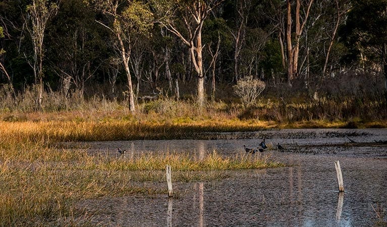
The pool is surrounded by a diverse range of plant life, from dwarf she-oaks and stunted mallee formed eucalypts on the dry ridge tops, to majestic white trunked ribbon gums on the river banks. Greater gliders can be spotlighted at night. You may also be lucky enough to see some of the larger owls such as the powerful owl and sooty owl, which depend on gliders for prey. There is also an abundance of other birds in the area.
This tranquil swimming hole has good gravel road access, as well as picnic facilities, making it a perfect spot for a day trip getaway.
Tips
Remember to take your binoculars if you want to birdwatch
A current NSW recreational fishing licence is required when fishing in all waters
There is no mobile reception at the Cascades precinct and very limited mobile reception in this park.
If you are bushwalking in this park it is a good idea to bring a topographic map, compass and a GPS.
Check the weather before you set out as the road to Cascades can become boggy when it rains.
For more information, please contact the Bombala office on (02) 6458 4080 between 9am and 12.30pm Monday to Friday.
Visit NSW National Parks and Wildlife Service for more information on this trail.
The longitude and latitude of the start and end points are approximately only and should not be used for navigation purposes. Please contact me if you know the correct coordinates.
Gallery
Got some great shots from this hike? Upload your photos here to inspire others and show off the beauty of the trail!
Click to view form >>
Submitting your photos doesn’t mean you lose ownership. You can be credited for your contributions, and you can request removal at any time.
Content use
Please don’t copy GPX files or content from this site to AllTrails or other platforms. Each trail has been personally mapped, documented, and refined to support Australia’s bushwalking and hiking community. While some details come from land managers, every listing reflects significant personal effort. This is a free, community-driven initiative—your respect helps keep it that way.
Walk map and GPX file
It looks like I don’t have a GPX file for this trail yet. If you have one to share, please email it to me! I’ll verify it against official maps before adding it to help other hikers have a safer, easier experience. Thanks for contributing to a better hiking resource.
Getting there
Getting to the trailhead: Wadbilliga National Park.
To Tuross Falls carpark. Cascades walking track is in the Cascades precinct of the Wadbilliga National Park. To get there From Canberra:Head south towards Cooma on the Monaro Highway. Exit just north of Cooma, turning left onto Polo Flat Road and then left again after crossing the train line onto Numeralla Road.Follow this for about 40 minutes, then turn right onto Badja Forest Road, which turns onto a dirt road immediately after the turn-off.From here, follow the signs to Cascades by turning right onto Peters Road and then right onto Tuross Falls Road. Follow the Tuross Falls Road to the end, where you will find a parking area. Park entry points Tuross Falls carpark See on map Parking Parking is available on Main Road, a short walk from the walking track.
Closest towns to this walk: Bemboka, Bermagui, Brogo, Candelo, Cobargo, Mumbulla Mountain, Nimmitabel
Similar walks nearby
Looking for more walks in or near Wadbilliga National Park? Try these trails with a similar difficulty grade.
Track grade
Grade 3 (Moderate) - Walks for Most Fitness Levels: Grade 3 on the AWTGS represents moderate walking tracks. These are ideal for walkers with some fitness who are comfortable with some hills and uneven terrain. While suitable for most ages, some bushwalking experience is recommended to ensure a safe and enjoyable experience. Tracks may have short, steep hill sections, a rough surface, and many steps. The total distance of a Grade 3 walk can be up to 20 kilometers.
Explore safe
Plan ahead and hike safely! Carry enough water, pack layers for changing conditions, and bring safety gear like a torch, PLB, and reliable communication device. Check official sources for trail updates, closures, and access requirements, and review local weather and bushfire advice. Most importantly, share your plans with someone before you go. Being prepared makes for a safer and more enjoyable hike! Stay Safe, Explore More, and Always #ExploreSafe.
Packing checklists
What you carry in your pack depends on factors like weather, terrain, and your adventure type. Not sure what to bring? My free planning, food, and packing checklists are a great starting point, covering day hikes, overnight trips, and multi-day adventures. Use them to customise your kit and always prioritise safety.
Let someone know
Before heading out, take a moment to fill out your trip intentions form. It’s a quick way to share your hike details with family or friends. If something goes wrong, they can notify emergency services, ensuring a faster response and peace of mind. Stay safe and enjoy your adventure
Suggest an edit
Spotted a change on this trail? Maybe there are new features, the route has shifted, or the trail is permanently closed. Whatever the update, I’d love your input. Your feedback helps fellow hikers stay informed and ensures that our trail info stays fresh and reliable.
Acknowledgement of Country
Trail Hiking Australia acknowledges the Traditional Owners of the lands on which we hike and pay respects to their Elders, past and present, and we acknowledge the First Nations people of other communities who may be here today.


