Hike at a Glance
Max elevation: 428m
Min elevation: 0m
Total Ascent: 1038m
Hike overview
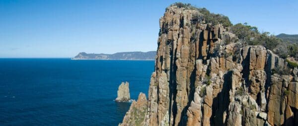
The Cape Raoul Walk is a 14 kilometre return hike in Tasmania’s Tasman National Park, rated grade 4 and typically completed in around five hours. It’s a trail that rewards every step with some of the most dramatic coastal scenery in the state, where towering cliffs, dolerite columns, rock platforms and offshore islands rise above a restless sea. The landscape here feels untamed and powerful, yet deeply peaceful at the same time. It’s the kind of place where you’ll want to stop often, unpack your lunch, and take in the sweep of the coastline as waves crash far below.
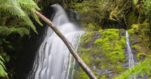
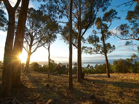
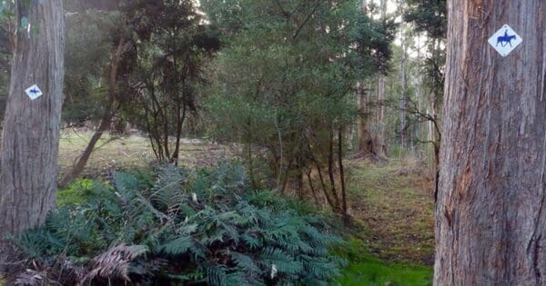
The walk begins gently, winding through open forest before the climb leads to the first lookout over the cliffs. This sudden reveal can take even seasoned walkers by surprise. From this point onward, the track alternates between heathland and light woodland, with the coastline never far from view. Each section offers a different perspective on the rugged dolerite formations that define this part of the Tasman Peninsula.
As you approach the cape, the landscape opens out again to reveal an immense headland plunging steeply into the Southern Ocean. The sense of scale is extraordinary, as if the land itself were carved from vertical stone. On calm days, the water below glitters in the sunlight; on wilder days, you’ll see the waves exploding against the cliffs in a display of raw energy. Keep an eye out for seals basking on the rocks and small islands below, a reminder of the thriving wildlife that calls this coastline home.
Cape Raoul is more than a destination; it’s a complete sensory experience. The shifting colours of the sea, the call of seabirds carried on the wind, and the scent of coastal heath all come together to create a place that lingers in memory long after the walk is done.
Tips
- A valid Parks Pass is required to enter Tasmania’s national parks. Passes can be purchased online or at park visitor centres before you begin your walk.
- This trail is best suited to those with some bushwalking experience, as it includes long, steep, and occasionally rough sections. Directional signs are limited, so ensure you carry a map or GPS.
- Toilet facilities and a boot wash station are available at the trailhead. The boot wash helps protect local ecosystems by reducing the spread of plant diseases, so please use it before setting off.
- There are no other facilities along the track. Carry out all waste, including human waste. If this is not possible, carry a small trowel and be prepared to bury all faecal waste and toilet paper or tissues in a hole 15–20 cm deep, at least 100 metres from water sources and the track. Remember to cover and disguise the hole afterwards.
- Except in designated areas at the Fortescue Bay campground, Tasman National Park is a Fuel Stove Only area. Campfires are not permitted anywhere else in the park.
- Supervise children closely, as there are hazardous cliffs and unprotected track edges along parts of the walk.
- Pets, firearms, and bicycles are not permitted in the national park.
Track grade
Grade 4 (Hard) - Challenging Walks for Experienced Walkers: Grade 4 on the AWTGS signifies challenging walking tracks. Bushwalking experience is recommended for these tracks, which may be long, rough, and very steep. Directional signage may be limited, requiring a good sense of navigation. These walks are suited for experienced walkers who are comfortable with steeper inclines, rougher terrain, and potentially longer distances.
Walk map and GPX file
Max elevation: 442 m
Min elevation: 0 m
Total climbing: 1382 m
Total descent: -1382 m
Content use
Please don’t copy GPX files or content from this site to AllTrails or other platforms. Each trail has been personally mapped, documented, and refined to support Australia’s bushwalking and hiking community. While some details come from land managers, every listing reflects significant personal effort. This is a free, community-driven initiative—your respect helps keep it that way.
Getting there
Getting to the trailhead: Tasman National Park.
From Port Arthur, take the B37 and drive about eight kilometres west until you reach the turnoff to Highcroft and Stormlea at Parsons Bay Creek. Turn left here and follow Stormlea Road for roughly nine kilometres along a well-maintained dirt road to the Cape Raoul carpark. If you’re travelling from Nubeena, take the same road by turning right about three kilometres south of town. Wherever possible, avoid driving through reserves at night, as native wildlife is often active on the roads. Take your time, drive carefully, and keep an eye out for animals along the way.
Need a rental car to get you to the hike? Find one here.
Find a place to stay
Wondering where to stay near this hike? Find accommodation close to the trailhead — hotels, cabins and campgrounds nearby. Click the button to view the interactive map.
Closest towns to this walk: Dunalley, Eaglehawk Neck, Nubeena, Port Arthur, Sorell, Taranna
Let someone know
Heading out? Fill in a trip intentions form so someone knows your plans. If things go wrong, they can raise the alarm fast, giving you peace of mind on the trail.
About the region
Tasman National Park offers a rare combination of wild beauty and easy accessibility, where tall eucalypt forests meet a coastline shaped by wind and waves. Along the edge of the Tasman Peninsula, the Southern Ocean collides with some of Australia’s highest sea cliffs, carving out dramatic rock formations, deep sea caves and natural arches. Coastal heath and low shrubs cling to the cliff tops, their greens and silvers forming a striking contrast to the dark, surging waters below. It’s a landscape that feels powerful and alive, yet inviting for those wanting to experience Tasmania’s rugged coast on foot.
Walkers on the acclaimed Three Capes Track are rewarded with sweeping coastal views and a sense of scale that is both humbling and exhilarating. For those who prefer shorter walks, Cape Hauy, Cape Raoul and the world-renowned Shipstern Bluff each offer a chance to experience this same grandeur from different vantage points. Whether you’re standing high above the ocean, feeling the wind whip across the cliffs, or watching the swell roll in below, every turn reveals another moment of raw coastal beauty.
Located in Tasmania’s south-east, the park lies about a 90-minute drive from Hobart. The journey follows sealed roads via Sorell on the A3, before continuing along the A9 (Arthur Highway) towards Port Arthur. The park spans both the Tasman and Forestier peninsulas, though most of its well-known walks and natural features are found on the Tasman Peninsula itself.
To reach Fortescue Bay from Eaglehawk Neck, stay on the A9 towards Port Arthur until you reach the C344 junction. Follow this road for around 12 kilometres to the bay. Although unsealed, the road is usually in good condition and suitable for two-wheel-drive vehicles and mountain bikes. Be mindful of tour buses, delivery trucks and vehicles towing trailers, and keep to the left on tight corners.
Access to the park’s south-western section is also via the Arthur Highway. From Port Arthur township, follow Safety Cove Road to reach Remarkable Cave and the walking tracks leading to Maingon Blowhole, Mount Brown and Crescent Bay. If you’re heading towards Nubeena, look for the turnoff to Highcroft Road, which becomes Stormlea Road. This route provides access to the Cape Raoul Great Short Walk as well as Shipstern Bluff and Tunnel Bay. Each area offers its own character, from rugged cliffs and powerful surf to quiet coves and sweeping coastal heathlands, making Tasman National Park a place you’ll want to explore again and again.
Similar walks nearby
Looking for more walks in or near Tasman National Park? Try these trails with a similar difficulty grade.
Explore safe
Plan ahead and hike safely! Carry enough water, pack layers for changing conditions, and bring safety gear like a torch, PLB, and reliable communication device. Check official sources for trail updates, closures, and access requirements, and review local weather and bushfire advice. Most importantly, share your plans with someone before you go. Being prepared makes for a safer and more enjoyable hike! Stay Safe, Explore More, and Always #ExploreSafe.
Packing checklists
What you carry in your pack depends on factors like weather, terrain, and your adventure type. Not sure what to bring? My free planning, food, and packing checklists are a great starting point, covering day hikes, overnight trips, and multi-day adventures. Use them to customise your kit and always prioritise safety.
Suggest an edit
Notice something different about this trail? Whether it’s a new feature, a route change, or a closure, share your update so we can keep our info accurate and helpful for fellow hikers.
Click to suggest edits >>
Acknowledgement of Country
Trail Hiking Australia acknowledges the Traditional Owners of the lands on which we hike and pay respects to their Elders, past and present, and we acknowledge the First Nations people of other communities who may be here today.
/Cape%20Raoul%20Cliffs%20Tasmania.jpg)
/Cape%20Raoul%20Walk%202.jpg)
/Cape%20Raoul%20Coastline.jpg)
/Cape%20Raoul%20Coastline%20Cliffs.jpg)
/Cape%20Raoul%20Walk%201.jpg)
/Cape%20Raoul%20Cliffs.jpg)


