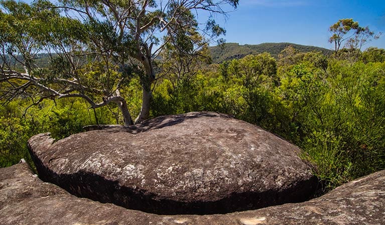
There's no better way to experience the beauty of Marramarra than by spending the day exploring Canoelands Ridge walking track on foot.
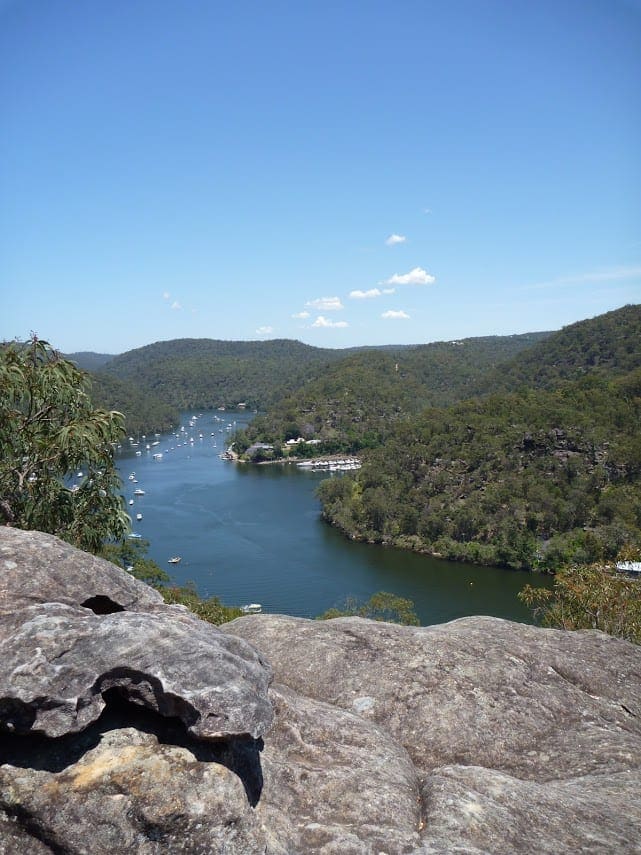
The 10km walk to Gentlemans Halt takes you through constantly changing vegetation and right in to the heart of this secluded pocket of bushland in the northern outskirts of Sydney. See spectacular ridge-top colours of iconic Hawkesbury sandstone and remarkable views of Hawkesbury River. Watch the occasional boat carving through the glistening blue waters of this beautiful waterway.
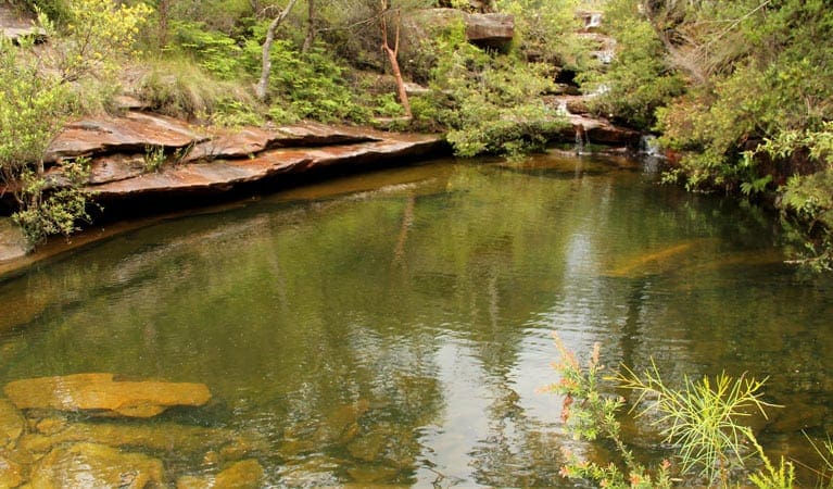
In spring, the bush turns into a vibrant display of colour with the native wildflowers. Wander through gullies of bright red waratahs and Gymea lilies, and explore the saltmarsh and mangroves by the river's edge near Gentlemans Halt. Head off for a long day walking in the bush, or pack your tent and sleeping bag for a peaceful night camping by the river at historic Gentlemans Halt campground.
Got some great shots from this hike? Upload your photos here to inspire others and show off the beauty of the trail!
Submitting your photos doesn’t mean you lose ownership. You can be credited for your contributions, and you can request removal at any time.
Please don’t copy GPX files or content from this site to AllTrails or other platforms. Each trail has been personally mapped, documented, and refined to support Australia’s bushwalking and hiking community. While some details come from land managers, every listing reflects significant personal effort. This is a free, community-driven initiative—your respect helps keep it that way.
It looks like I don’t have a GPX file for this trail yet. If you have one to share, please email it to me! I’ll verify it against official maps before adding it to help other hikers have a safer, easier experience. Thanks for contributing to a better hiking resource.
Getting there
Getting to the trailhead: Marramarra National Park.
To Canoelands Ridge walking track carpark. Canoelands Ridge walking track is in the northern precinct of Marramarra National Park. To get there:Follow the directions to the park via Canoelands RoadContinue driving along Canoelands Road until you see the parking area on your left where the walk starts Park entry points Canoelands Ridge walking track carpark See on map Parking Parking is available at the start of Canoelands Ridge walking track.
Visit NSW National Parks and Wildlife Service for more information on this trail.
The longitude and latitude of the start and end points are approximately only and should not be used for navigation purposes. Please contact me if you know the correct coordinates.
Closest towns to this walk: Berowra, Berowra Waters, Brooklyn, Cowan, Dangar Island, Lower Portland, Mount Kuring-gai, Wisemans Ferry
About the region
Marramarra National Park in the Sydney and surrounds region
Marramarra National Park is always open but may have to close at times due to poor weather or fire danger.
Similar walks nearby
Looking for more walks in or near Marramarra National Park? Try these trails with a similar difficulty grade.
Favourite

Favourite

Favourite

Favourite

Track grade
Grade 4 (Hard) -
Challenging Walks for Experienced Walkers: Grade 4 on the
AWTGS signifies challenging walking tracks. Bushwalking experience is recommended for these tracks, which may be long, rough, and very steep. Directional signage may be limited, requiring a good sense of navigation. These walks are suited for experienced walkers who are comfortable with steeper inclines, rougher terrain, and potentially longer distances.
Explore safe
Plan ahead and hike safely! Carry enough water, pack layers for changing conditions, and bring safety gear like a torch, PLB, and reliable communication device. Check official sources for trail updates, closures, and access requirements, and review local weather and bushfire advice. Most importantly, share your plans with someone before you go. Being prepared makes for a safer and more enjoyable hike! Stay Safe, Explore More, and Always #ExploreSafe.
Packing checklists
What you carry in your pack depends on factors like weather, terrain, and your adventure type. Not sure what to bring? My free planning, food, and packing checklists are a great starting point, covering day hikes, overnight trips, and multi-day adventures. Use them to customise your kit and always prioritise safety.
Let someone know
Before heading out, take a moment to fill out your trip intentions form. It’s a quick way to share your hike details with family or friends. If something goes wrong, they can notify emergency services, ensuring a faster response and peace of mind. Stay safe and enjoy your adventure
Suggest an edit
Spotted a change on this trail? Maybe there are new features, the route has shifted, or the trail is permanently closed. Whatever the update, I’d love your input. Your feedback helps fellow hikers stay informed and ensures that our trail info stays fresh and reliable.


