Hike at a Glance
Max elevation: 0m
Min elevation: 0m
Total Ascent: 0m
Hike overview
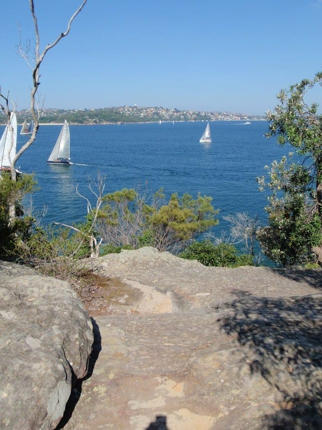
The views along Bradleys Head to Chowder Bay walk are almost too good to be true. The gentle bush track weaves around the harbour headlands from Taronga Zoo Wharf around Bradleys Head to Chowder Bay and is guaranteed to impress. There is even an app you can download directly to your iPhone or Android device.
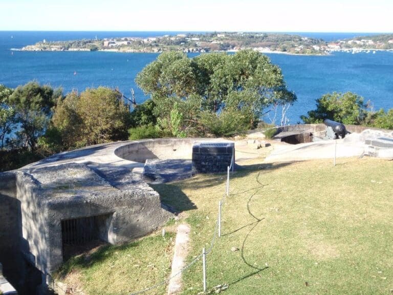
You can see the Opera House and Harbour Bridge - Sydney's most famous icons - in all their glory. Watch the boats glide by from Bradleys Head Amphitheatre or step into the past at Military relics at Bradleys Head. Come face-to-face with wildlife and ancient trees, and stop for a drink at heritage-listed Athol Hall or a Chowder Bay cafe.
The Harbour Bridge to The Spit Bridge walking track continues past Chowder Bay if you feel like a longer walk. Once you've explored this exquisite part of Sydney Harbour you're sure to want to walk more of Sydney's coastal walking tracks.
Take a virtual tour of Bradleys Head to Chowder Bay walk captured with Google Street View Trekker.
Gallery
Got some great shots from this hike? Upload your photos here to inspire others and show off the beauty of the trail!
Click to view form >>
Submitting your photos doesn’t mean you lose ownership. You can be credited for your contributions, and you can request removal at any time.
Content use
Please don’t copy GPX files or content from this site to AllTrails or other platforms. Each trail has been personally mapped, documented, and refined to support Australia’s bushwalking and hiking community. While some details come from land managers, every listing reflects significant personal effort. This is a free, community-driven initiative—your respect helps keep it that way.
Walk map and GPX file
It looks like I don’t have a GPX file for this trail yet. If you have one to share, please email it to me! I’ll verify it against official maps before adding it to help other hikers have a safer, easier experience. Thanks for contributing to a better hiking resource.
Getting there
Getting to the trailhead: Sydney Harbour National Park.
To Chowder Bay Road carpark. Bradleys Head to Chowder Bay walk is in the Bradleys Head precinct of Sydney Harbour National Park. To get there:By carFrom Mosman take Military Road onto Bradleys Head RoadThe walks starts at the end of the road at Taronga Zoo Wharf.Parking is not available at the WharfBy public transportTake the ferry from Circular Quay to Taronga Zoo WharfFrom Chowder Bay the 244 bus takes you to Wynyard in the city. Park entry points Chowder Bay Road carpark See on map Clifton Gardens carpark See on map Parking Paid parking is available at Clifton Gardens and Chowder Bay.
Visit NSW National Parks and Wildlife Service for more information on this trail.
The longitude and latitude of the start and end points are approximately only and should not be used for navigation purposes. Please contact me if you know the correct coordinates.
Closest towns to this walk: Balmain, Balmoral, Chatswood, Cremorne, Darling Harbour, Darling Point, Darlinghurst, Dee Why, Frenchs Forest, Glebe, Kirribilli, Manly, Mosman, Neutral Bay, North Sydney, Pyrmont, Rose Bay, Rozelle, Sydney, Terrey Hills, Vaucluse, Watsons Bay, Woolloomooloo
About the region
Sydney Harbour National Park protects islands and foreshore around Sydney Harbour. Explore Sydney's history on a school excursion or guided tour to enjoy coastal walks, picnics and swimming. Sydney Harbour National Park protects a number of islands and foreshore areas around one of the world's most famous harbours. The park is home to superb swimming spots, bushwalking tracks and picnic areas, which offer a huge range of activities that will have you coming back again and again.
See native wildlife living in rare pockets of bushland once common around Sydney, or take a fascinating walk to explore the park's cultural history. You'll see everything from convict-built buildings and military fortifications to Aboriginal sites and a heritage lighthouse. And with the harbour's staggering coastline creating an endless natural lookout, the park's jaw-dropping views simply have to be seen to be believed. If you're at one of the park's lookouts during winter, be sure to keep a lookout for whales on their annual migration north.
Similar walks nearby
Looking for more walks in or near Sydney Harbour National Park? Try these trails with a similar difficulty grade.
Track grade
Grade 3 (Moderate) - Walks for Most Fitness Levels: Grade 3 on the AWTGS represents moderate walking tracks. These are ideal for walkers with some fitness who are comfortable with some hills and uneven terrain. While suitable for most ages, some bushwalking experience is recommended to ensure a safe and enjoyable experience. Tracks may have short, steep hill sections, a rough surface, and many steps. The total distance of a Grade 3 walk can be up to 20 kilometers.
Explore safe
Plan ahead and hike safely! Carry enough water, pack layers for changing conditions, and bring safety gear like a torch, PLB, and reliable communication device. Check official sources for trail updates, closures, and access requirements, and review local weather and bushfire advice. Most importantly, share your plans with someone before you go. Being prepared makes for a safer and more enjoyable hike! Stay Safe, Explore More, and Always #ExploreSafe.
Packing checklists
What you carry in your pack depends on factors like weather, terrain, and your adventure type. Not sure what to bring? My free planning, food, and packing checklists are a great starting point, covering day hikes, overnight trips, and multi-day adventures. Use them to customise your kit and always prioritise safety.
Let someone know
Before heading out, take a moment to fill out your trip intentions form. It’s a quick way to share your hike details with family or friends. If something goes wrong, they can notify emergency services, ensuring a faster response and peace of mind. Stay safe and enjoy your adventure
Suggest an edit
Spotted a change on this trail? Maybe there are new features, the route has shifted, or the trail is permanently closed. Whatever the update, I’d love your input. Your feedback helps fellow hikers stay informed and ensures that our trail info stays fresh and reliable.
Acknowledgement of Country
Trail Hiking Australia acknowledges the Traditional Owners of the lands on which we hike and pay respects to their Elders, past and present, and we acknowledge the First Nations people of other communities who may be here today.


