Hike at a Glance
Max elevation: 245m
Min elevation: 141m
Total Ascent: 249m
Hike overview
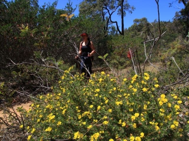
The Perth Hills Discovery Centre to Golden View Lookout walk (Bibbulmun Track Day Walk) is a scenic 8-kilometre out-and-back journey that takes you through the heart of Beelu National Park, following a few kilometres of the Bibbulmun Track. Starting at the Perth Hills Discovery Centre, the track meanders through a beautiful mix of jarrah and banksia forest on the side of the Helena Valley. As you walk, the first glimpses of Lake CY O'Connor and Mundaring Weir begin to emerge, providing a taste of the stunning views that await further along the trail.
Continuing on, you’ll pass the historic Mundaring Weir Hotel, before joining a short section of the Golden Pipeline, a remarkable feat of engineering that carries water from Mundaring Weir to the Goldfields near Kalgoorlie. The track crosses the Weir wall, offering a closer look at the impressive structure, before climbing up to the Golden View Lookout. From here, you’re treated to expansive views of the surrounding landscape, including the weir and the lush valley below. For those seeking a slightly different route, there is an alternative path at the Weir wall that descends to its base, where you’ll find the No.1 Pumping Station Museum. This route is often used when the gates along the weir wall are closed after hours or during maintenance.
To begin the walk, head towards the amphitheatre at the Discovery Centre, with the animal enclosure on your left and the amphitheatre on your right. Follow the Bibbulmun Track trail markers to guide you on your way. This hike offers a great way to experience the Perth Hills’ natural beauty and history, with the added bonus of stunning views along the way.
Gallery
Got some great shots from this hike? Upload your photos here to inspire others and show off the beauty of the trail!
Click to view form >>
Submitting your photos doesn’t mean you lose ownership. You can be credited for your contributions, and you can request removal at any time.
Content use
Please don’t copy GPX files or content from this site to AllTrails or other platforms. Each trail has been personally mapped, documented, and refined to support Australia’s bushwalking and hiking community. While some details come from land managers, every listing reflects significant personal effort. This is a free, community-driven initiative—your respect helps keep it that way.
Walk map and GPX file
Max elevation: 245 m
Min elevation: 141 m
Total climbing: 249 m
Total descent: -249 m
Getting there
Getting to the trailhead: Beelu National Park.
The trailhead for the Perth Hills Discovery Centre to Golden View Lookout walk is located at the Perth Hills Discovery Centre, situated in the heart of Beelu National Park. It’s easily accessible by car, around 40 kilometres east of Perth. The Centre offers a small, well-appointed campground, perfect for families or first-time campers looking to enjoy the natural surroundings. While there, you’ll find facilities such as toilets, a visitor centre, and some refreshments available on weekdays.
For food and drinks, the Mundaring Weir Hotel, just a short distance away, is another option. The South Ledge picnic area, located above the Golden View Lookout, provides a picnic table and toilets for hikers to rest. When preparing for the walk, be sure to bring a water bottle and snacks. For those looking to make the most of the day, you can either walk out and back—taking in a slightly different perspective on the return journey—or arrange a car shuffle by leaving a car at each end of the walk. Note that there is no public transport directly to Mundaring Weir, but track transfers can be organised through the Mundaring Visitor Information Centre.
Closest towns to this walk: Bickley, Boya, Carmel, Darlington, Glen Forrest, Gooseberry Hill, Helena Valley, Hovea, Kalamunda, Lesmurdie, Mahogany Creek, Mount Helena, Mundaring, Parkerville, Paulls Valley, Perth, Sawyers Valley, Stoneville
About the region
Located in the heart of the Perth Hills, Beelu National Park sits just 40 kilometres east of Western Australia's capital city. This beautiful stretch of bushland, once known as Mundaring National Park, was renamed to honour the Beelu people, the Traditional Owners of the land. Rich in natural beauty and cultural significance, it offers an incredible setting for hikes, bushwalks, and leisurely walks through towering jarrah, marri, and wandoo forests.
Whether you’re up for a challenging hike or a relaxed stroll, there are plenty of trails to explore. The park is home to a section of the famous Bibbulmun Track, one of Australia’s premier long-distance walking trails. With a variety of tracks winding through the forest, past granite outcrops and across seasonal creeks, walkers will find plenty of opportunities to experience the park’s rugged charm. In spring, bursts of colour from native wildflowers brighten the trails, creating a spectacular backdrop for your journey. Keep an eye out for wildlife along the way—western grey kangaroos, echidnas, and red-tailed black cockatoos are just some of the creatures you might encounter.
Mundaring Weir, one of the park’s most iconic landmarks, offers impressive views and a fascinating glimpse into Western Australia’s water supply history. Several lookouts provide sweeping panoramas over the dam and surrounding forest, making them great spots to pause and take in the scenery. If you’re keen to extend your visit, the Perth Hills Discovery Centre offers camping facilities and picnic areas, perfect for families and groups looking to immerse themselves in nature. The centre also runs the Nearer to Nature program, offering engaging outdoor activities that connect people of all ages to the environment.
Beelu National Park is easy to reach from Perth, with the main entry points near Mundaring and Kalamunda. Whether you're tackling a challenging hike, taking a peaceful walk, or simply unwinding in a scenic setting, this park is a fantastic spot to enjoy the outdoors.
Similar walks nearby
Looking for more walks in or near Beelu National Park? Try these trails with a similar difficulty grade.
Track grade
Grade 2 (Easy) - A Gentle Introduction to Inclines: Grade 2 on the AWTGS represents easy walking tracks that offer a slightly more challenging experience compared to Grade 1. Similar to Grade 1, no prior bushwalking experience is required. The track surface is typically hardened or compacted and may have gentle hill sections or occasional steps. The total distance of a Grade 2 walk is typically no greater than 10 kilometers. These walks are still suitable for families with a bit more experience or those seeking a gentle introduction to some inclines.
Explore safe
Plan ahead and hike safely! Carry enough water, pack layers for changing conditions, and bring safety gear like a torch, PLB, and reliable communication device. Check official sources for trail updates, closures, and access requirements, and review local weather and bushfire advice. Most importantly, share your plans with someone before you go. Being prepared makes for a safer and more enjoyable hike! Stay Safe, Explore More, and Always #ExploreSafe.
Packing checklists
What you carry in your pack depends on factors like weather, terrain, and your adventure type. Not sure what to bring? My free planning, food, and packing checklists are a great starting point, covering day hikes, overnight trips, and multi-day adventures. Use them to customise your kit and always prioritise safety.
Let someone know
Before heading out, take a moment to fill out your trip intentions form. It’s a quick way to share your hike details with family or friends. If something goes wrong, they can notify emergency services, ensuring a faster response and peace of mind. Stay safe and enjoy your adventure
Suggest an edit
Spotted a change on this trail? Maybe there are new features, the route has shifted, or the trail is permanently closed. Whatever the update, I’d love your input. Your feedback helps fellow hikers stay informed and ensures that our trail info stays fresh and reliable.
Acknowledgement of Country
Trail Hiking Australia acknowledges the Traditional Owners of the lands on which we hike and pay respects to their Elders, past and present, and we acknowledge the First Nations people of other communities who may be here today.


