Hike at a Glance
Max elevation: 734m
Min elevation: 447m
Total Ascent: 451m
Hike overview
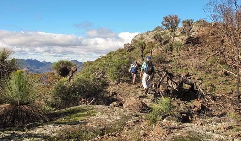
The Belougery Split Rock walking track is a 4.5km, grade 4 hike that offers a rewarding challenge for experienced bushwalkers or those with a moderate level of fitness. Located in Warrumbungle National Park, this hike typically takes around two hours to complete and is perfect for those seeking a bit of adventure and the promise of stunning views.
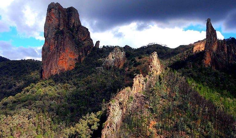
The track weaves its way around one of the park's most iconic features, Belougery Split Rock, a striking lava dome that rises dramatically from the surrounding landscape. The journey to the summit is not without its challenges, with a rough path that requires navigating around various obstacles. The final stretch includes a scramble up steps carved into a rocky knoll, making it a more demanding section of the walk. It’s important to bring plenty of water and be prepared for some physical exertion along the way.
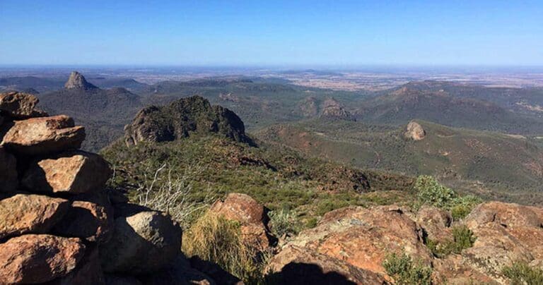
But once you reach the top, the effort is undeniably worth it. The 360-degree views from the summit are nothing short of breathtaking, with panoramic sights of the Warrumbungle mountains and the expansive Western Plains stretching out across the ancient volcanic terrain. It’s the perfect spot to pause, take in the scenery, and perhaps enjoy a picnic while soaking in the tranquil atmosphere.
If you're an avid birdwatcher, be sure to bring binoculars along. The area is home to wedge-tailed eagles, and you might even spot one soaring high above. In spring, the surrounding wildflowers create a colourful tapestry, and you may be lucky enough to spot a red-necked wallaby or a wallaroo resting in the shade. Whether you're there for the views, the wildlife, or the chance to connect with nature, the Belougery Split Rock walking track offers a memorable experience that combines both challenge and reward.
Tips
- If you're bushwalking, it's a good idea to bring a topographic map and compass, or a GPS.
- This walk is suitable for experienced bushwalkers who are comfortable undertaking self-reliant hiking
- There is limited/no mobile reception in this park
- It's a good idea to put sunscreen on before you set out and remember to take a hat and drinking water
- Remember to take your binoculars if you want to go birdwatching
Gallery
Got some great shots from this hike? Upload your photos here to inspire others and show off the beauty of the trail!
Click to view form >>
Submitting your photos doesn’t mean you lose ownership. You can be credited for your contributions, and you can request removal at any time.
Content use
Please don’t copy GPX files or content from this site to AllTrails or other platforms. Each trail has been personally mapped, documented, and refined to support Australia’s bushwalking and hiking community. While some details come from land managers, every listing reflects significant personal effort. This is a free, community-driven initiative—your respect helps keep it that way.
Walk map and GPX file
Max elevation: 734 m
Min elevation: 447 m
Total climbing: 451 m
Total descent: -451 m
Getting there
Getting to the trailhead: Warrumbungle National Park.
Exploring the Belougery Split Rock walking track requires a journey into the heart of Warrumbungle National Park. Here’s how to get there:
From Coonabarabran: Head out on the Newell Highway, keeping an eye out for signs directing you towards Warrumbungle National Park. Take the John Renshaw Parkway exit and follow it for roughly 33 kilometers, venturing deeper into the park. You’ll pass signs for campgrounds and the visitor center, but continue westward on John Renshaw Parkway for another 2 kilometers. Finally, turn left off the parkway and head straight to the Split Rock carpark.
From Tooraweenah: Follow signs eastward towards Warrumbungle National Park, staying on John Renshaw Parkway. Once you enter the park boundaries, continue along the parkway for about 5 kilometers. Look for the Split Rock carpark conveniently located on your right.
Parking: No need to fret about parking! Split Rock carpark offers ample space for you to leave your vehicle and embark on your adventure.
Closest towns to this walk: Baradine, Binnaway, Coolah, Coonabarabran, Dunedoo, Gilgandra, Gulargambone, Mendooran
About the region
Millions of years ago, a mighty shield volcano sculpted the jagged peaks of Warrumbungle National Park. Today, these ancient formations rise majestically from eucalyptus-dotted plains, creating a landscape unlike any other in New South Wales.
As Australia's first Dark Sky Park, Warrumbungle boasts pristine skies untouched by light pollution. Here, the Milky Way stretches across the heavens, revealing a dazzling display of stars, planets, and distant galaxies. Whether you're a seasoned astronomer or a curious beginner, Warrumbungle offers unforgettable stargazing experiences.
Lace up your boots and explore a network of walking tracks. Hike the iconic Breadknife and Grand High Tops Walk for breathtaking close-up views of the park's most recognizable rock formations. The park is a haven for outdoor enthusiasts, with opportunities for camping, birdwatching, and capturing stunning photographs of the dramatic scenery.
While wildfires impacted the park in 2013, the National Parks and Wildlife Service (NPWS) has meticulously restored walking tracks, campgrounds, and visitor facilities. Start your adventure at the Warrumbungle Visitor Centre, where you can gather park information or purchase a star chart to navigate the night sky.
Similar walks nearby
Looking for more walks in or near Warrumbungle National Park? Try these trails with a similar difficulty grade.
Track grade
Grade 4 (Hard) - Challenging Walks for Experienced Walkers: Grade 4 on the AWTGS signifies challenging walking tracks. Bushwalking experience is recommended for these tracks, which may be long, rough, and very steep. Directional signage may be limited, requiring a good sense of navigation. These walks are suited for experienced walkers who are comfortable with steeper inclines, rougher terrain, and potentially longer distances.
Explore safe
Plan ahead and hike safely! Carry enough water, pack layers for changing conditions, and bring safety gear like a torch, PLB, and reliable communication device. Check official sources for trail updates, closures, and access requirements, and review local weather and bushfire advice. Most importantly, share your plans with someone before you go. Being prepared makes for a safer and more enjoyable hike! Stay Safe, Explore More, and Always #ExploreSafe.
Packing checklists
What you carry in your pack depends on factors like weather, terrain, and your adventure type. Not sure what to bring? My free planning, food, and packing checklists are a great starting point, covering day hikes, overnight trips, and multi-day adventures. Use them to customise your kit and always prioritise safety.
Let someone know
Before heading out, take a moment to fill out your trip intentions form. It’s a quick way to share your hike details with family or friends. If something goes wrong, they can notify emergency services, ensuring a faster response and peace of mind. Stay safe and enjoy your adventure
Suggest an edit
Spotted a change on this trail? Maybe there are new features, the route has shifted, or the trail is permanently closed. Whatever the update, I’d love your input. Your feedback helps fellow hikers stay informed and ensures that our trail info stays fresh and reliable.
Acknowledgement of Country
Trail Hiking Australia acknowledges the Traditional Owners of the lands on which we hike and pay respects to their Elders, past and present, and we acknowledge the First Nations people of other communities who may be here today.


