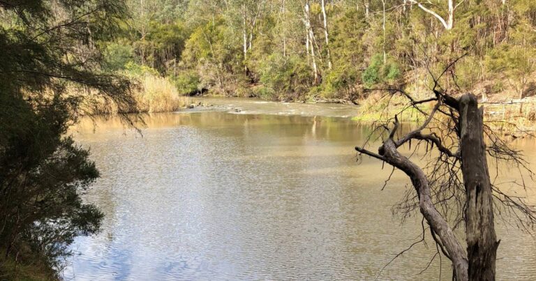
The Yarra River Heritage Walk is longer walk that combines many shorter ones in the area into a day hike. Following the Yarra River as closely as possible through the length of the Warrandyte State Park from the end of Lower Homestead Road to the Stonehouse Cafe.
- Snakes have been observed in the area, so make a lot of noise.
- There are no services or fresh water (other than the Yarra) along the trail, except at the Stan Brae Farm picnic area.
- There are many places where you can stop and start this walk, with the longest section being from Clifford Park to Jumping Creek Reserve (7km).
- Please respect the area - Clifford Park is owned by the Scouts, but allow use for walkers; a section of this walk is not marked on any maps and may be private property (although maps show it as State Park)
Contributed by Rob Collins
Got some great shots from this hike? Upload your photos here to inspire others and show off the beauty of the trail!
Uploading your photos doesn’t mean you lose ownership. You can be credited for your contributions, and you can request removal at any time.
Please don’t copy GPX files or content from this site to AllTrails or other platforms. Each trail has been personally mapped, documented, and refined to support Australia’s bushwalking and hiking community. While some details come from land managers, every listing reflects significant personal effort. This is a free, community-driven initiative—your respect helps keep it that way.
Total distance: 18530 m
Max elevation: 129 m
Min elevation: 33 m
Total climbing: 550 m
Total descent: -575 m
Getting there
Getting to the trailhead: Warrandyte State Park.
Park a car at the end of Lower Homestead Road and the other at the Stonehouse Cafe. Then simply follow the river!
The park is 24km north-east of Melbourne. Access is mainly via three sealed roads: Warrandyte Road, Research-Warrandyte Road and Ringwood-Warrandyte Road (Melways pages 23 & 24). Park at the end of Lower Homestead Rd, Wonga Park. Watch out for Kangaroos, they are everywhere. The track begins from the carpark.
Closest towns to this walk: Doncaster East, Donvale, Eltham, North Warrandyte, Park Orchards, Research, Ringwood North, Templestowe, Warrandyte
Similar walks nearby
Looking for more walks in or near Warrandyte State Park? Try these trails with a similar difficulty grade.
Favourite

Favourite

Favourite

Favourite

Track grade
Grade 3 (Moderate) - Walks for Most Fitness Levels: Grade 3 on the
AWTGS represents moderate walking tracks. These are ideal for walkers with some fitness who are comfortable with some hills and uneven terrain. While suitable for most ages, some bushwalking experience is recommended to ensure a safe and enjoyable experience. Tracks may have short, steep hill sections, a rough surface, and many steps. The total distance of a Grade 3 walk can be up to 20 kilometers.
Explore safe
Plan ahead and hike safely! Carry enough water, pack layers for changing conditions, and bring safety gear like a torch, PLB, and reliable communication device. Check official sources for trail updates, closures, and access requirements, and review local weather and bushfire advice. Most importantly, share your plans with someone before you go. Being prepared makes for a safer and more enjoyable hike! Stay Safe, Explore More, and Always #ExploreSafe.
Packing checklists
What you carry in your pack depends on factors like weather, terrain, and your adventure type. Not sure what to bring? My free planning, food, and packing checklists are a great starting point, covering day hikes, overnight trips, and multi-day adventures. Use them to customise your kit and always prioritise safety.
Let someone know
Before heading out, take a moment to fill out your trip intentions form. It’s a quick way to share your hike details with family or friends. If something goes wrong, they can notify emergency services, ensuring a faster response and peace of mind. Stay safe and enjoy your adventure
Suggest an edit
Spotted a change on this trail? Maybe there are new features, the route has shifted, or the trail is permanently closed. Whatever the update, I’d love your input. Your feedback helps fellow hikers stay informed and ensures that our trail info stays fresh and reliable.


7 Reviews on “Yarra River Heritage Walk (18.5km)”
I highly recommend this hike. Hiking along side the Yarra river is very pleasant and there are plenty of river side spots to rest and take in the river. Not an overly hard hike but well worth the effort.
Sajah Ramadan
Sajah Ramadan yas