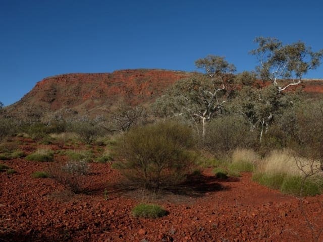
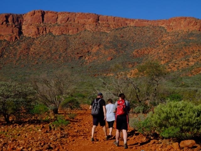
The Yaburara Heritage Trail is a 3.5 kilometre grade 4 walk highlighting the Karratha district's natural history and cultural heritage and in particular the heritage of the Traditional Owners of the land, the Ngarluma people, in honour of the Yaburara people. It covers rugged country with some steep climbs and descents and features a number of Aboriginal sites including rock engravings and artefact scatters.
The trail commences from the water tanks over looking the town centre and access is via the information bay on Karratha Road, next to the Karratha Visitor Centre or from the back of Karratha Leisureplex off Dampier Highway. There are also two short branch trails and three longer branch trails - a secondary trail around the base of the hills, a recreational trail following the ridge top and a nature trail along two major valleys. Much of the Yaburara Heritage Trail is rough with loose rocks with no shade. The trail is on Aboriginal Heritage Registed sites which are significant to Aboriginal people; they are a great interest to non-Aboriginal people and they are protected by law. The layout of this trail was done in close liaison with the Ngarluma people, the Traditional Owners of the land. We trust that giving people a better understanding will engender greater respect for Aborigial culture. The trail brochure is available from the Karratha Visitor Centre and Karratha Leisureplex or scan the QR Code from the trailhead map to download map and brochure to your phone.
Start Point: 1535km north of Perth. Trail head maps can be found at top of Karratha Visitor Centre - Water Tanks and Karrtha Leisureplex
End Point: Karratha Leisureplex off Dampier Highway
Region: Karratha, North West
For more information, a location map and GPS file please visit Trails WA.
Got some great shots from this hike? Upload your photos here to inspire others and show off the beauty of the trail!
Submitting your photos doesn’t mean you lose ownership. You can be credited for your contributions, and you can request removal at any time.
Please don’t copy GPX files or content from this site to AllTrails or other platforms. Each trail has been personally mapped, documented, and refined to support Australia’s bushwalking and hiking community. While some details come from land managers, every listing reflects significant personal effort. This is a free, community-driven initiative—your respect helps keep it that way.
It looks like I don’t have a GPX file for this trail yet. If you have one to share, please email it to me! I’ll verify it against official maps before adding it to help other hikers have a safer, easier experience. Thanks for contributing to a better hiking resource.
Getting there
Getting to the trailhead: Karratha.
Closest towns to this walk: Dampier, Munjina, Point Samson, Roebourne, Wickham
About the region
Karratha is a city in the Pilbara region of Western Australia, adjoining the port of Dampier. It was established in 1968 to accommodate the processing and exportation workforce of the Hamersley Iron mining company and, in the 1980s, the petroleum and liquefied natural gas operations of the North West Shelf Venture.
Similar walks nearby
Looking for more walks in or near Karratha? Try these trails with a similar difficulty grade.
Favourite

Favourite

Favourite

Mount Augustus National Park
Favourite

Mount Augustus National Park
Track grade
Grade 4 (Hard) -
Challenging Walks for Experienced Walkers: Grade 4 on the
AWTGS signifies challenging walking tracks. Bushwalking experience is recommended for these tracks, which may be long, rough, and very steep. Directional signage may be limited, requiring a good sense of navigation. These walks are suited for experienced walkers who are comfortable with steeper inclines, rougher terrain, and potentially longer distances.
Explore safe
Plan ahead and hike safely! Carry enough water, pack layers for changing conditions, and bring safety gear like a torch, PLB, and reliable communication device. Check official sources for trail updates, closures, and access requirements, and review local weather and bushfire advice. Most importantly, share your plans with someone before you go. Being prepared makes for a safer and more enjoyable hike! Stay Safe, Explore More, and Always #ExploreSafe.
Packing checklists
What you carry in your pack depends on factors like weather, terrain, and your adventure type. Not sure what to bring? My free planning, food, and packing checklists are a great starting point, covering day hikes, overnight trips, and multi-day adventures. Use them to customise your kit and always prioritise safety.
Let someone know
Before heading out, take a moment to fill out your trip intentions form. It’s a quick way to share your hike details with family or friends. If something goes wrong, they can notify emergency services, ensuring a faster response and peace of mind. Stay safe and enjoy your adventure
Suggest an edit
Spotted a change on this trail? Maybe there are new features, the route has shifted, or the trail is permanently closed. Whatever the update, I’d love your input. Your feedback helps fellow hikers stay informed and ensures that our trail info stays fresh and reliable.


