Hike at a Glance
Max elevation: 399m
Min elevation: 174m
Total Ascent: 528m
Important info
Parts of this hiking trail traverse through private land. You will need to seek an alternate route or seek permission of the land owner to access their land.
Hike overview
This Werribee Gorge Offtrail hike explores Western Bluff, Pyramid Rock and a number of steep and rocky spurs. the Circuit hike commences at the Falcons Lookout Car Park and gradually descends the ridge to the rocky outcrop of Western Bluff. From the bluff the main trail descends steeply via Needles spur into the depths of the Werribee Gorge before climbing to the summit of Pyramid Rock.
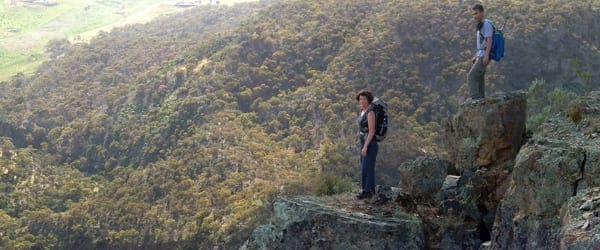
There are a number of ways to ascend and descend the summit of Pyramid Rock so select a path suited tto your level of skill. We dropped off the face of the rock structure on the descent.
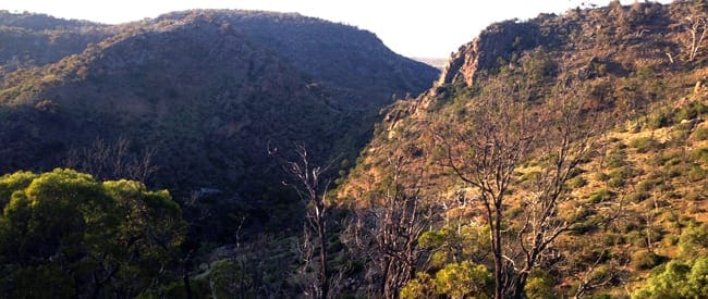
From this high vantage point you will be rewarded with possibly the best views of Werribee Gorge and the Werribee River below. To the south east you will see the plains of Bacchus Marsh while to the north you can see as far as Centenary hill at the other end of the gorge.
The trail then descends down into the heart of the Werribee Gorge, following the river across to Needles beach before ascending an unnamed spur to picnic point and Western Viewpoint. From here you will descend back into the gorge before traversing a narrow ridge and saddle back to the start of the Granties trail and the Ironbark Gorge Track which will return you to the start.
There will be plenty of rock scrambling, a few river crossings and a few steep ascents to get the heart pumping.
Tips
This is an unofficial off-trail hike without formed trails or signage. You will need to be confident with navigation and steep and rocks ascents and descents.
- Trail can be taken in any direction.
- The river is prone to flooding so avoid after heavy rains.
- Walking poles will be beneficial.
- Be mindful of snakes and hit weather during the summer months
Content use
Please don’t copy GPX files or content from this site to AllTrails or other platforms. Each trail has been personally mapped, documented, and refined to support Australia’s bushwalking and hiking community. While some details come from land managers, every listing reflects significant personal effort. This is a free, community-driven initiative—your respect helps keep it that way.
Walk map and GPX file
Max elevation: 399 m
Min elevation: 174 m
Total climbing: 528 m
Total descent: -527 m
Getting there
Getting to the trailhead: Werribee Gorge State Park.
Follow the Western Highway past Bacchus Marsh to the Pentland Hills exit (5km beyond Bacchus Marsh). At the end of the exit ramp turn right to pass under the freeway. Turn left onto Pentland Hills Road. After passing under the freeway again turn left onto Myers Road and follow it down to the Werribee Gorge State Park.
Closest towns to this walk: Bacchus Marsh, Ballan, Blackwood, Geelong, Gellibrand Hill, Gisborne, Gordon, Greendale, Hoppers Crossing, Little River, Melton, Myrniong, Point Cook, Toolern Vale, Werribee
About the region
Werribee Gorge State Park is part of an Aboriginal cultural landscape that includes the traditional Country of the Wadawurrung and Wurundjeri Peoples. Werribee Gorge is a wild, rugged natural beauty shaped by 500 million years of geological history. A range of challenging walks amid the steep, river-washed gorge and surrounding rocky ridges offer spectacular views and access to a rock-climbing site within the park. Self-sufficient visitors can picnic and hike to explore this unique park and its distinctive settings.
Similar walks nearby
Looking for more walks in or near Werribee Gorge State Park? Try these trails with a similar difficulty grade.
Track grade
Grade 4 (Hard) - Challenging Walks for Experienced Walkers: Grade 4 on the AWTGS signifies challenging walking tracks. Bushwalking experience is recommended for these tracks, which may be long, rough, and very steep. Directional signage may be limited, requiring a good sense of navigation. These walks are suited for experienced walkers who are comfortable with steeper inclines, rougher terrain, and potentially longer distances.
Explore safe
Plan ahead and hike safely! Carry enough water, pack layers for changing conditions, and bring safety gear like a torch, PLB, and reliable communication device. Check official sources for trail updates, closures, and access requirements, and review local weather and bushfire advice. Most importantly, share your plans with someone before you go. Being prepared makes for a safer and more enjoyable hike! Stay Safe, Explore More, and Always #ExploreSafe.
Packing checklists
What you carry in your pack depends on factors like weather, terrain, and your adventure type. Not sure what to bring? My free planning, food, and packing checklists are a great starting point, covering day hikes, overnight trips, and multi-day adventures. Use them to customise your kit and always prioritise safety.
Let someone know
Before heading out, take a moment to fill out your trip intentions form. It’s a quick way to share your hike details with family or friends. If something goes wrong, they can notify emergency services, ensuring a faster response and peace of mind. Stay safe and enjoy your adventure
Suggest an edit
Spotted a change on this trail? Maybe there are new features, the route has shifted, or the trail is permanently closed. Whatever the update, I’d love your input. Your feedback helps fellow hikers stay informed and ensures that our trail info stays fresh and reliable.
Acknowledgement of Country
Trail Hiking Australia acknowledges the Traditional Owners of the lands on which we hike and pay respects to their Elders, past and present, and we acknowledge the First Nations people of other communities who may be here today.
/Werribee-Gorge-OffTrail_21.jpg)
/Werribee-Gorge-OffTrail_23.jpg)
/Werribee-Gorge-OffTrail_3.jpg)
/Werribee-Gorge-OffTrail_18.jpg)
/Werribee-Gorge-OffTrail_8.jpg)
/Werribee-Gorge-OffTrail_16.jpg)
/Werribee-Gorge-OffTrail_15.jpg)
/Werribee-Gorge-OffTrail_6.jpg)
/Werribee-Gorge-OffTrail_14.jpg)
/Werribee-Gorge-OffTrail_9.jpg)
/Werribee-Gorge-OffTrail_17.jpg)
/Werribee-Gorge-OffTrail_25.jpg)
/Werribee-Gorge-OffTrail_19.jpg)
/Werribee-Gorge-OffTrail_2.jpg)
/Werribee-Gorge-OffTrail_13.jpg)


9 Reviews on “Werribee Gorge: OffTrail (6.9km)”
We are going to this trail on this weekend, is it trail closed?
Friends and I attempted the trail today. Tracks were closed. Does archive mean that the trail is no longer available? Thanks.