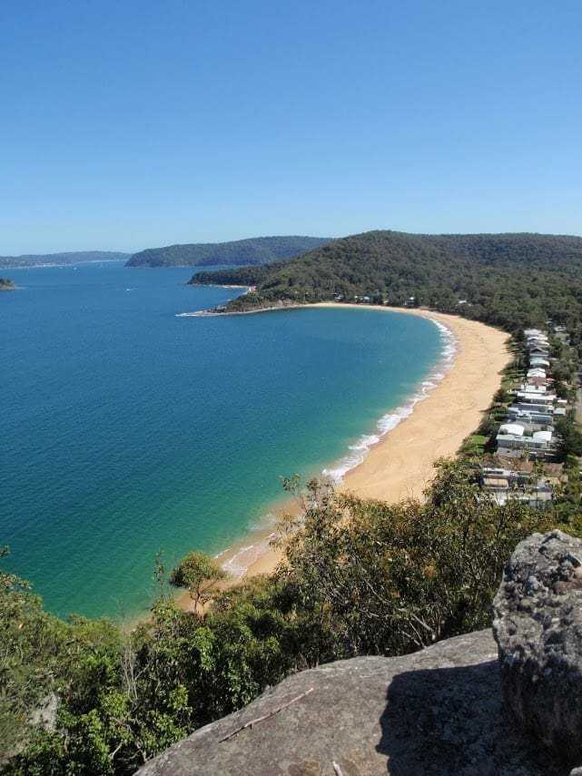
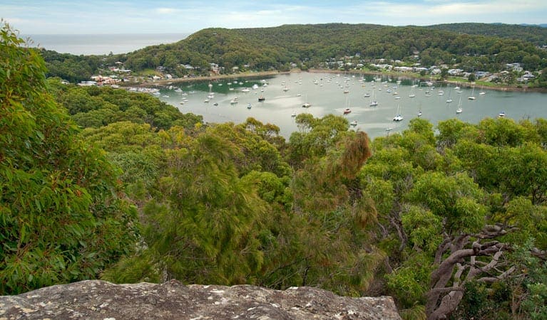
This walk takes you from the old Warrah Trig Station down the ridge along a well formed rock path to Warrah Lookout. From the lookout there are fantastic views spanning from the distant Barrenjoey headland across the Hawkesbury river to Brisk Bay and Patonga. There are no facilities provided at the Warrah Trig Station but the Lookout is fenced for safety. After the walk it is also worth a trip down to Patonga for lunch or just to explore the local area.
Download maps and tracknotes for Warrah Trig to Lookout hiking track from wildwalks.com.
Got some great shots from this hike? Upload your photos here to inspire others and show off the beauty of the trail!
Submitting your photos doesn’t mean you lose ownership. You can be credited for your contributions, and you can request removal at any time.
Please don’t copy GPX files or content from this site to AllTrails or other platforms. Each trail has been personally mapped, documented, and refined to support Australia’s bushwalking and hiking community. While some details come from land managers, every listing reflects significant personal effort. This is a free, community-driven initiative—your respect helps keep it that way.
It looks like I don’t have a GPX file for this trail yet. If you have one to share, please email it to me! I’ll verify it against official maps before adding it to help other hikers have a safer, easier experience. Thanks for contributing to a better hiking resource.
Getting there
Getting to the trailhead: Brisbane Water National Park.
Closest towns to this walk: East Gosford, Ettalong Beach, Gosford, Holgate, Horsfield Bay, Kariong, Koolewong, North Gosford, Pearl Beach, Saratoga, Umina Beach, Woy Woy, Wyoming
About the region
The Brisbane Water National Park is a protected national park that is in the Central Coast region of New South Wales, in eastern Australia. The 11,506-hectare national park is situated 47 kilometres north of Sydney, 10 kilometres west of Woy Woy, and 12 kilometres southwest of Gosford. The Brisbane Water National Park has two picnic areas within the park close of an evening: Girrakool picnic area is open 9am to 5pm every day Somersby Falls picnic area is open 8am to 8pm during daylight savings and is open 8am to 5pm at other times Other areas of Brisbane Water National Park will be open at all times, however may have to close at times due to poor weather or fire danger.
Similar walks nearby
Looking for more walks in or near Brisbane Water National Park? Try these trails with a similar difficulty grade.
Favourite

Favourite

Favourite

Brisbane Water National Park
Favourite

Track grade
Grade 2 (Easy) - A Gentle Introduction to Inclines: Grade 2 on the
AWTGS represents easy walking tracks that offer a slightly more challenging experience compared to Grade 1. Similar to Grade 1, no prior bushwalking experience is required. The track surface is typically hardened or compacted and may have gentle hill sections or occasional steps. The total distance of a Grade 2 walk is typically no greater than 10 kilometers. These walks are still suitable for families with a bit more experience or those seeking a gentle introduction to some inclines.
Explore safe
Plan ahead and hike safely! Carry enough water, pack layers for changing conditions, and bring safety gear like a torch, PLB, and reliable communication device. Check official sources for trail updates, closures, and access requirements, and review local weather and bushfire advice. Most importantly, share your plans with someone before you go. Being prepared makes for a safer and more enjoyable hike! Stay Safe, Explore More, and Always #ExploreSafe.
Packing checklists
What you carry in your pack depends on factors like weather, terrain, and your adventure type. Not sure what to bring? My free planning, food, and packing checklists are a great starting point, covering day hikes, overnight trips, and multi-day adventures. Use them to customise your kit and always prioritise safety.
Let someone know
Before heading out, take a moment to fill out your trip intentions form. It’s a quick way to share your hike details with family or friends. If something goes wrong, they can notify emergency services, ensuring a faster response and peace of mind. Stay safe and enjoy your adventure
Suggest an edit
Spotted a change on this trail? Maybe there are new features, the route has shifted, or the trail is permanently closed. Whatever the update, I’d love your input. Your feedback helps fellow hikers stay informed and ensures that our trail info stays fresh and reliable.


