Hike at a Glance
Max elevation: 0m
Min elevation: 0m
Total Ascent: 0m
Hike overview
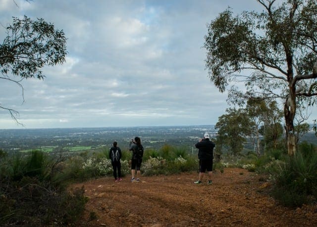
Located right in the heart of the Perth Hills, the Victoria Reservoir Trail is a hilly seven kilometre loop taking in the relics of the first dam ever constructed in Western Australia and the surrounding bushland. Admire the old dam wall as well as taking in the replacement Victoria Reservoir.
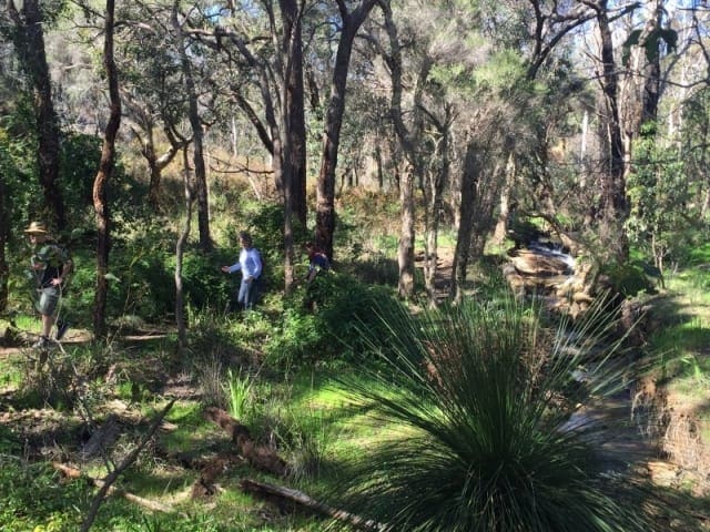
The Victoria Reservoir Trail is a challenging hike through a historic part of the Perth Hills. Taking in the ruins of the old Victoria Dam that was completed in 1891, enjoy exploring this important part of Western Australian history using the information boaRoads provided. An area of the old dam wall has been preserved and a grassed Picnic Area has been created under the new Victoria Dam wall. Starting at the top of the valley, the trail descends down into the catchment area and eventually takes you back up to the start point through scenic Australian bushland. Watch the bush come alive in spring as the wildflowers bloom in a variety of colours all over the forest floor. The start point for the trail is the Car Park before the gates into the Reservoir. Note that the gates to the reservoir close at 5.00pm.
Tips
Start Point: Masonmill Road, Carmel - 30km (40mins) east of Perth
End Point: Masonmill Road, Carmel - 30km (40mins) east of Perth
Region: Perth Hills, Perth
For more information, a location map and GPS file please visit Trails WA.
Gallery
Got some great shots from this hike? Upload your photos here to inspire others and show off the beauty of the trail!
Click to view form >>
Submitting your photos doesn’t mean you lose ownership. You can be credited for your contributions, and you can request removal at any time.
Content use
Please don’t copy GPX files or content from this site to AllTrails or other platforms. Each trail has been personally mapped, documented, and refined to support Australia’s bushwalking and hiking community. While some details come from land managers, every listing reflects significant personal effort. This is a free, community-driven initiative—your respect helps keep it that way.
Walk map and GPX file
It looks like I don’t have a GPX file for this trail yet. If you have one to share, please email it to me! I’ll verify it against official maps before adding it to help other hikers have a safer, easier experience. Thanks for contributing to a better hiking resource.
Getting there
Getting to the trailhead: Korung National Park.
Closest towns to this walk: Beacon, Bencubbin, Broomehill, Gnowangerup, Katanning, Mukinbudin, Nungarin, Nyabing, Tambellup, Wyalkatchem
About the region
Scattered throughout the wide ranges of the Darling Scarp and only 45 minutes east of Perth City, you'll find the Perth Hills. Its character townships including Mundaring, Kalamunda, Bickley Valley and Armadale, exude a country charm and views that are simply astounding.
With the first vineyards in the Perth Hills planted in the 1880s, it comes as no surprise that the region now boasts a well-established wine scene with a fantastic food and wine trail and cider and brews trail to follow.
Surrounded by national and state forest the region, the Perth Hills are blessed with a series of more than 40 bike trails, walk trails and wildflower trails, as well as scenic lookouts and picnic spots. The region marks the start of both the Bibbulmun Track and Munda Biddi Cycle Trail.
Similar walks nearby
Looking for more walks in or near Korung National Park? Try these trails with a similar difficulty grade.
Track grade
Grade 3 (Moderate) - Walks for Most Fitness Levels: Grade 3 on the AWTGS represents moderate walking tracks. These are ideal for walkers with some fitness who are comfortable with some hills and uneven terrain. While suitable for most ages, some bushwalking experience is recommended to ensure a safe and enjoyable experience. Tracks may have short, steep hill sections, a rough surface, and many steps. The total distance of a Grade 3 walk can be up to 20 kilometers.
Explore safe
Plan ahead and hike safely! Carry enough water, pack layers for changing conditions, and bring safety gear like a torch, PLB, and reliable communication device. Check official sources for trail updates, closures, and access requirements, and review local weather and bushfire advice. Most importantly, share your plans with someone before you go. Being prepared makes for a safer and more enjoyable hike! Stay Safe, Explore More, and Always #ExploreSafe.
Packing checklists
What you carry in your pack depends on factors like weather, terrain, and your adventure type. Not sure what to bring? My free planning, food, and packing checklists are a great starting point, covering day hikes, overnight trips, and multi-day adventures. Use them to customise your kit and always prioritise safety.
Let someone know
Before heading out, take a moment to fill out your trip intentions form. It’s a quick way to share your hike details with family or friends. If something goes wrong, they can notify emergency services, ensuring a faster response and peace of mind. Stay safe and enjoy your adventure
Suggest an edit
Spotted a change on this trail? Maybe there are new features, the route has shifted, or the trail is permanently closed. Whatever the update, I’d love your input. Your feedback helps fellow hikers stay informed and ensures that our trail info stays fresh and reliable.
Acknowledgement of Country
Trail Hiking Australia acknowledges the Traditional Owners of the lands on which we hike and pay respects to their Elders, past and present, and we acknowledge the First Nations people of other communities who may be here today.


