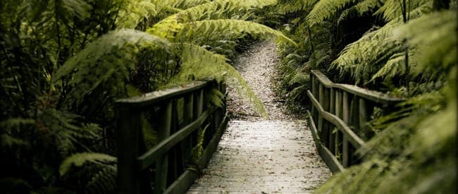
The Tarra Bulga Scenic Circuit, in the Tarra Bulga National Park, is truly one of the most beautiful hikes close to Melbourne and is well worth the visit. This hike is a good introduction to the area and follows a combination of the popular trails around the Visitor Centre. The Tarra Valley is home to some of the best primeval rainforest in Victoria. You won't be disappointed in the beauty of this place.
The trail starts near the BBQ at the North end of the car park at the visitor centre. Take Link Track, shortly this arrives at the gravel road. Walk past the water tank to take Scenic Track. This winds through some very beautiful forest before arriving at the swing bridge. After crossing the bridge, at the next junction take the left to Ash Track. The next junction will be with Lyrebird Ridge Track, take the left to follow this. This then becomes Forest Track at the picnic area. Follow this for nearly 2km. When you reach the junction you can take the left to head down to Wild Cherry Track. Then return back to the junction with Forest but take the left to continue along this to Old Yarram Balook Rod. This will return you to the main road where you need to walk up for a few minutes to reach the car park a the Visitor Centre again.
- Bring wet weather gear as this area has a very high rainfall.
- Don't forget your camera.
Please don’t copy GPX files or content from this site to AllTrails or other platforms. Each trail has been personally mapped, documented, and refined to support Australia’s bushwalking and hiking community. While some details come from land managers, every listing reflects significant personal effort. This is a free, community-driven initiative—your respect helps keep it that way.
Total distance: 8203 m
Max elevation: 676 m
Min elevation: 555 m
Total climbing: 409 m
Total descent: -410 m
Getting there
Getting to the trailhead: Tarra Bulga National Park.
Tarra Bulga National Park is situated approximately 200 kilometres east of Melbourne. The park is reached from the Princes Highway at Traralgon by following Traralgon Creek Road to Balook. Alternatively the park can be reached from Yarram via the Tarra Valley Road or Bulga Park Road. Roads throughout the area are narrow and winding but offer marvelous scenery with panoramic views from several points, including Mount Tassie.
Closest towns to this walk: Boolarra, Churchill, Gormandale, Mirboo North, Moe, Tanjil South, Thorpdale, Toora, Trafalgar, Traralgon, Traralgon South, Welshpool, Yarram, Yinnar
About the region
With its lush gullies, giant mountain ash trees and tree ferns, Tarra Bulga National Park is one of only four major areas of cool temperate rainforest in the state. The rainforest is a haven for plants and wildlife. Discover a wide variety of birds including the pilotbird, yellow tailed black cockatoo, eastern whipbird, and currawongs. Visit in the evening when the forest comes to life as possums, owls and bats emerge to feed. If you're lucky, you may see a lyrebird scratching the forest floor looking for food or catch a glimpse of some of the other inhabitants like wombats, swamp wallabies, gliders and platypuses.
Similar walks nearby
Looking for more walks in or near Tarra Bulga National Park? Try these trails with a similar difficulty grade.
Favourite

Favourite

Favourite

Favourite

Wilsons Promontory National Park
Track grade
Grade 2 (Easy) - A Gentle Introduction to Inclines: Grade 2 on the
AWTGS represents easy walking tracks that offer a slightly more challenging experience compared to Grade 1. Similar to Grade 1, no prior bushwalking experience is required. The track surface is typically hardened or compacted and may have gentle hill sections or occasional steps. The total distance of a Grade 2 walk is typically no greater than 10 kilometers. These walks are still suitable for families with a bit more experience or those seeking a gentle introduction to some inclines.
Explore safe
Plan ahead and hike safely! Carry enough water, pack layers for changing conditions, and bring safety gear like a torch, PLB, and reliable communication device. Check official sources for trail updates, closures, and access requirements, and review local weather and bushfire advice. Most importantly, share your plans with someone before you go. Being prepared makes for a safer and more enjoyable hike! Stay Safe, Explore More, and Always #ExploreSafe.
Packing checklists
What you carry in your pack depends on factors like weather, terrain, and your adventure type. Not sure what to bring? My free planning, food, and packing checklists are a great starting point, covering day hikes, overnight trips, and multi-day adventures. Use them to customise your kit and always prioritise safety.
Let someone know
Before heading out, take a moment to fill out your trip intentions form. It’s a quick way to share your hike details with family or friends. If something goes wrong, they can notify emergency services, ensuring a faster response and peace of mind. Stay safe and enjoy your adventure
Suggest an edit
Spotted a change on this trail? Maybe there are new features, the route has shifted, or the trail is permanently closed. Whatever the update, I’d love your input. Your feedback helps fellow hikers stay informed and ensures that our trail info stays fresh and reliable.
/Mount%20Tassie%20Loop/Mount-Tassie-Loop_2.jpg)
/Tarra%20Bulga%20Scenic%20Circuit/Tarra-Bulga-Scenic-Circuit_25.jpg)
/Mount%20Tassie%20Loop/Mount-Tassie-Loop_24.jpg)
/Tarra%20Bulga%20Scenic%20Circuit/Tarra-Bulga-Scenic-Circuit_37.jpg)
/Mount%20Tassie%20Loop/Mount-Tassie-Loop_38.jpg)
/Mount%20Tassie%20Loop/Mount-Tassie-Loop_54.jpg)
/Tarra%20Bulga%20Scenic%20Circuit/Tarra-Bulga-Scenic-Circuit_59.jpg)
/Tarra%20Bulga%20Scenic%20Circuit/Tarra-Bulga-Scenic-Circuit_26.jpg)
/Tarra%20Bulga%20Scenic%20Circuit/Tarra-Bulga-Scenic-Circuit_20.jpg)
/Tarra%20Bulga%20Scenic%20Circuit/Tarra-Bulga-Scenic-Circuit_4.jpg)
/Mount%20Tassie%20Loop/Mount-Tassie-Loop_34.jpg)
/Tarra%20Bulga%20Scenic%20Circuit/Tarra-Bulga-Scenic-Circuit_24.jpg)
/Tarra%20Bulga%20Scenic%20Circuit/Tarra-Bulga-Scenic-Circuit_36.jpg)
/Tarra%20Bulga%20Scenic%20Circuit/Tarra-Bulga-Scenic-Circuit_21.jpg)
/Tarra%20Bulga%20Scenic%20Circuit/Tarra-Bulga-Scenic-Circuit_16.jpg)


