Hike at a Glance
Max elevation: 12m
Min elevation: 1m
Total Ascent: 30m
Hike overview
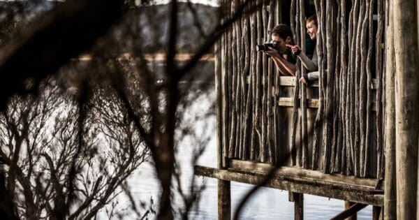
Just 10 minutes drive from the heart of Launceston, you can walk through wetlands and across a river channel to the 7 hectare Tamar Island. For company you'll have pelicans, swans, cormorants and numerous other bird species as well as frogs, dragonflies and lizards. The wetlands centre has displays and information.
Highlights
The Tamar River Conservation Area is part of an estuarine wetland. Such wetlands are important habitats for a wide diversity of plant and animal life. It remains the stronghold for one of Tasmania's poorly reserved vegetation comunities - coastal paperbark forest.
Tips
Wetlands centre, water bird viewing and toilets located close to car park. Picnic area, gas barbecue and toilets on the island.
The boarded walkway to the island is level and will suit some wheelchair users and those with prams and strollers. Tracks on the island have natural surfaces and are generally not suited for wheelchairs.
Supervise children, tidal waters.
Pets, bicycles, roller blades and skateboards are not permitted.
Track grade
Grade 1 (All-abilities) - Perfect for Families and Beginners: Grade 1 on the AWTGS represents the easiest walking tracks, perfect for families with young children or those new to bushwalking. No prior experience is required. These gentle walks feature a flat, even surface with no steps or steep sections. They are suitable for wheelchair users with assistance due to the even terrain. The total distance of a Grade 1 walk is typically no greater than 5 kilometers, making them a comfortable and manageable option for all ages and fitness levels.
Walk map and GPX file
Max elevation: 12 m
Min elevation: 1 m
Total climbing: 30 m
Total descent: -30 m
For more information about this hiking trail please visit Parks and Wildlife Service Tasmania
Content use
Please don’t copy GPX files or content from this site to AllTrails or other platforms. Each trail has been personally mapped, documented, and refined to support Australia’s bushwalking and hiking community. While some details come from land managers, every listing reflects significant personal effort. This is a free, community-driven initiative—your respect helps keep it that way.
Getting there
Getting to the trailhead: Tamar River Conservation Area.
West Tamar Highway (A7) between the Launceston suburbs of Riverside and Legana. Signs indicate the turnoff.
Need a rental car to get you to the hike? Find one here.
Find a place to stay
Wondering where to stay near this hike? Find accommodation close to the trailhead — hotels, cabins and campgrounds nearby. Click the button to view the interactive map.
Closest towns to this walk: Kings Meadows, Launceston, Longford, Riverside, Rosevears
Let someone know
Heading out? Fill in a trip intentions form so someone knows your plans. If things go wrong, they can raise the alarm fast, giving you peace of mind on the trail.
About the region
On the outskirts of Launceston is a unique estuarine wetland ecosystem of mudflats, lagoons and islands. Abundant with plant and animal life, the Tamar Island Wetlands are a magnificent Tasmanian landscape and a haven for various birds, mammals, reptiles, frogs, fish and invertebrates. The wetlands are best enjoyed by wandering along the accessible boardwalk, which is flanked by tall native Tasmanian grass species as it traverses the wetlands. The walk weaves through the grasses and over footbridges that reveal kanamaluka/River Tamar and its diverse birdlife.
Similar walks nearby
Looking for more walks in or near Tamar River Conservation Area? Try these trails with a similar difficulty grade.
Explore safe
Plan ahead and hike safely! Carry enough water, pack layers for changing conditions, and bring safety gear like a torch, PLB, and reliable communication device. Check official sources for trail updates, closures, and access requirements, and review local weather and bushfire advice. Most importantly, share your plans with someone before you go. Being prepared makes for a safer and more enjoyable hike! Stay Safe, Explore More, and Always #ExploreSafe.
Packing checklists
What you carry in your pack depends on factors like weather, terrain, and your adventure type. Not sure what to bring? My free planning, food, and packing checklists are a great starting point, covering day hikes, overnight trips, and multi-day adventures. Use them to customise your kit and always prioritise safety.
Suggest an edit
Notice something different about this trail? Whether it’s a new feature, a route change, or a closure, share your update so we can keep our info accurate and helpful for fellow hikers.
Click to suggest edits >>
Acknowledgement of Country
Trail Hiking Australia acknowledges the Traditional Owners of the lands on which we hike and pay respects to their Elders, past and present, and we acknowledge the First Nations people of other communities who may be here today.
/Tamar%20Island%20Walk%20(2).jpg)
/Tamar%20Island%20Walk%20(1).jpg)


