-
Length: 58km
-
Duration: 3 Days
-
Grade: 4
-
Style: Circuit
-
Start: Lake Becking Campsite
-
End: Lake Becking Campsite
-
Location: Murray-Sunset National Park
-
Closest Town: Underbool (27km)
-
Distance from CBD: 505km
-
State: VIC
-
Latitude: -35.03826
Longitude: 141.715607
Keep the Trail Access info current...

Select items to indicate conditions for access to the trail.


2WD Access


4WD Access


Public Transport


Bitumen Road


Gravel Road


Steep Road


Winding Road


Speed Bumps


Vehicle Ford


Entry Fee


Large Car Park


Small Car Park


Accessible Parking


Accessible Toilet


Public Toilets


Drinking Water


Untreated Water


Picnic Shelter


Picnic Table


BBQ Facilities


Campfire Pit


Camping Area
Keep the Trail Features current...

Murray-Sunset National Park...
Select items to indicate features found along the trail.


Concrete Path


Timber Boardwalk


Gravel Path


Sandy Trail


Rough Trail


Undefined Trail


Prams & Strollers


Manual Wheelchair


Motorised Wheelchair


Bicycle Trail


Mountain Bike Trail


Historic Rail Trail


Dog Friendly


Urban Walk


Coast & Beach


Historic Lighthouse


Waterfalls & Lakes


Rainforest Walk


Goldfields & Mining


Heritage Walk


Aboriginal Art


Alpine Region


Alpine Huts


Exposed Ledges


Rock Scrambling


Steep Terrain


Bush Bashing


River Crossings


Scenic Viewpoints


Well Marked


Drinking Water


Untreated Water


Fishing Spots


Swimming Spots


Overnight Campsites


Trail Running


Horse Riding
Hike Summary
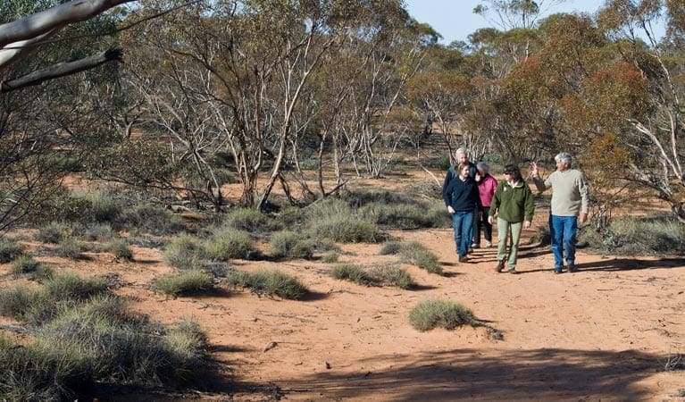
Lying in Victoria's northwest corner is Murray-Sunset National Park, an untouched semi-arid wilderness known for its low-lying Outback landscapes and entrancing pink lakes.
This hike is a grade 4, desert scrub walk, best completed over 3 days. the hike is intended to be walked clockwise (as per notes from the ranger), although we completed it anticlockwise over 3.25 days, by walking into the first water tank (approx 5km) in the late afternoon.
Best time to walk late Autumn to early Spring. Unlikely to be any water in creeks, water only at water tanks, status should be confirmed with local ranger prior to walk.
Notes and Map available from local ranger in Underbool.
About the region
The Murray-Sunset National Park is the second largest national park in Victoria, Australia, located in the Mallee district in the northwestern corner of the state, bordering South Australia. The 633,000-hectare (1,560,000-acre) national park is situated approximately 440 kilometres northwest of Melbourne and was proclaimed on 26 April 1979. It is in the northwestern corner of the state, bordering South Australia to the west and the Murray River to the north. The Sturt Highway passes through the northern part of the park, but most of the park is in the remote area between the Sturt Highway and the Mallee Highway, west of the Calder Highway.
Getting there
Lake Becking is searchable in google maps.
Take A79 from Melbourne (via Woodend) turn left at Lake Tyrell (C248) then right at Patchewollock (C247). Left a Walpeup (B12). right onto Pink Lakes Road after Underbool , continue on Pink Lakes Road to Lake Becking Campsite (Dirt Road).
Tips
Contact local ranger prior to walk is required. Water tanks can be empty.
Hike contributed by Alexandra Vallata
GPX File
Max elevation: 111 m
Min elevation: 17 m
Total climbing: 1207 m
Total descent: -1205 m