Hike at a Glance
Max elevation: 1064m
Min elevation: 416m
Total Ascent: 678m
Important info
The risks from exposure and dehydration and heatstroke are significant in this area - some hikers have not survived this trail. During the hotter months (at least September March) these risks are extreme. Temperatures often exceed 40°C. Due to recent deaths, this trail is now closed during Summer. Only very fit and experienced bushwalkers should attempt this full day, very challenging hike.
Hike overview
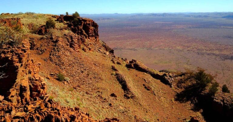
The very challenging Mount Augustus Summit Trail takes walkers to the top of the biggest 'rock' in the world, Mount Augustus. Twice as high as Uluru (Ayers Rock) the experienced walker will be rewarded with extensive views over the surrounding plain to the distant ranges.
Located in the Mount Augustus National Park, Mount Augustus, or Burringurrah as it is known by the local Wadjari Aboriginal people, is about midway between the Great Northern and North West Coastal highways.
One of the most spectacular solitary peaks in the world, the visible portion of the sandstone and conglomerate structure which makes up Mount Augustus, is twice the size of Uluru. Sitting on a bedrock of granite, the mountain is eight kilometres long and stands 858 metres above the surrounding plain and 1105 metres above sea level - and is clearly visible from the air for more than 160 kilometres.
The rock itself, which culminates in a small peak on a plateau, is an area of 4,795 hectares. During dawn and dusk, its colour changes almost minute by minute from deep indigo to bright pink, orange or red and occasionally green, reflecting the mood of the rock and the spirits living there The return walk to the top of the mount and back is well signposted and takes a full day to complete.
For the less-hardy soul there are a variety of easier walk trails, drive trails, lookouts, swimming holes and picnic spots.
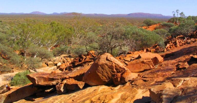
Main image: Graeme Churchard from Bristol, UK, CC BY 2.0, via Wikimedia Commons
Tips
Things to consider if you are attempting the Summit Trail:
- The Summit Trail is open May to August.
- The Summit Trail is closed after 7am September, October, March and April. Start your hike before 7am in these months.
- The Summit Trail is closed November to February.
- Spend a few days hiking shorter trails before considering your ability to tackle this challenging trail.
- Fill out the Summit Hiking Form and leave on your vehicle dashboard. Also available from Mount Augustus Tourist Park.
- It's hard work going up it's even harder coming back down.
- Know your limits and turn back if you feel fatigued.
- Rescues put other lives at risk and can take time as there is no rescue helicopter in this region.
- Roads may be closed or substantially damaged after heavy rain. Details about road conditions can be obtained from the Shire of Upper Gascoyne (08) 9943 0988 and the Shire of Meekatharra (08) 9981 1002.
- Scenic flights from Shark Bay to Mount Augustus are available from Shark Bay Air Charter.
- Camping and accommodation is available at the Mount Augustus Tourist Park (08) 9943 0527.
Gallery
Got some great shots from this hike? Upload your photos here to inspire others and show off the beauty of the trail!
Click to view form >>
Submitting your photos doesn’t mean you lose ownership. You can be credited for your contributions, and you can request removal at any time.
Content use
Please don’t copy GPX files or content from this site to AllTrails or other platforms. Each trail has been personally mapped, documented, and refined to support Australia’s bushwalking and hiking community. While some details come from land managers, every listing reflects significant personal effort. This is a free, community-driven initiative—your respect helps keep it that way.
Walk map and GPX file
Max elevation: 1064 m
Min elevation: 416 m
Total climbing: 678 m
Total descent: -678 m
Getting there
Getting to the trailhead: Mount Augustus National Park.
Mount Augustus is a two day drive from Perth via Carnarvon or Meekatharra. The park is 465km from Carnarvon via Gascoyne Junction. The 172km road between Carnarvon and Gascoyne Junction is sealed but all other roads in the area are unsealed. Be aware that there are long distances¯between settlements, supplies and services this is outback Australia. Mount Augustus Summit Trail Car Park is located off Mount Augustus Road via Gascoyne Junction.
The Loop Drive and all access roads are generally suitable for two-wheel drive vehicles. Drive to the road conditions and obey road closures and speed limits.
Closest towns to this walk: Carnarvon, Cue, Gascoyne Junction, Meekatharra, Mount Magnet, Mullewa, Murchison, Murchison Settlement, Paraburdoo, Wiluna
About the region
Rising 715m above the surrounding alluvial plain, Mount Augustus is an inselberg, meaning island mountain'. There are rocky creeks, gorges and open plains supporting a variety of vegetation and wildlife. Mount Augustus is known as Burringurrah to the local Wajarri Aboriginal people. The park was gazetted on 22 September 1989 and is made up of former parts of Mount Augustus and Cobra Stations.
During 1999-2000, the State purchased nearby pastoral leases Cobra and Waldburg and part leases of Mount Philip and Dalgety Downs with the aim of managing the whole area including the national park for conservation. The total area is now 607,603 hectares.
Sometimes described as the world's largest monocline, it is estimated that the rock of the mountain is around 1000 million years old and was formed from an uplift which raised an ancient seabed of sedimentary proterozoic sandstone and conglomerate. The granite rock which lies beneath Mount Augustus is said to be 1650 million years old. The Indigenous name for Mount Augustus is Burringurah.
Similar walks nearby
Looking for more walks in or near Mount Augustus National Park? Try these trails with a similar difficulty grade.
Track grade
Grade 5 (Difficult) - Walks for the Most Experienced: Grade 5 represents the most challenging walking tracks on the AWTGS. These are only recommended for very experienced and fit walkers with specialised skills, including navigation and emergency first aid. Tracks are likely to be very rough, very steep, and unmarked. Walks may be more than 20 kilometers. These challenging walks demand a high level of fitness and experience to navigate difficult terrain, significant elevation changes, and potentially unformed paths.
Explore safe
Plan ahead and hike safely! Carry enough water, pack layers for changing conditions, and bring safety gear like a torch, PLB, and reliable communication device. Check official sources for trail updates, closures, and access requirements, and review local weather and bushfire advice. Most importantly, share your plans with someone before you go. Being prepared makes for a safer and more enjoyable hike! Stay Safe, Explore More, and Always #ExploreSafe.
Packing checklists
What you carry in your pack depends on factors like weather, terrain, and your adventure type. Not sure what to bring? My free planning, food, and packing checklists are a great starting point, covering day hikes, overnight trips, and multi-day adventures. Use them to customise your kit and always prioritise safety.
Let someone know
Before heading out, take a moment to fill out your trip intentions form. It’s a quick way to share your hike details with family or friends. If something goes wrong, they can notify emergency services, ensuring a faster response and peace of mind. Stay safe and enjoy your adventure
Suggest an edit
Spotted a change on this trail? Maybe there are new features, the route has shifted, or the trail is permanently closed. Whatever the update, I’d love your input. Your feedback helps fellow hikers stay informed and ensures that our trail info stays fresh and reliable.
Acknowledgement of Country
Trail Hiking Australia acknowledges the Traditional Owners of the lands on which we hike and pay respects to their Elders, past and present, and we acknowledge the First Nations people of other communities who may be here today.


