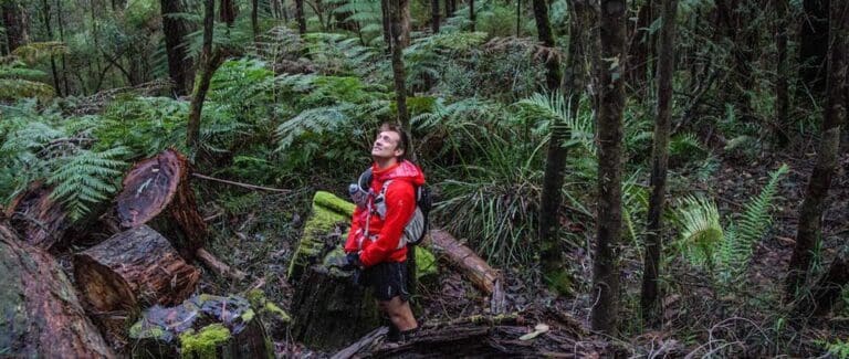
This beautiful Starling Gap to High Lead Carpark hike follows various paths that used to be tramways used by the timber industry. Various historical remnants can be seen along the route e.g. old machinery, small sections of tram lines etc. The area is very lush and a delight to hike through.
Whilst most of the hike is very gentle,t here is the very steep and long High Lead. This drops 400 metres over 1,600 metres. It is a section that must be taken with great care, and is actually quite grueling to do. When arriving at Starling Gap look for the signposted entry. There is another track near the toilet block, but do not take that. Once underway the track meanders through the forest. You will get glimpses of the Ada River through the forest.
After roughly 7.6km you will reach the crossroads.From here you can continue straight down to the High Lead. But it is worth taking the short (2.1km each way) side trip to Federal Mill. A great lunch spot. Just before you hit Federal Mill you will need to cross the Ada River. There is a series of fallen logs across. But the easier way is to use the stepping stones across.
Once you've visited Federal Mill, backtrack to the Cross Roads. Then head South to the High Lead. Take your time down this very steep section. There will be a couple of points crossing the road. At the bottom of High Lead, follow the trail to High Lead Carpark. There will be the occasional log (or similar) crossings to do.
Hiking poles will be useful to assist with High Lead.
Plus leeches are common here, so bring your favorite leech remedy/repellent.
Got some great shots from this hike? Upload your photos here to inspire others and show off the beauty of the trail!
Submitting your photos doesn’t mean you lose ownership. You can be credited for your contributions, and you can request removal at any time.
Please don’t copy GPX files or content from this site to AllTrails or other platforms. Each trail has been personally mapped, documented, and refined to support Australia’s bushwalking and hiking community. While some details come from land managers, every listing reflects significant personal effort. This is a free, community-driven initiative—your respect helps keep it that way.
Total distance: 17942 m
Max elevation: 796 m
Min elevation: 321 m
Total climbing: 594 m
Total descent: -1049 m
Getting there
Getting to the trailhead: Yarra State Forest.
Note: You will need to arrange a car shuffle to get back from High Lead to Starling Gap after you have done the hike.
There are various ways to reach Starling Gap. One way is to go to Powelltown, then after approx 10km you will see the turnoff up Big Creek Road. You’l nee to continue to High Lead Carpark to leave one vehicle there.
Once back at Big Creek Road, follow the signs (some may be missing) to reach Starling Gap. This is roughly 11km from the junction.
Closest towns to this walk: Emerald, Gladysdale, Healesville, Heathcote, Launching Place, Marysville, Millgrove, Monbulk, Mount Dandenong, Mount Evelyn, Olinda, Toolangi, Warburton, Woori Yallock, Yarra Glen, Yarra Junction
Similar walks nearby
Looking for more walks in or near Yarra State Forest? Try these trails with a similar difficulty grade.
Favourite

Favourite

Favourite

Favourite

Track grade
Grade 4 (Hard) -
Challenging Walks for Experienced Walkers: Grade 4 on the
AWTGS signifies challenging walking tracks. Bushwalking experience is recommended for these tracks, which may be long, rough, and very steep. Directional signage may be limited, requiring a good sense of navigation. These walks are suited for experienced walkers who are comfortable with steeper inclines, rougher terrain, and potentially longer distances.
Explore safe
Plan ahead and hike safely! Carry enough water, pack layers for changing conditions, and bring safety gear like a torch, PLB, and reliable communication device. Check official sources for trail updates, closures, and access requirements, and review local weather and bushfire advice. Most importantly, share your plans with someone before you go. Being prepared makes for a safer and more enjoyable hike! Stay Safe, Explore More, and Always #ExploreSafe.
Packing checklists
What you carry in your pack depends on factors like weather, terrain, and your adventure type. Not sure what to bring? My free planning, food, and packing checklists are a great starting point, covering day hikes, overnight trips, and multi-day adventures. Use them to customise your kit and always prioritise safety.
Let someone know
Before heading out, take a moment to fill out your trip intentions form. It’s a quick way to share your hike details with family or friends. If something goes wrong, they can notify emergency services, ensuring a faster response and peace of mind. Stay safe and enjoy your adventure
Suggest an edit
Spotted a change on this trail? Maybe there are new features, the route has shifted, or the trail is permanently closed. Whatever the update, I’d love your input. Your feedback helps fellow hikers stay informed and ensures that our trail info stays fresh and reliable.


8 Reviews on “Starling Gap to High Lead Carpark Hike (17.9km)”
Done it a few times. Lovely.
Charlie Vandenbelt it is a beautiful walk.
Trail Hiking Australia I can’t remember the first camp after Starlings gap, but I would take beginner overnight walkers there. Not too far for a first overnight. Nice bush setting; we always had a nice fire in Autumn and Winter….